Ligha
| Ligha लिघा Lipa लिपा | |
|---|---|
| Village Development Committee | |
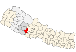
 Ligha लिघा Location in Nepal | |
| Coordinates: 28°16′N 82°55′E / 28.27°N 82.91°ECoordinates: 28°16′N 82°55′E / 28.27°N 82.91°E | |
| Country |
|
| Region | Mid-Western |
| Zone | Rapti Zone |
| District | Pyuthan District |
| VDC | Ligha |
| Population (2001 Census[1]) | |
| • Total | 2,421 |
| 443 households | |
| Time zone | UTC+5:45 (Nepal Time) |
Ligha also known as Lipa is a village and Village Development Committee in Pyuthan, a Middle Hills district of Rapti Zone, western Nepal.
Villages in this VDC
| Ward | Lat. | Lon | Elev. | ||
|---|---|---|---|---|---|
| Budhi Pokhara | बुढी पोखरा | 28°15'N | 82°54'E | 1,710 | |
| Chormol | चोरमोल | 28°14'N | 82°55'E | 1,370 | |
| Danda Kateri | डाँडा कटेरी | 8 | 28°15'N | 82°54'E | 1,830 |
| Dar Bisauna | दर बिसौना | 28°15'N | 82°55'E | 1,370 | |
| Dihi | डिही | 28°14'N | 82°54'E | 1,325 | |
| Dingbungdanda | डिङबुङडाँडा | 28°17'N | 82°54'E | 2,470 | |
| Dobata | दोबाटा | 28°14'N | 82°54'E | 1,670 | |
| Kurtibang | कुर्तीबाङ | 1 | 28°17'N | 82°55'E | 1,610 |
| Kurtibhir | कुर्ती भिर | 28°18'N | 82°55'E | 2,522 | |
| Ligha | लिघा | 28°15'N | 82°55'E | 1,590 | |
| Majhbhir | माझभिर | 28°16'N | 82°54'E | 2,050 | |
| Patauti | पटौटी | 28°14'N | 82°54'E | 1,630 | |
| Phaune Pokhari | फाउने पोखरी | 28°16'N | 82°55'E | 1,910 | |
| Pinara | पिनारा | 28°14'N | 82°55'E | 1,590 | |
| Shirbang | शिरबाङ | 4 | 28°16'N | 82°55'E | 1,590 |
| Silkhan | सिलखन | 28°16'N | 82°56'E | 1,610 | |
| Sirbidhara | सिर्बिघारा | 28°17'N | 82°56'E | 1,815 | |
| Sirnechaur | सिर्नेचौर | 28°17'N | 82°55'E | 1,742 | |
| Thantihalna | ठाँटीहाल्ना | 28°15'N | 82°54'E | 1,730 |
References
- ↑ "Nepal Census 2001". Nepal's Village Development Committees. Digital Himalaya. Archived from the original on 12 October 2008. Retrieved 21 September 2008.
- ↑ "Index of Geographical Names of Nepal, Volume IV: Mid Western Development Region, List of Settlements, Pyuthan" (PDF). Government of Nepal, National Geographic Information Infrastructure Program. Archived from the original (PDF) on 2011-07-24. Retrieved 2011-03-12.
External links
This article is issued from
Wikipedia.
The text is licensed under Creative Commons - Attribution - Sharealike.
Additional terms may apply for the media files.