Los Angeles City Council District 14
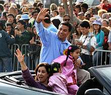
Los Angeles City Council District 14 is one of the 15 districts of the Los Angeles City Council. It is a primarily Latino district in Boyle Heights and Northeast Los Angeles.[1] Council Member Jose Huizar has represented it since 2005.
Geography
Modern
District 14 consists of all or part of the neighborhoods of the Downtown, Boyle Heights, Eagle Rock, El Sereno, Garvanza, Glassell Park, Lincoln Heights, and Monterey Hills.[2] The Boyle Heights and Northeast sections are connected by a narrow strip of land. Huizar maintains field offices in Downtown, Boyle Heights, El Sereno and Eagle Rock.[3]
Historic
A new city charter effective in 1925 replaced the former "at large" voting system for a nine-member council with a district system with a 15-member council. Each district was to be approximately equal in population, based upon the voting in the previous gubernatorial election; thus redistricting was done every four years. (At present, redistricting is done every ten years, based upon the preceding U.S. census results.)[4] The numbering system established in 1925 for City Council districts began with No. 1 in the north of the city, the San Fernando Valley, and ended with No. 15 in the south, the Harbor area.
District 14 has always represented Eagle Rock and Highland Park. As the city's population increased, it has expanded southward. The rough boundaries or descriptions of the district have been as follows:
1925 The communities of Eagle Rock, Highland Park and Annandale.[5]
1928 Westward extension to Allesandro Street.[6]
1932–33: East boundary: South Pasadena and Pasadena. North: Glendale. West: Glendale Boulevard.[7]
1935 Same general area as 1932, with the western boundary at Griffith Park,[8] thus including the Atwater area.
1940 Same general area as previously, with the west boundary at Glendale Boulevard.[9]
1955: Rose Hill [sic] is now included in the district's description.[10]
1971 "The district begins in the East Los Angeles Mexican-American barrios of El Sereno and Lincoln Heights extends westward across the Pasadena Freeway to Anglo middle-class homes in Glassell Park, Highland Park, Hermon, and Eagle Rock through Griffith Park. Around the western edge of the district is the Los Feliz District, with some of the city's more expensive homes."[11]
1986 No longer includes Los Feliz. Southern reach includes El Sereno, College Avenue, Huntington Drive and portions of Alhambra Avenue and Valley Boulevard, then across the San Bernardino Freeway to Brooklyn Avenue, East Beverly Boulevard, Fourth Street and Whittier Boulevard.[12]
Officeholders
District 14 has been represented by 10 men and no women:
- Isaac Colton Ash, 1925–27
- William G. Bonelli, 1927–29
- Charles A. Holland, 1929–31
- Edward L. Thrasher, 1931–43
- John C. Holland, 1943–67
- Art Snyder, 1967–85
- Richard Alatorre, 1985–99
- Nick Pacheco, 1999–2003
- Antonio Villaraigosa, 2003–05
- José Huizar, 2005–
See also
- Los Angeles City Council districts
- Los Angeles City Council
References
- ↑ Official city map of District 10 boundaries
- ↑ http://cd14.lacity.org/index.htm
- ↑ "Archived copy". Archived from the original on 2010-03-13. Retrieved 2010-03-29.
- ↑ Tina Daunt and Seema Mehta, "Council Districts Drawn to Benefit Valley, Latinos," Los Angeles Times, June 12, 2002
- ↑ "First Map Showing City's Council Districts," Los Angeles Times, January 16, 1925, page A-1 Includes a map.
- ↑ "Council Areas' Lines Changed," Los Angeles Times, December 29, 1928, page A-1
- ↑ "District Lines Get Approval," Los Angeles Times, December 24, 1932, page 2
- ↑ "Do You Know Who Your City Councilman Is?" Los Angeles Times, March 24, 1935, page 22 Includes a map.
- ↑ "Proposed New Alignment for City Voting Precincts," Los Angeles Times, November 30, 1940, page A-3 Includes a map.
- ↑ "Unusual Setup for Council's Contests," Los Angeles Times, April 3, 1955, page B-3
- ↑ Bill Boyarsky, "Snyder Expected to Win Easily," Los Angeles Times, March 25, 1971, page C-1
- ↑ "Los Angeles' Realigned Council Districts," Los Angeles Times, September 21, 1986 Includes a map.
External links
Current members of the Los Angeles City Council | |||||||||||
|---|---|---|---|---|---|---|---|---|---|---|---|
President: Herb Wesson | |||||||||||
 | |||||||||||
| Districts and neighborhoods | _edit1.jpg) | |
|---|---|---|
| Points of interest | ||
| Districts and neighborhoods |  | |
|---|---|---|
| Points of interest | ||
| Neighboring cities and communities | ||
| City Council |  | |||||
|---|---|---|---|---|---|---|---|
| Departments |
| ||||||
| Elections |
| ||||||
| Officials |
| ||||||
| School Districts | |||||||
| By topic | | |
|---|---|---|
| Government | ||