Cesar Chavez Avenue
| Maintained by | Bureau of Street Services, City of L.A. DPW, County of L.A. DPW |
|---|---|
| Length | 6.19 mi (9.96 km) |
| West end |
Figueroa Street/Sunset Boulevard in Downtown Los Angeles near |
| Major junctions |
|
| East end | Atlantic Boulevard/Riggin Street in Monterey Park |
| Construction | |
| Inauguration | = 1994 |
Cesar Chavez Avenue (Spanish: Avenida César Chávez) is a major east–west thoroughfare in Downtown Los Angeles, the Eastside and East Los Angeles, measuring 6.19 miles (9.96 km) in length.
Named in honor of union leader César Chávez, the street was formed in 1994 from Sunset Boulevard between Figueroa and Main streets, a new portion of roadway, Macy Street between Main Street and Mission Road, and Brooklyn Avenue through Brooklyn Heights, Boyle Heights and East Los Angeles into Monterey Park.
Much of the street is double-signed with its former names.
Approval and sign unveiling
In October 1993, the Los Angeles City Council and the County Board of Supervisors approved the renaming of the stretch of roadway, but agreed to delay the change until 1994 and to put up historic plaques along Brooklyn Avenue to accommodate the opposition,[1] many of whom believed that the new name would cause people to forget the Jewish history of the area.
A street sign unveiling ceremony was held on Thursday, March 31, 1994, Chávez's birthday, at the five-points intersection at Indiana Street, in Brooklyn Heights, where the city and county borders meet.[2]
Route
Part of the pre-1940 Route 66, Cesar Chavez Avenue begins as a continuation of Sunset Boulevard on the east side of Figueroa Street. It runs through Downtown Los Angeles, crosses Alameda Street and passes over the Los Angeles River, through the neighborhoods of Brooklyn Heights and Boyle Heights and the northern portion of East Los Angeles into the southern portion of Monterey Park.
The roadway becomes Riggin Street when it crosses Atlantic Boulevard in Monterey Park.
Transportation
- Union Station, which provides connections to the Red, Purple and Gold lines, as well as Metrolink and Amtrak.
- Metro Local line 68 and Metro Rapid line 770 run through Cesar Chavez Avenue.
Notable Landmarks
- Sunset Boulevard
- Pueblo de Los Angeles
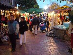
- Olvera Street
- Terminal Annex
- Union Station
- Evergreen Cemetery
- East Los Angeles Civic Center
- East Los Angeles College
References
- ↑ "Cesar Chavez Avenue Gets OK After Concessions To Critics Of Site." Los Angeles Times. Oct. 14, 1993. p. B 3.
- ↑ "EASTSIDE Sign of the Times: Cesar Chavez Avenue." Los Angeles Times. Apr. 3, 1994. p. 8.