Lomas de Carrasco
| Lomas de Carrasco | |
|---|---|
| Residential area | |
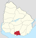
 Lomas de Carrasco Location in Uruguay | |
| Coordinates: 34°47′10″S 55°58′20″W / 34.78611°S 55.97222°WCoordinates: 34°47′10″S 55°58′20″W / 34.78611°S 55.97222°W | |
| Country |
|
| Department | Canelones Department |
| Population (2011) | |
| • Total | 806 |
| Time zone | UTC -3 |
| Postal code | 14000 |
| Dial plan | +598 2 (+7 digits) |
Lomas de Carrasco is a residential area in the Canelones Department of southern Uruguay.
Location
It is located east of Route 101 and northwest of Colinas de Solymar, about 6 kilometres (3.7 mi) northeast of the Carrasco International Airport. It is joined with La Tahona and Carmen to its west and south and Villa El Tato to the northwest. It is part of the wider metropolitan area of Montevideo.
Population
In 2011 Lomas de Carrasco had a population of 806.[1][2]
| Year | Population |
|---|---|
| 2004 | 332 |
| 2011 | 806 |
Source: INE - 2004 census[3]
References
- ↑ "Censos 2011 Cuadros Canelones". INE. 2012. Archived from the original on 10 October 2012. Retrieved 25 August 2012.
- ↑ "Censos 2011 Canelones". INE. 2012. Archived from the original on 7 September 2012. Retrieved 28 August 2012.
- ↑ 2004 "Censos 2004 Cuadro 7_03" Check
|url=value (help). INE. 2004. Retrieved 14 February 2011.
External links
Capital: Canelones | ||
| Towns and villages |
|  |
| Resorts of the Ciudad de la Costa | ||
| Sights |
| |
This article is issued from
Wikipedia.
The text is licensed under Creative Commons - Attribution - Sharealike.
Additional terms may apply for the media files.