Estación Atlántida
| Estación Atlántida | |
|---|---|
| Suburb of Atlántida | |
 Church of Estación Atlántida | |
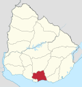
 Estación Atlántida Location in Uruguay | |
| Coordinates: 34°45′0″S 55°46′0″W / 34.75000°S 55.76667°WCoordinates: 34°45′0″S 55°46′0″W / 34.75000°S 55.76667°W | |
| Country |
|
| Department | Canelones Department |
| Population (2011) | |
| • Total | 2,274 |
| Time zone | UTC -3 |
| Postal code | 16000 |
| Dial plan | +598 437 (+5 digits) |
Estación Atlántida is a northern suburb of the city Atlántida in the Canelones Department of southern Uruguay.
Location
The suburb is located on Route 11, about 3 kilometres (1.9 mi) north of its junction with Ruta Interbalnearia. The railroad track that connects Montevideo with the city of Rocha passes from this place.
Population
In 2011 Estación Atlántida had a population of 2,274.[1][2]
| Year | Population |
|---|---|
| 1963 | 1,659 |
| 1975 | 1,843 |
| 1985 | 2,007 |
| 1996 | 2,297 |
| 2004 | 2,358 |
| 2011 | 2,274 |
Source: Instituto Nacional de Estadística de Uruguay[3]
Places of worship
- Parish Church of Christ the Worker and Our Lady of Lourdes (Roman Catholic), a wonderful architectural landmark of modernist architecture, built in 1958-60 by Eladio Dieste.[4]
References
- ↑ "Censos 2011 Cuadros Canelones". INE. 2012. Archived from the original on 10 October 2012. Retrieved 25 August 2012.
- ↑ "Censos 2011 Canelones". INE. 2012. Archived from the original on 7 September 2012. Retrieved 28 August 2012.
- ↑ "1963–1996 Statistics / E" (DOC). Instituto Nacional de Estadística de Uruguay. 2004. Retrieved 29 June 2011.
- ↑ Ching, Frank; Jarzombek, Mark; Prakash, Vikramaditya (2007). A global history of architecture. J. Wiley & Sons. p. 732. ISBN 978-0-471-26892-5. Retrieved 30 May 2011.
External links
Capital: Canelones | ||
| Towns and villages |
|  |
| Resorts of the Ciudad de la Costa | ||
| Sights |
| |
This article is issued from
Wikipedia.
The text is licensed under Creative Commons - Attribution - Sharealike.
Additional terms may apply for the media files.