Lockport (town), New York
| Lockport, New York | |
|---|---|
| Town | |
_highlighted.svg.png) Location in Niagara County and the state of New York. | |
| Coordinates: 43°9′2″N 78°40′37″W / 43.15056°N 78.67694°WCoordinates: 43°9′2″N 78°40′37″W / 43.15056°N 78.67694°W | |
| Country | United States |
| State | New York |
| County | Niagara |
| Government | |
| • Type | Town Council |
| • Town Supervisor | Mark C. Crocker (R) |
| • Town Council |
Members' List
|
| Area[1] | |
| • Total | 44.90 sq mi (116.28 km2) |
| • Land | 44.84 sq mi (116.14 km2) |
| • Water | 0.05 sq mi (0.13 km2) |
| Elevation | 630 ft (192 m) |
| Population (2010) | |
| • Total | 20,529 |
| • Estimate (2016)[2] | 20,094 |
| • Density | 448.10/sq mi (173.01/km2) |
| Time zone | UTC-5 (Eastern (EST)) |
| • Summer (DST) | UTC-4 (EDT) |
| ZIP codes | 14094-14095 |
| Area code(s) | 716 |
| FIPS code | 36-43093 |
| GNIS feature ID | 0979165 |
.png)
Lockport is a town in Niagara County, New York, United States. The population was 20,529 at the 2010 census. The name is derived from the series of canal locks on the Erie Canal. The locks lift boats from the lowland of Lake Ontario past the Niagara Escarpment.
The Town of Lockport is in the south-central part of the county and surrounds the City of Lockport.
History
Many early settlers were Quakers and helped make the area a bastion of anti-slavery. The Town of Lockport was established in 1824, the same year the canal was completed up to the City of Lockport.
Cold Springs Cemetery was listed on the National Register of Historic Places in 2004.[3]
Geography
According to the United States Census Bureau, the town has a total area of 44.7 square miles (115.8 km²), of which, 44.6 square miles (115.6 km²) of it is land and 0.1 square miles (0.2 km²) of it (0.18%) is water.
The south border of the town is formed by Tonawanda Creek. The Erie Canal passes through the north part of the town and the City of Lockport. New York State Route 78 marks the west town line of Lockport.
Adjacent cities and towns
- Town of Cambria - west
- Erie County, Town of Clarence - south
- Town of Pendleton - southwest
- Town of Royalton - east
- Town of Newfane - north
- Town of Hartland - northeast
- City of Lockport - Town surrounds the City of Lockport.
Major highways in the Town of Lockport


Demographics
| Historical population | |||
|---|---|---|---|
| Census | Pop. | %± | |
| 1830 | 3,823 | — | |
| 1840 | 9,125 | 138.7% | |
| 1850 | 12,323 | 35.0% | |
| 1860 | 13,523 | 9.7% | |
| 1870 | 3,032 | −77.6% | |
| 1880 | 2,847 | −6.1% | |
| 1890 | 2,773 | −2.6% | |
| 1900 | 2,585 | −6.8% | |
| 1910 | 2,399 | −7.2% | |
| 1920 | 1,833 | −23.6% | |
| 1930 | 2,720 | 48.4% | |
| 1940 | 3,160 | 16.2% | |
| 1950 | 3,945 | 24.8% | |
| 1960 | 6,492 | 64.6% | |
| 1970 | 8,177 | 26.0% | |
| 1980 | 12,942 | 58.3% | |
| 1990 | 16,596 | 28.2% | |
| 2000 | 19,655 | 18.4% | |
| 2010 | 20,529 | 4.4% | |
| Est. 2016 | 20,094 | [2] | −2.1% |
| U.S. Decennial Census[4] | |||
As of the census[5] of 2010, there were 20,529 people, 8,293 households, and 5,482 families residing in the town. There were 8,680 housing units. The racial makeup of the town was 91.1% White, 4.8% Black or African American, 0.4% Native American, 1.0% Asian, 0.01% Pacific Islander, 0.6% from other races, and 2.1% from two or more races. Hispanic or Latino of any race were 2.6% of the population.
(2000 Census)There were 7,537 households out of which 33.3% had children under the age of 18 living with them, 55.4% were married couples living together, 10.7% had a female householder with no husband present, and 30.3% were non-families. 25.3% of all households were made up of individuals and 8.3% had someone living alone who was 65 years of age or older. The average household size was 2.52 and the average family size was 3.03.
In the town, the population was spread out with 25.3% under the age of 18, 8.3% from 18 to 24, 30.4% from 25 to 44, 24.2% from 45 to 64, and 11.9% who were 65 years of age or older. The median age was 37 years. For every 100 females, there were 96.6 males. For every 100 females age 18 and over, there were 94.6 males.
The median income for a household in the town was $45,977, and the median income for a family was $55,414. Males had a median income of $41,166 versus $25,810 for females. The per capita income for the town was $22,194. About 6.5% of families and 7.7% of the population were below the poverty line, including 10.8% of those under age 18 and 2.8% of those age 65 or over.
Notable natives
- See City of Lockport
Communities and locations in the Town of Lockport
- Carlisle Gardens – A community bordering the east side of the City of Lockport.
- County Fair Grounds – The fair grounds are north of the City of Lockport.
- Highland Park – A location north of the City of Lockport, next to the fair grounds.
- Nottingham Estates – A location east if the City of Lockport, and north of Route 31.
- Rapids – A hamlet on the south border of the town.
- Raymond – A location northwest of Rapids.
- Ridge Lea – A location north of the City of Lockport.
- Shooktown – A location east of the City of Lockport.
- South Lockport – A community bordering the south side of the City of Lockport.
- Wrights Corners – A hamlet on the north town line, located on Route 78, partly in the Town of Newfane.
- City of Lockport – The City of Lockport is in the north-central part of the town.
- Lockport Mall – A former shopping mall located on Transit Road in South Lockport. As of 2007, the mall was all but vacant and demolition began in April 2011.[6] Demolition had been mostly completed but was halted on 9 June 2011, after finding a number of federally protected baby seagulls had been nesting the roof.[7] All that remains of the former mall is The Bon-Ton department store. A new Walmart supercenter now lies on part of the former footprint of the mall.
References
- ↑ "2016 U.S. Gazetteer Files". United States Census Bureau. Retrieved Jul 5, 2017.
- 1 2 "Population and Housing Unit Estimates". Retrieved June 9, 2017.
- ↑ National Park Service (2009-03-13). "National Register Information System". National Register of Historic Places. National Park Service.
- ↑ "Census of Population and Housing". Census.gov. Retrieved June 4, 2015.
- ↑ "American FactFinder". United States Census Bureau. Retrieved 2008-01-31.
- ↑ Sanders, Nancy (29 March 2011). "Demolition date for Lockport Mall". WIVB Channel 4. Retrieved 29 March 2011.
- ↑ McKinley, David (9 June 2011). "Lockport Bird Rescue". WGRZ Channel 2. Retrieved 9 July 2011.
External links
Municipalities and communities of Niagara County, New York, United States | ||
|---|---|---|
| Cities | 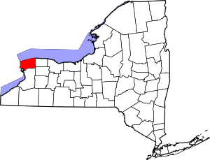 | |
| Towns | ||
| Villages | ||
| CDPs | ||
| Other hamlets |
| |
| Indian reservations | ||
| Footnotes | ‡This populated place also has portions in an adjacent county or counties | |