Lough Tay
| Lough Tay Loch Té | |
|---|---|
| The Guinness Lake | |
 | |
 Lough Tay | |
| Location | Wicklow Mountains, County Wicklow |
| Coordinates | 53°06′22″N 6°16′00″W / 53.106014°N 6.266763°WCoordinates: 53°06′22″N 6°16′00″W / 53.106014°N 6.266763°W |
| Primary inflows | Cloghoge River |
| Primary outflows | Cloghoge River |
| Basin countries | Ireland |
| Surface area | 48.1 ha (119 acres) |
| Average depth | 10.1 m (33 ft) |
| Max. depth | 35 m (115 ft) |
| Water volume | 0.005 km3 (0.0012 cu mi) |
| Surface elevation | 246 m (807 ft) |
| Islands | none |
| Wikimedia Commons has media related to Lough Tay. |
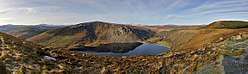
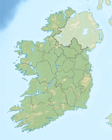
Lough Tay (Irish: Loch Té), commonly called The Guinness Lake, is a small but scenic lake set on private property, in the Wicklow Mountains in County Wicklow, Ireland. It lies between the mountains of Djouce and Luggala, and is most easily viewed from above, from the R759 or the Wicklow Way as it descends past the J. B. Malone memorial. It is fed by the Cloghoge River, which then drains into Lough Dan to the south.[1] It is not possible to visit Lough Tay without prior permission.
The name is believed to derive from the Proto-Indo-European root *teh₂w-, "melt", "dissolve", "flow".[2]
The northern coastline forms part of an estate belonging to the Guinness family; it is edged with a beach of startlingly white sand, the dark peaty water and the white sand create a striking similarity to a pint (a glass) of Guinness. The best way to enjoy it is to drink a pint on the cliffs above.
The philosopher Bertrand Russell wrote in his Autobiography:
- "Twice I went with my Aunt Agatha to Ireland. I used to go for walks with
- Michael Davitt, the Irish patriot, and also by myself. The beauty of the scenery
- made a profound impression on me. I remember especially a small lake in
- County Wicklow, called Lugala. I have associated it ever since, though for no
- good reason, with the lines:
- Like as the waves make toward the pebbled shore,
- So do our minutes hasten to their end.
- Fifty years later, when visiting my friend Crompton Davies in Dublin, I
- induced him to take me to Lugala. But he took me to a wood high above the
- lake, not to the ‘pebbled shore’ that I had remembered, and I went away
- convinced that one should not attempt to renew old memories."[3]
Many people say that Lough Tay is the site used to portray the city of Kattegat in the very popular series Vikings.
References
- ↑ OSI Discovery map series sheet 56
- ↑ https://www.logainm.ie/en/1166411
- ↑ Russell, Bertrand (1951). Autobiography. p. 35.