Little Somborne
| Little Somborne | |
|---|---|
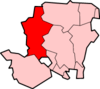
 Little Somborne Little Somborne shown within Hampshire | |
| OS grid reference | SU3824532573 |
| District | |
| Shire county | |
| Region | |
| Country | England |
| Sovereign state | United Kingdom |
| Post town | STOCKBRIDGE |
| Postcode district | SP20 |
| Dialling code | 01264 |
| Police | Hampshire |
| Fire | Hampshire |
| Ambulance | South Central |
| EU Parliament | South East England |
| UK Parliament | |
Little Somborne is a hamlet and civil parish of the Test Valley district in Hampshire, England. Its nearest town is Stockbridge, which lies approximately 2.3 miles (3.5 km) north-west from the hamlet.
Geography of the Civil Parish
The most Northerly point of the CP is 175m (190yds) N. of the Tumulus near New Farm, Leckford CP. A section of the A30 Primary Route passes through the North of the parish. It crosses the parish Eastern boundary 275 m (300yds) before the previously mentioned Tumulus and exits the parish after another 0.87km (0.54mi) at the junction with Whitehall road.The B3049 Winchester to Stockbridge road crosses the Eastern boundary of the parish on the Stockbridge side of Turnpike Copse, it leaves the parish 0.65 km (0.4 mi) later at the Winchester side of Ridge's Grove. The parish is crossed North South by a road generally less than 4m wide called Whitehall Road.The Northern end of WhiteHall Road begins at a junction off the A30. It heads SE for 1.3 km (0.8mi) where it turns SW and crosses the B3049 after 0.6 km (0.4mi). From the junction with the B3048, Whitehall Road continues SW for 2.2 km (1.4 mi) to a junction near Park Farm Cottages, Little Sombourne. The most Southerly point of the parish is 160 m (175yds) SE of the entrance to Chalk Hill cottages along Chalk Hill lane, at this point the lane has a bend. [1]
References
See also