Awbridge
| Awbridge | |
|---|---|
 All Saints Church, Awbridge | |
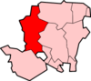
 Awbridge Awbridge shown within Hampshire | |
| Population | 712 (2011 Census)[1] |
| District | |
| Shire county | |
| Region | |
| Country | England |
| Sovereign state | United Kingdom |
| Post town | SOUTHAMPTON |
| Postcode district | SO51 |
| Dialling code | 01794 |
| Police | Hampshire |
| Fire | Hampshire |
| Ambulance | South Central |
| EU Parliament | South East England |
| UK Parliament |
|
Awbridge is a small village and civil parish in the Test Valley district of Hampshire, England, about three miles northwest of Romsey, and near the River Test. According to the 2001 census the parish, which includes the villages of Awbridge, Upper Ratley and Lower Ratley, had a population of 695, increasing to 712 at the 2011 Census. Commonly the terms Upper and Lower Ratley are dropped, with locals referring to the entire area as Awbridge. Confusingly, the intersection through the village of its 3 main roads, location of the village school, and previously Post Office, is in Upper Ratley, and is denoted on Maps as such, with the mapped location of Awbridge being further towards Romsey than is generally accepted.
As if this naming ambiguity is not enough, there is often a 'Kent's Oak', listed on maps of the area as if this were also a location in its own right. It is a large oak tree in the corner of the school field, and despite its impressive size and age is no more than a local landmark, and not another village. As well though there exists a fine house, now a home for the elderly named Kent's Oak which was formerly a children's home run by Hampshire County Council. Adjacent is Little Kent's Oak - another house built in later years though of similar appearance yet smaller.
Locally, the name of the village is pronounced 'A-bridge', with the letter 'w' silent. This pronunciation can be the subject of some snobbery (and reverse-snobbery).
It is within walking distance of Kimbridge, Dunbridge and Mottisfont, with Dunbridge providing a railway link to both Salisbury (to the north west) and Southampton (to the south).
References
- ↑ "Civil Parish population 2011". Neighbourhood Statistics. Office for National Statistics. Retrieved 8 December 2016.
External links

- Awbridge in the Domesday Book