Barton Stacey
| Barton Stacey | |
|---|---|
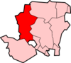
 Barton Stacey Barton Stacey shown within Hampshire | |
| Population |
892 (2001 Census) 948 (2011 Census including Bransbury and Newton Stacey)[1] |
| OS grid reference | SU435415 |
| District | |
| Shire county | |
| Region | |
| Country | England |
| Sovereign state | United Kingdom |
| Post town | Winchester |
| Postcode district | SO21 |
| Dialling code | 01962, 01264 |
| Police | Hampshire |
| Fire | Hampshire |
| Ambulance | South Central |
| EU Parliament | South East England |
| UK Parliament | |

Barton Stacey is a village and undulating civil parish including Bransbury, Newton Stacey, Drayton and Cocum in the Test Valley district of Hampshire, England, centred about 7 miles (11 km) south-east of Andover. It is bounded by the estate of Drayton Lodge north of the A303 (a UK Trunk Road) to the north and mainly by the minor A30 road popular for cycling to the south; both become parallel to the west. The distance between the two roads is 2 miles (3.2 km), double the width of the parish. The area is well-connected by roads. Bullington, to the east has the A34 road which joins the south-central coast from near the close of the M3 to The Midlands. At Newton Stacey and Bransbury Common in the west the parish adjoins the braided River Test; its tributary the Dever runs through the north of the parish, which similarly has trout fisheries.[2]
Civil parish
The total area of the civil parish is 5,027 acres (20,340,000 m2). It has a population of 892 living in 341 households[3]; the population of the parish in 2016 was estimated to be 1,034[4]. The civil parish includes the village of Barton Stacey, and the hamlets of Bransbury, Newton Stacey, Cocum, and Drayton.[5]
Cocum lies to the south, it includes a farm and buildings, and incorporates a military small-arms firing range, situated to the north of the A30 road.
South of the A303 at Drayton is Barton Stacey Services, a trunk road service area accessible by westbound traffic only. This area was formerly known as Drayton Filling Station, having been developed from a parcel of MOD land in 1959.
Bransbury is to the west of Drayton, accessible either by turning south off the A303 or by taking a narrow lane westwards from the church, then a right turn. There is a mill building here alongside the river. On that narrow lane westwards from the church, but straight on from the junction, lies the hamlet of Newton Stacey.
Environment

Barton Stacey lies in a corridor of land between the North Wessex Downs and the South Downs National Park. Its downland area is predominantly arable farmland, which has traditionally been used for growing malting barley, though other crops are grown, and sheep grazed.
The chalk streams of the Test and Dever are managed for sport fishing and the Dever also feeds a trout fishery just outside the village. The valley to the north of the village is characterised by pasture and woodland, whilst the local sections of the Dever and Test valleys are predominated by wet woodland and water meadows.
At either end of Roberts Road there are two pieces of woodland, both MOD property, but many villagers use the footpaths that have been made over the years to walk through these magnificent woodland areas. Much of the remainder of the MOD land is now rented to a local farmer.
Much of Barton Stacey lies within a Conservation Area.[6] Many of its structures are listed or designated buildings of local interest'[7]
The village itself lies in two parts: the original section comprises Kings Elms, Gravel Lane and The Street, situated around the church. Over the years, housing has been extended to the south but principally to the north-west. Ninety per cent of the residential properties in the village overlook open land.
Half the parish's homes are located around Roberts Road, East Road and West Road in housing built in the 1950s by the MOD as married quarters for troops posted to the army camps. From 1987 the MOD sold many of these houses privately, retaining some in West Road for military personnel. Since then, only a few houses have been built in the parish, all privately constructed. In 2006/07 four flats were built on the edge of Roman Way, in Roberts Road. In 2018 five homes began construction on a former commercial site next to the village store, and a plan exists to build some low-cost housing on land owned by the MOD.
In the south west of the parish there is a working oil well.
Wildlife
Local wildlife includes several protected species and includes the water vole, otter, roe deer, fallow deer, badger, and pipistrelle and long-eared bats. The area is popular for trout fishing.
Birds include the lapwing, skylark, red kite, kestrel, yellowhammer, corn bunting, house martin, swift, swallow and barn owl.
History
Three Neolithic long barrows have been found on Moody’s Down which date from between 3,500 and 2,000 B.C.), along with Bronze Age bowl barrows at Moody’s Down and Newton Down Farm. All of them are designated Scheduled Monuments.[8]
The Andyke at Bransbury is an Iron Age ditch and bank, and a remnant of a promontory fort, with some evidence of roundhouses.
The hundred of Barton was granted by King John to Rogo de Sacy or Stacey in September 1199, remained a possession of his son Emery who paid his knights fees for Bertune Sacy in 1206,and afterwards remained in the possession of the lords of the manor of Barton Stacey, hence referred to as the hundred of Barton Stacey[9].
The hundred court was held in Barton Stacey until the late 19th century when other governmental divisions assumed local jurisdiction.
A Roman road that once linked Winchester to Marlborough and Cirencester crosses the parish via Bransbury Common and signs of a Roman camp can be seen east of Manor Farm. Evidence of Romano-British inhabitants was discovered between Barton Stacey and Bransbury in 1977, in the form of a ‘plank burial' of a woman.
The first written record of Barton Stacey (Beretune), Newton Stacey and Bransbury is within the Anglo-Saxon Chronicles (855 A.D.) Beretune is thought to be Old English for ‘barley farm’. The Drove, leading east from the village, may be of Saxon origin.
The ‘Great Fire of Barton Stacey’ in 1792 razed much of the village. Rebuilding works resulted in the present day character of the village, centred around The Street. The Barton Stacey Village Store was erected as a shop at about this time, and the original school buildings followed in Bullington Lane in 1886. There was some expansion of the village in the late 19th Century and many of the present day homes were added between 1939 and the 1980s.
In 1943 the War Department (now MOD) purchased 2106.556 acres (852.5 hectares) to the north, east and south of the village for £24,000 for use as a military training area. Four army camps were developed at Drayton: 'A', 'B' & 'C' Camps to the north of the A303, and 'D' Camp to the south, east of the road from the village to Longparish. All of the original buildings are long gone, though many of the roadways and hard-standings remain visible and these areas are now vacant.
Religious buildings

The All Saints Church in the village is situated to the west of the village opposite the start of Bullington Lane. Built largely of flint, it is renowned to be one of the oldest in England, and certainly the oldest building in Barton Stacey, dating in part from the 12th century;[10] it is mentioned in the Domesday Book. Both the parish church and Church Farm House are grade II* listed.
The church was extended in the 1200's, 1400's and 1500's, and much of it was restored n in 1877. it consists of an aisled nave with a west tower partly inserted into it, and a chancel with transeptal north and south chapels, and a porch to the south. The tower is early 16th century, of ashlar, with a polygonal south west turret, and battlemented parapet with pinnacles.
Education
A school, Barton Stacey C. of E. Primary, is located at the end of The Green. It has around 96 enrolled students.
Sport and Leisure
Activity clubs that include a choir, judo club, football club, two drama clubs and a 'Tuesday Club'. Many activities are held in the village hall.
Recreation ground
The recreation ground is situated in the west of the village and contains two football pitches, a pavilion and a play park. There is a small car park in front of the village shop which is used as parking.
The Football Club
Barton Stacey Football Club was established in 1919 and plays and trains on the Barton Stacey recreational ground. The club currently fields four youth teams at Under 8, U9, U13 and U15, and a senior side.
Economy

A village store and post office is in the centre of the village, next to the village's one remaining pub, The Swan Inn. The shop has operated as a general store for 200 years, while The Swan dates to the late 18th Century.
Dever Springs is a private trout fishery specialising in corporate fishing days. Specimen fish taken at Dever include a British record brown of 28 lbs 2 ozs.[11] Lionel Hitchens Essential Oils Ltd is the largest employer in the village.
The trunk road service area 'Barton Stacey Services' comprises a Park Homes site of seven occupied units, a petrol filling station, a Starbucks, and motel[12], together with a vehicle repair business.
Travel and transport
Barton Stacey suffers somewhat from localised traffic congestion due to narrow roads, particularly around the school, but enjoys good road links to Winchester, Andover, Basingstoke and Newbury thanks to its proximity to regional important trunk roads.
Stagecoach operates the Number 86 service to Winchester, and the 851 service and Cango C4 bus to Andover.
The nearest railway services run from Micheldever Station (5.5 miles) and Andover (8 miles). A Barton Stacey railway station operated during World War II for military purposes but was soon closed.
References
- ↑ "Civil Parish population 2011". Neighbourhood Statistics. Office for National Statistics. Retrieved 8 December 2016.
- ↑ http://www.visionofbritain.org.uk/unit/10106011/boundary
- ↑ 2001 census
- ↑ "Barton Stacey parish profile" (pdf). Test Valley Borough Council. Retrieved 14 December 2017.
- ↑ Barton Stacey Fete 2017, accessed June 2017.
- ↑ "Conservation Areas". Test Valley Borough Council. Test Valley Borough Council. Retrieved 14/06/2018. Check date values in:
|accessdate=(help) - ↑ "Barton Stacey Conservation Area Character Appraisal" (PDF). Test Valley Borough Council. pp. 9, 33. Retrieved 14/06/2018. Check date values in:
|accessdate=(help) - ↑ "Village Design Statement | Barton Stacey". www.bartonstacey-pc.co.uk. Retrieved 2018-03-23.
- ↑ "Barton Stacey Fete".
- ↑ Barton Stacey Conservation Area Character Appraisal. Test Valley Borough Council. 2009. p. 12.
- ↑ Boswell, James. "UK Game Fish Records, British Rod Caught Game Fish Records". www.fish-uk.com. Retrieved 2018-03-19.
- ↑ "Travelodge Barton Stacey". Travelodge. Retrieved 14 December 2017.
External links
| Wikimedia Commons has media related to Barton Stacey. |
- Barton Stacey Parish Council website
- Barton Stacey History Group
- Photo of the old Plough Inn (Closed Pubs website)
- Barton [Stacey] in the Domesday Book
- Barton Stacey Walks and More (Ordnance Survey)