List of waterfalls of Australia

This is a list of waterfalls in Australia.
Wallaman Falls in Queensland are Australia's tallest permanent waterfall with a plunge of nearly 300 metres (980 ft). Wollomombi Falls in New South Wales are second with a 220-metre (720 ft) combined drop and Ellenborough Falls, also in New South Wales, is third plunging 160 metres (520 ft) as a single drop.[1]
Australian Capital Territory
The following waterfalls are located in the Australian Capital Territory:
| Image | Waterfall | Location | Drop | Type | Coordinates |
|---|---|---|---|---|---|
 | Gibraltar Falls | Namadgi National Park | 67–120 m (220–394 ft)[2] | Cascade | 35°29′12″S 148°56′06″E / 35.48667°S 148.93500°E |
| Ginini Falls | Namadgi National Park | 190–220 m (623–722 ft)[3] | 35°29′43″S 148°48′16″E / 35.49528°S 148.80444°E | ||
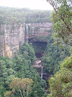
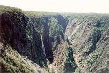
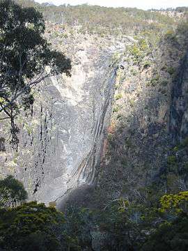
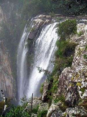
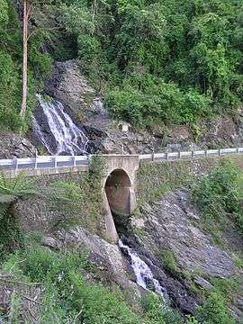
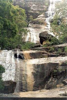
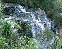
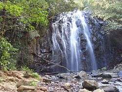
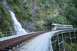
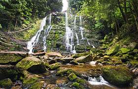
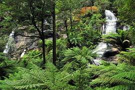
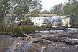
New South Wales
The following waterfalls are located in New South Wales:


.JPG)


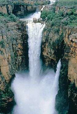
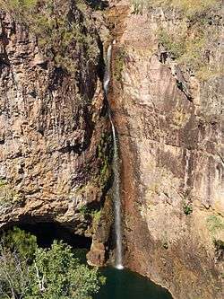
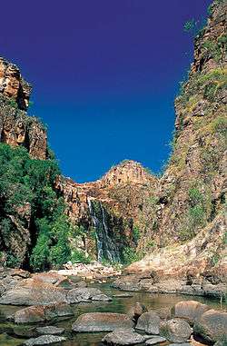
Northern Territory
The following waterfalls are location in the Northern Territory:


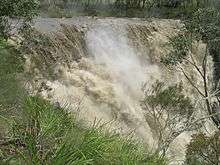
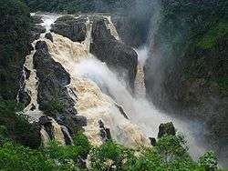
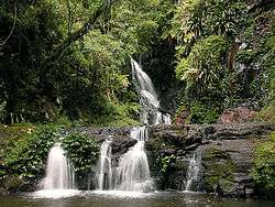
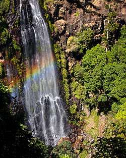
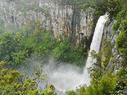
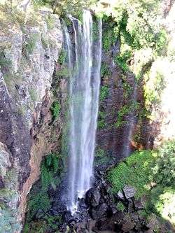
Queensland
The following waterfalls are located in Queensland:


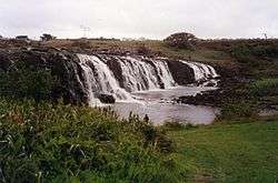
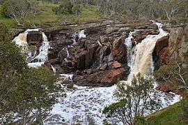
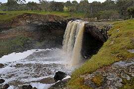
South Australia
The following waterfalls are located in South Australia:
| Image | Waterfall | Location | Drop | Type | Coordinates |
|---|---|---|---|---|---|
| Ferntree Falls | Flinders Ranges National Park, Rawnsley Park | ||||
| Fifth Falls[60] | |||||
| First Falls (Adelaide Hills) | Morialta Conservation Park | 30 metres (98 ft)[61] | Plunge | 35°54′23″S 138°42′29″E / 35.90639°S 138.70806°E | |
| First Falls (City of Burnside)[62] | Waterfall Gully, Cleland Conservation Park | Cascade | 34°58′14″S 138°40′53″E / 34.97056°S 138.68139°E | ||
| Fourth Falls[60] | |||||
| Glenora Falls[60] | |||||
| Hay Flat Waterfall[60] | |||||
| Hindmarsh Falls[60] | Fleurieu Peninsula | 35°26′38″S 138°35′00″E / 35.44389°S 138.58333°E | |||
| Ingalalla Waterfalls | Fleurieu Peninsula | 81–92 metres (266–302 ft)[63] | Cascade | 35°31′52″S 138°20′34″E / 35.53111°S 138.34278°E | |
| Kanalla Falls | Flinders Ranges National Park | 64–79 metres (210–259 ft)[64] | 31°29′52″S 138°30′43″E / 31.49778°S 138.51194°E | ||
| Kapinka Falls[60] | |||||
| Lower Waterfall[60] | |||||
| Malloga Falls[65] | Flinders Ranges National Park, near Wilpena | ||||
| Mannum Waterfall[60] | |||||
| Morialta Falls[60] | Morialta Conservation Park | ||||
| Petalinka Waterfall[60] | |||||
 | Second Falls (Adelaide Hills)[66] | Morialta Conservation Park | 15 metres (49 ft) | ||
| Second Falls (City of Burnside)[60] | |||||
| Seventh Falls[60] | |||||
| Six Falls[60] | |||||
| Strepara Waterfall[60] | |||||
| The Waterfall[60] | |||||
| The Waterfalls[60] | |||||
| Third Falls[66] | Morialta Conservation Park | 13 metres (43 ft) | |||
| Upper Waterfall[60] | |||||
| Wadella Falls[60] | near Tumby Bay | ||||
| Waukarie Falls[60] | Mount Brown Conservation Park | ||||
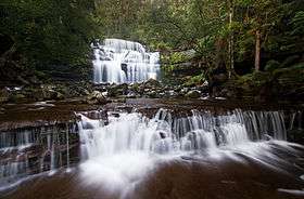
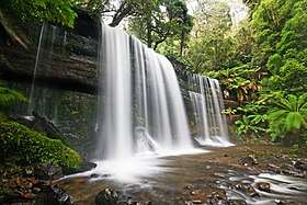
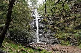
Tasmania
The following waterfalls are located in Tasmania:


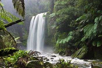
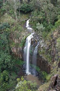
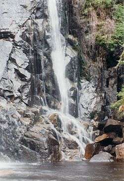
Victoria
The following waterfalls are located in Victoria:

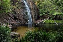
Western Australia
The following waterfalls are located in Western Australia:
| Image | Waterfall | Location | Drop | Type | Coordinates |
|---|---|---|---|---|---|
| Baden Powell Water Spout | Murray River near Dwellingup | ||||
| Big Mertens Falls | Mitchell Plateau in the Kimberley | ||||
| Beedalup Falls | Beedalup National Park near Pemberton | ||||
| Black Rock Falls | near Kununurra | ||||
| The Cascades | Gloucester National Park | Cascade | |||
| Eagle Rock Falls | near Newman | ||||
 | Fernhook Falls | ||||
| Fortescue Falls | Karijini National Park | ||||
| Gladstone Falls | |||||
| Hovea Falls | John Forrest National Park | ||||
| Joffre Falls | Karijini National Park | ||||
| Kalamina Falls | Karijini National Park | ||||
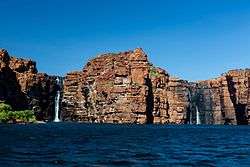 | King George Falls | King George River | |||
| Kings Cascade | Prince Regent River near Wyndham | ||||
| Lane-Poole Falls | Northcliffe | 34°41′47″S 116°15′01″E / 34.696391°S 116.250286°E | |||
 | Lesmurdie Falls | Mundy Regional Park | 31°59′39″S 116°02′03″E / 31.994246°S 116.03425°E | ||
| Marrinup Falls | near Marrinup | ||||
| Mitchell Falls | The Kimberley | 14°49′00″S 125°41′00″E / 14.81667°S 125.68330°E | |||
| National Park Falls | John Forrest National Park | ||||
 | Noble Falls | near Gidgegannup | |||
| Quinninup Falls | near Yallingup | ||||
 | Serpentine Falls | Serpentine National Park | |||
| Sixty Foot Falls | Ellis Brook Valley, Martin | ||||
| Spa Pool | Karijini National Park |
See also
References
- ↑ "Tallest Waterfalls". Australian Government. Archived from the original on 25 May 2010. Retrieved 11 August 2009.
- ↑ "Map of Gibraltar Falls, ACT". Bonzle Digital Atlas of Australia. Retrieved 17 May 2014.
- ↑ "Map of Ginni Falls, ACT". Bonzle Digital Atlas of Australia. Retrieved 17 May 2014.
- 1 2 3 4 5 6 7 8 9 10 11 12 13 "Name search". New South Wales Government (Geographical Names Board). Retrieved 2008-08-19.
- ↑ "Belmore Falls - Robertson". Visit NSW. Retrieved 11 February 2014.
- ↑ "Gibraltar Range National Park". Department of Environment and Climate Change. Retrieved 2008-08-19.
- ↑ "Morton National Park - Fitzroy Falls". Department of Environment and Climate Change. Retrieved 2009-06-02.
- ↑ "Wild Walks". Retrieved 2009-08-31.
- ↑ "Minyon Falls". New South Wales Government. Retrieved 2009-11-18.
- ↑ "Protestors Falls". New South Wales Government. Retrieved 2009-11-18.
- ↑ "Map of 17 Mile Falls, NT". Bonzle Digital Atlas of Australia. Retrieved 17 May 2014.
- ↑ "Map of Bine - Jeruk Falls, NT". Bonzle Digital Atlas of Australia. Retrieved 17 May 2014.
- ↑ "Map of Crystal Falls, NT". Bonzle Digital Atlas of Australia. Retrieved 17 May 2014.
- ↑ "Map of Cuthbertson Falls, NT". Bonzle Digital Atlas of Australia. Retrieved 17 May 2014.
- ↑ "Map of Edith Falls, NT". Bonzle Digital Atlas of Australia. Retrieved 17 May 2014.
- ↑ "Map of Florence Falls, NT". Bonzle Digital Atlas of Australia. Retrieved 17 May 2014.
- ↑ "Map of Havelock Falls, NT". Bonzle Digital Atlas of Australia. Retrieved 17 May 2014.
- ↑ "Map of Henscke Falls, NT". Bonzle Digital Atlas of Australia. Retrieved 17 May 2014.
- ↑ "Map of Inukalen Cataract, NT". Bonzle Digital Atlas of Australia. Retrieved 17 May 2014.
- ↑ "Map of Jim Jim Falls (Barrkmalam), NT". Bonzle Digital Atlas of Australia. Retrieved 17 May 2014.
- ↑ "Map of Kathleen Falls, NT". Bonzle Digital Atlas of Australia. Retrieved 17 May 2014.
- ↑ "Map of Lily Ponds Falls, NT". Bonzle Digital Atlas of Australia. Retrieved 17 May 2014.
- ↑ "Map of Mandjawuril, NT". Bonzle Digital Atlas of Australia. Retrieved 17 May 2014.
- ↑ "Map of Myra Falls, NT". Bonzle Digital Atlas of Australia. Retrieved 17 May 2014.
- ↑ "Map of Robin Falls, NT". Bonzle Digital Atlas of Australia. Retrieved 17 May 2014.
- ↑ "Map of Rosies Falls, NT". Bonzle Digital Atlas of Australia. Retrieved 17 May 2014.
- ↑ "Litchfield National Park - Surprise Creek Falls". Litchfield National Park. Retrieved 9 August 2009.
- ↑ "Map of Tjaetaba Falls, NT". Bonzle Digital Atlas of Australia. Retrieved 17 May 2014.
- ↑ "Map of Tjaynera Falls, NT". Bonzle Digital Atlas of Australia. Retrieved 17 May 2014.
- ↑ "Map of Tjaynera (Sandy Creek) Falls, NT". Bonzle Digital Atlas of Australia. Retrieved 17 May 2014.
- ↑ "Map of Tolmer Falls, NT". Bonzle Digital Atlas of Australia. Retrieved 17 May 2014.
- ↑ "Map of Trudies Falls, NT". Bonzle Digital Atlas of Australia. Retrieved 17 May 2014.
- ↑ "Map of Gungkurdul (Twin Falls), NT". Bonzle Digital Atlas of Australia. Retrieved 17 May 2014.
- ↑ "Map of Walwalgiyn Falls, NT". Bonzle Digital Atlas of Australia. Retrieved 17 May 2014.
- ↑ "Map of Wangi Falls, NT". Bonzle Digital Atlas of Australia. Retrieved 17 May 2014.
- ↑ "Map of Wangi Falls, NT". Bonzle Digital Atlas of Australia. Retrieved 17 May 2014.
- ↑ "Map of Yawuriyarra Falls, NT". Bonzle Digital Atlas of Australia. Retrieved 17 May 2014.
- ↑ "Barron Falls". World Waterfall Database. 2014. Retrieved 18 May 2014.
- ↑ "Map of Binda Falls, QLD". Bonzle Digital Atlas of Australia. Retrieved 2009-08-14.
- ↑ "Blencoe Falls". World of Waterfalls. Johnny T. Cheng. 19 May 2008. Retrieved 18 May 2014.
- ↑ "Tour the Bloomfield Falls with an expert". 150 Must dos in Queensland. RACQ. Retrieved 18 May 2014.
- ↑ "Browns Falls". World of Waterfalls. Johnny T. Cheng. 9 May 2008. Retrieved 18 May 2014.
- ↑ "Map of Buderim Falls, QLD". Bonzle Digital Atlas of Australia. Retrieved 2009-08-30.
- ↑ Lackner, Thomas (1989). Discovering Binna Burra on Foot. Envirobook. p. 37. ISBN 0-85881-088-3.
- ↑ "Davies Creek Falls". World Waterfall Database. 21 May 2011. Retrieved 20 May 2014.
- ↑ "Map of Herbert River Falls, QLD". Bonzle Digital Atlas of Australia. Retrieved 23 May 2014.
- ↑ "Map of Jones Falls in Queensland". Bonzle Digital Atlas of Australia. Retrieved 14 August 2009.
- ↑ "Map of Josephine Falls, QLD". Bonzle Digital Atlas of Australia. Retrieved 23 May 2014.
- ↑ "Map of Kondalilla Falls, QLD". Bonzle Digital Atlas of Australia. Retrieved 2009-08-14.
- ↑ "Millaa Millaa Falls". World of Waterfalls. 18 May 2008. Retrieved 24 May 2014.
- ↑ "Map of Milmilgee River Falls, QLD". Bonzle Digital Atlas of Australia. Retrieved 29 May 2014.
- ↑ "Murray Falls". World of Waterfalls. Johnny T. Cheng. 16 May 2008.
- ↑ "Purling Brook Falls". World of Waterfalls. Johnny T. Cheng. 16 May 2008. Retrieved 30 May 2014.
- ↑ "Queen Mary Falls". World of Waterfalls. Johnny T. Cheng. 9 May 2008. Retrieved 18 May 2014.
- ↑ "Daggs Falls". World of Waterfalls. Johnny T. Cheng. 9 May 2008. Retrieved 18 May 2014.
- ↑ "Tully Falls". World Waterfall Database. 21 May 2011. Retrieved 30 May 2014.
- ↑ "Education: Significant Waterfalls". Geoscience Australia. Australian Government. 23 November 2010. Retrieved 30 May 2014.
- ↑ "Map of Wongalee Falls, QLD". Bonzle Digital Atlas of Australia. Retrieved 31 May 2014.
- ↑ Lackner, Thomas (1989). Discovering Binna Burra on Foot. Envirobook. p. 37. ISBN 0-85881-088-3.
- 1 2 3 4 5 6 7 8 9 10 11 12 13 14 15 16 17 18 19 "PlaceNames Online, South Australian State Gazetteer". Department for Transport, Energy and Infrastructure. Retrieved 30 July 2008.
- ↑ "Morialta Conservation Park". South Australia Tourism. Government of South Australia. Retrieved 31 May 2014.
- ↑ "Cleland Conservation Park Map" (PDF). National Parks and Wildlife South Australia. Retrieved 2009-11-24.
- ↑ "Map of Ingalalla Waterfalls, SA". Bonzle Digital Atlas of Australia. Retrieved 31 May 2014.
- ↑ "Map of Kanalla Falls, SA". Bonzle Digital Atlas of Australia. Retrieved 31 May 2014.
- ↑ "Flinders Ranges National Park". National Parks and Wildlife South Australia. Retrieved 2009-11-24.
- 1 2 "National Parks and Wildlife South Australia - Morialta Conservation Park". Department for Environment and Heritage. Retrieved 2008-08-14.
- ↑ "Preston Falls (Delaney's Falls)". World of Waterfalls. Johnny T. Cheng. 27 November 2006. Retrieved 31 May 2014.
- ↑ "Dip Falls". Bonzle Digital Atlas of Australia. Retrieved 31 May 2014.
- ↑ "Map of Guide Falls, TAS". Bonzle Digital Atlas of Australia. Retrieved 31 May 2014.
- ↑ "Map of Liffey Falls, TAS". Bonzle Digital Atlas of Australia. Retrieved 31 May 2014.
- ↑ "Montezuma Falls". World Waterfall Database. 21 May 2011. Retrieved 31 May 2014.
- ↑ "Montezuma Falls Area, Roseberry, TAS, Australia". Australian Heritage Database: Register of the National Estate. Retrieved 31 May 2014.
- ↑ "Nelson Falls". World of Waterfalls. Johnny T. Cheng. 29 November 2006. Retrieved 31 May 2014.
- ↑ "Map of Russell Falls, TAS". Bonzle Digital Atlas of Australia. Retrieved 31 May 2014.
- 1 2 3 "Waterfalls in Gippsland". Visit Victoria. Retrieved 9 August 2009.
- ↑ "Agnes Falls". Parks Victoria. Retrieved 3 June 2010.
- ↑ "Map of Beauchamp Falls, VIC". Bonzle Digital Atlas of Australia. Retrieved 20 June 2014.
- ↑ "Map of Carisbrook Falls, VIC". Bonzle Digital Atlas of Australia. Retrieved 20 June 2014.
- ↑ "Carmichael Falls Walk" (PDF).
- ↑ "Cora Lynn Cascades". Parks Victoria. Retrieved 3 June 2010.
- ↑ "Map of Cora Lynn Falls, VIC". Bonzle Digital Atlas of Australia. Retrieved 20 June 2014.
- ↑ "Map of Cumberland Falls, VIC". Bonzle Digital Atlas of Australia. Retrieved 20 June 2014.
- ↑ "Significant Waterfalls". Geoscience Australia. Archived from the original on 25 May 2010. Retrieved 31 May 2010.
- ↑ "Dandongadale Falls". World Waterfall Database. Retrieved 31 May 2010.
- ↑ "Erskine Falls". Parks Victoria. Retrieved 3 June 2010.
- ↑ "Map of Erskine Falls, VIC". Bonzle Digital Atlas of Australia. Retrieved 20 June 2014.
- ↑ "Map of Hopkins Falls, VIC". Bonzle Digital Atlas of Australia. Retrieved 20 June 2014.
- ↑ "Map of Hopetoun Falls, VIC". Bonzle Digital Atlas of Australia. Retrieved 20 June 2014.
- ↑ "Kalimna Falls". Parks Victoria. Retrieved 3 June 2010.
- ↑ "Map of La La Falls, VIC". Bonzle Digital Atlas of Australia. Retrieved 20 June 2014.
- ↑ "Map of Loddon Falls, VIC". Bonzle Digital Atlas of Australia. Retrieved 20 June 2014.
- ↑ Thomas, Tyrone T. (2000). 120 Walks in Victoria. Melbourne: Hill of Content. p. 87. ISBN 0-85572-308-4.
- ↑ "Map of Nigretta Falls, VIC". Bonzle Digital Atlas of Australia. Retrieved 20 June 2014.
- ↑ "Piemans Falls". World Waterfall Database. Retrieved 31 May 2010.
- ↑ "Sabine Falls". World Waterfall Database. Retrieved 31 May 2010.
- ↑ "Map of Steavenson Falls, VIC". Bonzle Digital Atlas of Australia. Retrieved 20 June 2014.
- ↑ "Straw Falls". Parks Victoria. Retrieved 3 June 2010.
- ↑ "Map of Straw Falls, VIC". Bonzle Digital Atlas of Australia. Retrieved 20 June 2014.
- ↑ "Map of Trentham Falls, VIC". Bonzle Digital Atlas of Australia. Retrieved 20 June 2014.
- ↑ "Map of Wannon Falls, VIC". Bonzle Digital Atlas of Australia. Retrieved 20 June 2014.
- ↑ "Map of Wilhelmina Falls, VIC". Bonzle Digital Atlas of Australia. Retrieved 20 June 2014.
External links
| Wikimedia Commons has media related to Waterfalls in Australia. |