List of lighthouses in Vietnam
This is a list of lighthouses in Vietnam, sorted by Region. [1] [2][3][4][5]
Lighthouses
Northwest Region (Tây Bắc Bộ)
Red River Delta (Đồng Bằng Sông Hồng)
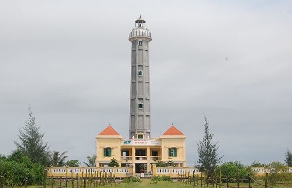
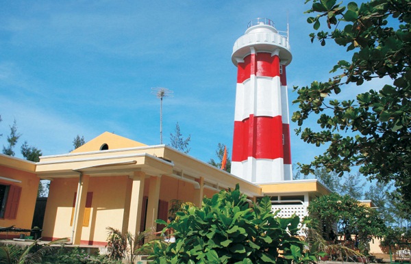
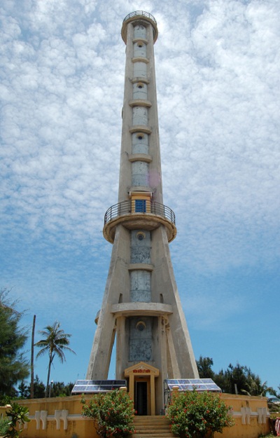
| Name | Image | Year built | Location & coordinates | Class of Light [3] | Focal height[3] | NGA number[3] | Admiralty number[3] | Range nml[3] |
|---|---|---|---|---|---|---|---|---|
| Ba Lạt Lighthouse | Image | 1962 | Tiền Hải District 20°15′23.9″N 106°35′46.8″E / 20.256639°N 106.596333°E | Fl (3+1) W 20s. | 37 metres (121 ft) | 20272.5 | F3233 | 18 |
| Cửa Nam Triệu Bar Range Rear Lighthouse | Imahe | n/a | Hai Phong 20°46′37.3″N 106°49′51.1″E / 20.777028°N 106.830861°E | F W | 21 metres (69 ft) | 20252 | F3268.1 | n/a |
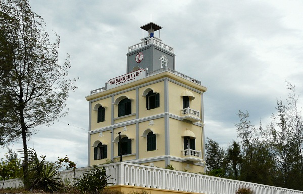
| Đảo Bạch Long Vĩ Lighthouse | Image | 1995 | Bạch Long Vĩ island 20°08′03.3″N 107°43′43.8″E / 20.134250°N 107.728833°E | Fl (2) W 10s. | 80 metres (260 ft) | 20273 | F3230 | 26 |
| Diêm Điền Lighthouse | Image | 1997 | Thái Thủy 20°33′35.4″N 106°34′39.6″E / 20.559833°N 106.577667°E | Fl W 5s. | 26 metres (85 ft) | 20270 | F3235 | 18 |
| Đình Vũ Entrance North Side Lighthouse | Image | n/a | Haiphong 20°50′54.7″N 106°45′45.8″E / 20.848528°N 106.762722°E | Fl W 3s. | 11 metres (36 ft) | 20265 | F3268 | n/a |
| Đình Vũ Entrance South Side Lighthouse | Image | n/a | Haiphong 20°50′47.1″N 106°45′48.8″E / 20.846417°N 106.763556°E | Fl R 3s. | 11 metres (36 ft) | 20265.1 | F3267 | n/a |
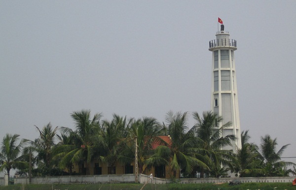
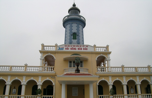
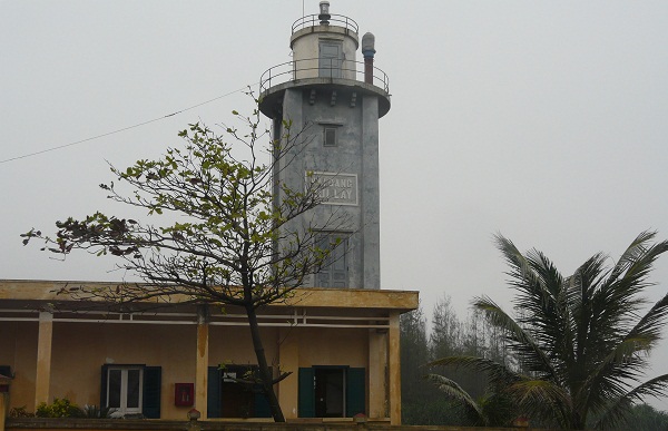
| Hòn Dấu Lighthouse | Image | 1894 | Hòn Island Hai Phong 20°39′59.5″N 106°48′58.8″E / 20.666528°N 106.816333°E | Fl (2) W 15s. | 63 metres (207 ft) | 20268 | F3236 | 22 |
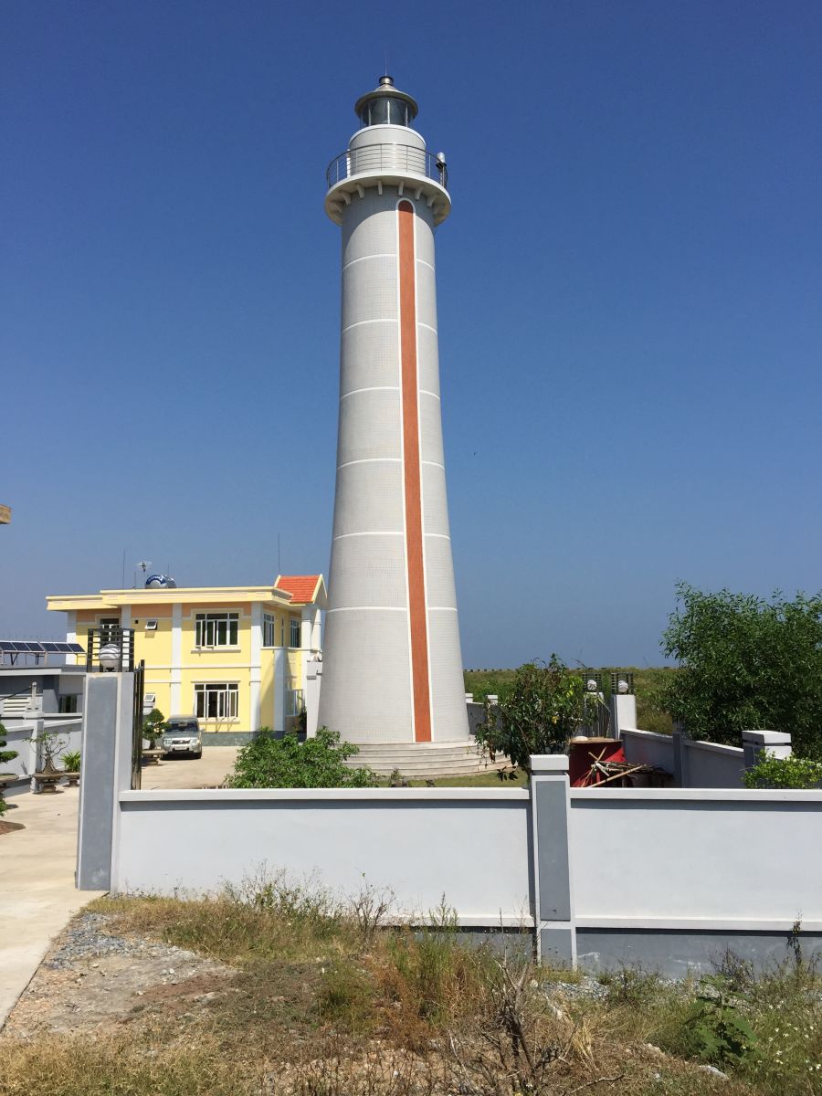
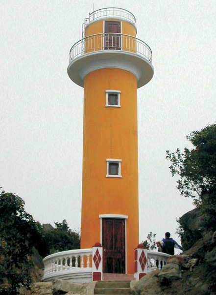
| Lạch Giang Lighthouse | Image | 2001 | Nghĩa Hưng District 19°59′11.9″N 106°10′52.8″E / 19.986639°N 106.181333°E | Fl (2+1) W 10s. | 21 metres (69 ft) | 20279.9 | F3228 | 14 |
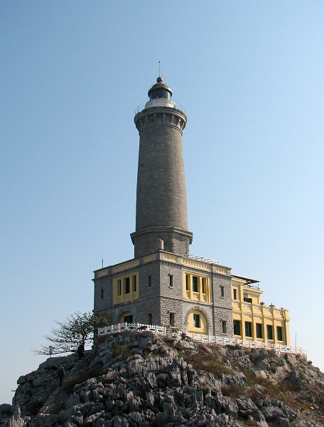
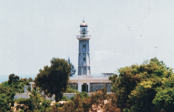
| Long Châu Lighthouse | Image | 1894 | Quần đảo Long Châu Hai Phong 20°37′23.5″N 107°09′33.6″E / 20.623194°N 107.159333°E | Fl (3) W 20s. | 110 metres (360 ft) | 20216 | F3232 | 27 |
| Quất Lâm Lighthouse | Image | 1966 est. | Giao Thủy District 20°11′01.3″N 106°21′44.0″E / 20.183694°N 106.362222°E | Fl W 4s. | 26 metres (85 ft) | 20278.8 | F3229 | 15 |
| Van Châu Lighthouse | 1900 | Thủy Nguyên District 20°52′47.8″N 106°45′00.4″E / 20.879944°N 106.750111°E | L Fl (3+1) WR 6s. | 8 metres (26 ft) | 20264.5 | F3280.4 | n/a | |
North Central Coast (Bắc Trung Bộ)
South Central Coast (Nam Trung Bộ)
South Central Coast (Duyên hải Nam Trung Bộ)

Spratly Islands (Quần đảo Trường Sa)
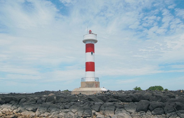
| Name | Image | Year built | Location & coordinates | Class of Light [3] | Focal height[3] | NGA number[3] | Admiralty number[3] | Range nml[3] |
|---|---|---|---|---|---|---|---|---|
| An Bang Lighthouse | 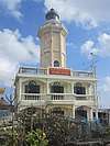 | 1938 | Amboyna Cay 7°53′30.9″N 112°55′17.7″E / 7.891917°N 112.921583°E | Fl (2) W 10s. | 22 metres (72 ft) | 20290.8 | F2825.18 | 15 |
| Ba Kè Lighthouse | Image | 1995 | Bombay Castle (South China Sea) 7°49′09.8″N 110°30′03.4″E / 7.819389°N 110.500944°E | Fl (3+1) W 12s. | 22 metres (72 ft) | 20290.6 | F2825.19 | 12 |
| Bãi Phúc Nguyên Lighthouse | Image | n/a | Prince Consort Bank 7°48′48.0″N 109°56′54.0″E / 7.813333°N 109.948333°E | Fl (2) W 8s. | 22 metres (72 ft) | 20291 | F2825.195 | 12 |
| Bãi Tư Chính A Lighthouse | n/a | Southwest of Prince Consort Bank 7°33′00.0″N 109°42′00.0″E / 7.550000°N 109.700000°E | Fl (2) W 13s. | 22 metres (72 ft) | 20291.4 | F2825.192 | 12 | |
| Bãi Tư Chính B Lighthouse | n/a | Southwest of Prince Consort Bank 7°33′12.0″N 109°48′00.0″E / 7.553333°N 109.800000°E | Fl (3) W 8s. | 22 metres (72 ft) | 20291.6 | F2825.193 | 12 | |
| Đá Đông Lighthouse | Image | 2010 | East London Reef 8°50′24.4″N 112°35′40.0″E / 8.840111°N 112.594444°E | n/a | 15 metres (49 ft) | n/a | n/a | n/a |
| Đá Lát Lighthouse | Image | 1994 | Ladd Reef 8°39′58.3″N 111°39′51.3″E / 8.666194°N 111.664250°E | Fl W 5s. | 40 metres (130 ft) | 20290 | F2825.1 | 15 |
| Đá Tây Lighthouse | Image | 1994 | 8°50′42.2″N 112°11′42.9″E / 8.845056°N 112.195250°E | Fl (3) W 10s. | 22 metres (72 ft) | 20290.1 | F2825.15 | 15 |
| Đảo Dá Lớn Lighhtouse | Image | n/a | Discovery Great Reef 10°01′20.7″N 113°51′17.2″E / 10.022417°N 113.854778°E | n/a | ~ 13 metres (43 ft) | n/a | n/a | n/a |
| Huyền Trân Lighthouse | Image | 1994 | Alexandra Bank 8°01′12.6″N 110°37′51.2″E / 8.020167°N 110.630889°E | Fl (2+1) W 10s. | 23 metres (75 ft) | 20290.4 | F2825.186 | 12 |
| Nam Yết LIghthouse | Image | 2010 | Namyit Island 10°10′45.2″N 114°21′47.2″E / 10.179222°N 114.363111°E | Fl (3) W 15s. | 25 metres (82 ft) | n/a | F2823.4 | n/a |
| Núi Le Lighthouse | Image | n/a | Cornwallis South Reef 8°44′51.8″N 114°10′46.1″E / 8.747722°N 114.179472°E | n/a | 15 metres (49 ft) | n/a | n/a | n/a |
| Phan Vinh Lighthouse | 2010 | Pearson Reef 8°58′32.6″N 113°42′34.2″E / 8.975722°N 113.709500°E | n/a | ~ 15 metres (49 ft) | n/a | n/a | n/a | |
| Phúc Tần Lighthouse | Image | 1997 | Southwest Bank 8°09′59.1″N 110°35′47.5″E / 8.166417°N 110.596528°E | Fl W 5s. | 23 metres (75 ft) | 20290.2 | F2825.197 | 12 |
| Quế Đường Lighthouse | 1994 | Grainger Bank 07°49′09.8″N 110°30′03.4″E / 7.819389°N 110.500944°E | Fl (3) W 10s. | 23 metres (75 ft) | 20291.2 | F2825.194 | 12 | |
| Sinh Tồn Lighthouse | Image | 2010 | Sin Cowe Island 9°53′09.2″N 114°19′48.0″E / 9.885889°N 114.330000°E | Fl (2+1) R 15s. | 25 metres (82 ft) | n/a | F2823.2 | n/a |
| Sơn Ca Lighthouse | Image | 2009 | Sand Cay 10°22′26.3″N 114°28′53.1″E / 10.373972°N 114.481417°E | Fl (2) W 10s. | 28 metres (92 ft) | n/a | n/a | 15 |
| Song Tử Tây Lighthouse | Image | 1993 | Southwest Cay 11°25′41.5″N 114°19′52.2″E / 11.428194°N 114.331167°E | Fl W 15s. | 36 metres (118 ft) | 20289.2 | F2824.5 | 21 |
| Tiên Nữ Lighthouse | Image | 2000 | Dangerous Ground (South China Sea) 8°51′00.1″N 114°38′19.6″E / 8.850028°N 114.638778°E | Fl (2+1) W 10s. | 22 metres (72 ft) | n/a | F2825.06 | 15 |
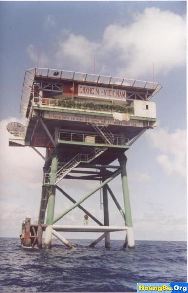
| Trường Sa Lớn Lighthouse | Image | 2009 | Spratly Island 8°38′47.2″N 111°55′08.9″E / 8.646444°N 111.919139°E | Fl W 10s. | 25 metres (82 ft) | n/a | F2825.08 | 18[6] |
See also
References
- ↑ Northern Vietnam The Lighthouse Directory. University of North Carolina at Chapel Hill. Retrieved 28 October 2016
- ↑ Southern Vietnam The Lighthouse Directory. University of North Carolina at Chapel Hill. Retrieved 1 November 2016
- 1 2 3 4 5 6 7 8 9 10 11 12 13 14 15 16 17 18 19 20 21 22 23 24 25 26 27 28 29 30 31 List of Lights, Pub. 112: Western Pacific and Indian Oceans Including the Persian Gulf and Red Sea (PDF). List of Lights. United States National Geospatial-Intelligence Agency. Retrieved 28 October 2016
- ↑ Vietnam Maritime Safety Retrieved 29 October 2016
- ↑ Southern Vietnam Maritime Safety Retrieved 1 November 2016
- ↑ Spratly Islands The Lighthouse Directory. University of North Carolina at Chapel Hill. Retrieved 2 November 2016
External links
| Wikimedia Commons has media related to Lighthouses in Vietnam. |
- Rowlett, Russ. "The Lighthouse Directory". University of North Carolina at Chapel Hill.
| Types |
| _-_cropped.jpg) | ||||||
|---|---|---|---|---|---|---|---|---|
| Fixtures | ||||||||
| Maintenance | ||||||||
| Locations | ||||||||
| Categories |
| |||||||
| Global organizations | ||||||||
| ||||||||
List of lighthouses in Asia | |
|---|---|
| Sovereign states |
|
| States with limited recognition |
|
| Dependencies and other territories |
|
| |
This article is issued from
Wikipedia.
The text is licensed under Creative Commons - Attribution - Sharealike.
Additional terms may apply for the media files.