| Name | Pop. (1991) | Coordinates | Parish |
| Cities |
| Kingston | 587,798 | 17°59′00″N 76°48′00″W / 17.9833°N 76.8000°W / 17.9833; -76.8000 (Kingston) | Kingston / St. Andrew |
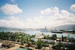
| Montego Bay | 96,488 | 18°28′00″N 77°55′00″W / 18.4666°N 77.9166°W / 18.4666; -77.9166 (Montego Bay) | Saint James |
| Towns |
| Above Rocks | 3,263 | 18°06′32″N 76°52′38″W / 18.1089°N 76.8772°W / 18.1089; -76.8772 (Above Rocks) | Saint Catherine |
| Albert Town | 3,389 | 18°17′45″N 77°32′29″W / 18.2958°N 77.5414°W / 18.2958; -77.5414 (Albert Town) | Trelawny |
| Alexandria | 1,672 | 18°17′54″N 77°21′27″W / 18.2983°N 77.3575°W / 18.2983; -77.3575 (Alexandria) | Saint Ann |
| Alligator Pond | 1,542 | 17°52′16″N 77°34′06″W / 17.8711°N 77.5683°W / 17.8711; -77.5683 (Alligator Pond) | Manchester |
| Anchovy | 3,633 | 18°24′35″N 77°56′02″W / 18.4097°N 77.9339°W / 18.4097; -77.9339 (Anchovy) | Saint James |
| Annotto Bay | 5,468 | 18°16′13″N 76°46′14″W / 18.2703°N 76.7706°W / 18.2703; -76.7706 (Annotto Bay) | Saint Mary |
| Balaclava | 2,837 | 18°10′14″N 77°38′54″W / 18.1705°N 77.6484°W / 18.1705; -77.6484 (Balaclava) | Saint Elizabeth |
| Bamboo | 3,732 | 18°23′06″N 77°15′58″W / 18.3851°N 77.2662°W / 18.3851; -77.2662 (Bamboo) | Saint Ann |
| Bath | 2,151 | 17°57′N 76°21′W / 17.95°N 76.35°W / 17.95; -76.35 (Bath) | Saint Thomas |
| Bethel Town | 2,768 | 18°18′N 77°57′W / 18.30°N 77.95°W / 18.30; -77.95 (Bethel Town) | Westmoreland |
| Black River | 3,675 | 18°02′N 77°52′W / 18.03°N 77.86°W / 18.03; -77.86 (Black River) | Saint Elizabeth |
| Bluefields | 2,564 | 18°10′N 78°02′W / 18.17°N 78.03°W / 18.17; -78.03 (Bluefields) | Westmoreland |
| Bog Walk | 8,794 | 18°06′N 77°01′W / 18.10°N 77.02°W / 18.10; -77.02 (Bog Walk) | Saint Catherine |
| Brompton | 1,457 | 18°04′N 77°54′W / 18.06°N 77.90°W / 18.06; -77.90 (Brompton) | Saint Elizabeth |
| Brown's Town | 6,762 | 18°24′N 77°22′W / 18.40°N 77.36°W / 18.40; -77.36 (Brown's Town) | Saint Ann |
| Buff Bay | 2,596 | 18°14′N 76°40′W / 18.23°N 76.67°W / 18.23; -76.67 (Buff Bay) | Portland |
| Bull Savanna | | 17°53′N 77°35′W / 17.88°N 77.59°W / 17.88; -77.59 (Bull Savanna) | Saint Elizabeth |
| Cambridge | 3,384 | 18°19′N 77°53′W / 18.32°N 77.89°W / 18.32; -77.89 (Cambridge) | Saint James |
| Cascade | 1,220 | 18°24′N 78°06′W / 18.40°N 78.10°W / 18.40; -78.10 (Cascade) | Hanover |
| Cave Valley | 1,777 | 18°16′N 77°22′W / 18.27°N 77.37°W / 18.27; -77.37 (Cave Valley) | Saint Ann |
| Chapelton | 3,930 | 18°05′N 77°16′W / 18.08°N 77.27°W / 18.08; -77.27 (Chapelton) | Clarendon |
| Sanguinetti | 3,900 | 18°06′N 77°20′W / 18.10°N 77.34°W / 18.10; -77.34 (Sanguinetti) | Clarendon |
| Spalding | 5,481 | 18°08′N 77°25′W / 18.14°N 77.41°W / 18.14; -77.41 (Spalding) | Clarendon |
| Christiana | 7,235 | 18°10′N 77°29′W / 18.17°N 77.49°W / 18.17; -77.49 (Christiana) | Manchester |
| Claremont | 2,154 | 18°23′N 77°10′W / 18.38°N 77.17°W / 18.38; -77.17 (Claremont) | Saint Ann |
| Clark's Town | 3,139 | 18°25′N 77°34′W / 18.42°N 77.57°W / 18.42; -77.57 (Clark's Town) | Trelawny |
| Coleyville | 3,320 | 18°13′N 77°30′W / 18.22°N 77.50°W / 18.22; -77.50 (Coleyville) | Manchester |
| Constant Spring | 12,369 | 18°03′N 76°47′W / 18.05°N 76.78°W / 18.05; -76.78 (Constant Spring) | Saint Andrew |
| Croft's Hill | 2,994 | 18°08′N 77°13′W / 18.13°N 77.22°W / 18.13; -77.22 (Croft's Hill) | Clarendon |
| Dalvey | 2,742 | 17°54′N 76°15′W / 17.90°N 76.25°W / 17.90; -76.25 (Dalvey) | Saint Thomas |
| Darliston | 1,435 | 18°14′N 77°58′W / 18.23°N 77.97°W / 18.23; -77.97 (Darliston) | Westmoreland |
| Discovery Bay (Dry Harbour) | 2,230 | 18°28′N 77°23′W / 18.47°N 77.39°W / 18.47; -77.39 (Discovery Bay) | Saint Ann |
| Duncans | 1,849 | 18°28′N 77°32′W / 18.47°N 77.53°W / 18.47; -77.53 (Duncans) | Trelawny |
| Easington | 2,378 | 17°55′N 76°36′W / 17.92°N 76.60°W / 17.92; -76.60 (Easington) | Saint Thomas |
| Ewarton | 8,742 | 18°11′N 77°05′W / 18.18°N 77.08°W / 18.18; -77.08 (Ewarton) | Saint Catherine |
| Falmouth | 7,245 | 18°29′N 77°40′W / 18.49°N 77.66°W / 18.49; -77.66 (Falmouth) | Trelawny |
| Frankfield | 2,865 | 18°09′N 77°21′W / 18.15°N 77.35°W / 18.15; -77.35 (Frankfield) | Clarendon |
| Frome | 900 | 18°18′N 78°09′W / 18.30°N 78.15°W / 18.30; -78.15 (Frome) | Westmoreland |
| Gayle | 3,205 | 18°20′N 77°00′W / 18.33°N 77.00°W / 18.33; -77.00 (Gayle) | Saint Mary |
| Seaford Town | 4,108 | 18°09′N 77°32′W / 18.15°N 77.54°W / 18.15; -77.54 (German Town) | Westmoreland |
| Golden Grove | 2,761 | 17°56′N 76°16′W / 17.93°N 76.27°W / 17.93; -76.27 (Golden Grove) | Saint Thomas |
| Gordon Town | 1,049 | 18°03′N 76°42′W / 18.05°N 76.70°W / 18.05; -76.70 (Gordon Town) | Saint Andrew |
| Grange Hill | 6,530 | 18°22′N 78°12′W / 18.37°N 78.20°W / 18.37; -78.20 (Grange Hill) | Westmoreland |
| Green Island | 1,591 | 18°23′N 78°35′W / 18.38°N 78.58°W / 18.38; -78.58 (Green Island) | Hanover |
| Guy's Hill | 3,165 | 18°15′N 77°00′W / 18.25°N 77.00°W / 18.25; -77.00 (Guy's Hill) | Saint Mary |
| Hayes | 8,447 | 17°53′N 77°15′W / 17.88°N 77.25°W / 17.88; -77.25 (Hayes) | Clarendon |
| Highgate | 5,418 | 18°19′N 76°52′W / 18.32°N 76.87°W / 18.32; -76.87 (Highgate) | Saint Mary |
| Hope Bay | 1,569 | 18°12′N 76°34′W / 18.20°N 76.57°W / 18.20; -76.57 (Hope Bay) | Portland |
| Hopewell | 4,268 | 18°15′N 78°18′W / 18.25°N 78.30°W / 18.25; -78.30 (Hopewell) | Hanover |
| Islington | 2,868 | 18°19′N 76°51′W / 18.32°N 76.85°W / 18.32; -76.85 (Islington) | Saint Mary |
| Kellits | 2,291 | 18°10′N 77°14′W / 18.17°N 77.23°W / 18.17; -77.23 (Kellits) | Clarendon |
| Lacovia | 3,159 | 18°04′N 77°45′W / 18.07°N 77.75°W / 18.07; -77.75 (Lacovia) | Saint Elizabeth |
| Linstead | 14,114 | 18°09′N 77°01′W / 18.15°N 77.02°W / 18.15; -77.02 (Linstead) | Saint Catherine |
| Lionel Town | 4,669 | 17°48′N 77°14′W / 17.80°N 77.23°W / 17.80; -77.23 (Lionel Town) | Clarendon |
| Little London | 1,848 | 18°18′N 78°12′W / 18.30°N 78.20°W / 18.30; -78.20 (Little London) | Westmoreland |
| Lluidas Vale | 2,161 | 18°07′N 77°09′W / 18.12°N 77.15°W / 18.12; -77.15 (Lluidas Vale) | Saint Catherine |
| Lucea | 6,002 | 18°26′N 78°11′W / 18.44°N 78.18°W / 18.44; -78.18 (Lucea) | Hanover |
| Lucky Hill | 750 | 18°18′N 77°01′W / 18.30°N 77.02°W / 18.30; -77.02 (Lucky Hill) | Saint Mary |
| Maggotty | 1,359 | 18°09′N 77°46′W / 18.15°N 77.77°W / 18.15; -77.77 (Maggotty) | Saint Elizabeth |
| Malvern | 3,262 | 17°58′N 77°43′W / 17.97°N 77.72°W / 17.97; -77.72 (Malvern) | Saint Elizabeth |
| Manchioneal | 2,185 | 18°03′N 76°17′W / 18.05°N 76.28°W / 18.05; -76.28 (Manchioneal) | Portland |
| Mandeville | 39,945 | 18°03′N 77°29′W / 18.05°N 77.48°W / 18.05; -77.48 (Mandeville) | Manchester |
| Maroon Town | 2,669 | 18°21′N 77°47′W / 18.35°N 77.79°W / 18.35; -77.79 (Maroon Town) | Saint James |
| Mavis Bank | 1,756 | 18°01′N 76°40′W / 18.02°N 76.67°W / 18.02; -76.67 (Mavis Bank) | Saint Andrew |
| May Pen | 45,903 | 17°58′N 77°14′W / 17.97°N 77.24°W / 17.97; -77.24 (May Pen) | Clarendon |
| Moneague | 2,880 | 18°17′N 77°06′W / 18.28°N 77.10°W / 18.28; -77.10 (Moneague) | Saint Ann |
| Moore Town | 1,054 | 18°04′N 76°26′W / 18.07°N 76.43°W / 18.07; -76.43 (Moore Town) | Portland |
| Morant Bay | 9,602 | 17°52′N 76°23′W / 17.87°N 76.39°W / 17.87; -76.39 (Morant Bay) | Saint Thomas |
| Nain | 2,373 | 17°58′N 77°36′W / 17.97°N 77.60°W / 17.97; -77.60 (Nain) | Saint Elizabeth |
| Negril | 4,184 | 18°19′N 78°20′W / 18.32°N 78.33°W / 18.32; -78.33 (Negril) | Westmoreland |
| Ocho Rios | 8,189 | 18°25′N 77°07′W / 18.42°N 77.11°W / 18.42; -77.11 (Ocho Rios) | Saint Ann |
| Old Harbour | 17,778 | 17°55′N 77°06′W / 17.92°N 77.10°W / 17.92; -77.10 (Old Harbour) | Saint Catherine |
| Old Harbour Bay | 5,405 | 17°54′N 77°06′W / 17.90°N 77.10°W / 17.90; -77.10 (Old Harbour Bay) | Saint Catherine |
| Oracabessa | 4,066 | 18°28′N 76°56′W / 18.47°N 76.93°W / 18.47; -76.93 (Oracabessa) | Saint Mary |
| Osbourne Store | 3,390 | 17°58′N 77°20′W / 17.97°N 77.33°W / 17.97; -77.33 (Osbourne Store) | Clarendon |
| Petersfield | 2,045 | 18°15′N 78°04′W / 18.25°N 78.07°W / 18.25; -78.07 (Petersfield) | Westmoreland |
| Point Hill | 3,651 | 18°05′N 77°06′W / 18.08°N 77.10°W / 18.08; -77.10 (Point Hill) | Saint Catherine |
| Port Antonio | 13,246 | 18°10′N 76°23′W / 18.16°N 76.38°W / 18.16; -76.38 (Port Antonio) | Portland |
| Port Maria | 7,651 | 18°22′N 76°53′W / 18.37°N 76.89°W / 18.37; -76.89 (Port Maria) | Saint Mary |
| Port Royal | 3,004 | 17°56′N 76°51′W / 17.93°N 76.85°W / 17.93; -76.85 (Port Royal) | Kingston |
| Portmore | 90,138 | 17°57′00″N 76°52′48″W / 17.9499°N 76.8799°W / 17.9499; -76.8799 (Portmore) | Saint Catherine |
| Porus | 5,095 | 18°02′N 77°25′W / 18.03°N 77.42°W / 18.03; -77.42 (Porus) | Manchester |
| Race Course | 2,589 | 17°50′N 77°17′W / 17.83°N 77.28°W / 17.83; -77.28 (Race Course) | Clarendon |
| Richmond | 1,984 | 18°14′N 76°54′W / 18.23°N 76.90°W / 18.23; -76.90 (Richmond) | Saint Mary |
| Rio Bueno | 1,108 | 18°34′N 77°27′W / 18.57°N 77.45°W / 18.57; -77.45 (Rio Bueno) | Trelawny |
| Riversdale | 2,791 | 18°09′N 76°58′W / 18.15°N 76.97°W / 18.15; -76.97 (Riversdale) | Saint Catherine |
| Rocky Point | 2,744 | 17°46′N 77°16′W / 17.77°N 77.27°W / 17.77; -77.27 (Rocky Point) | Clarendon |
| Runaway Bay | 5,655 | 18°27′N 77°20′W / 18.45°N 77.33°W / 18.45; -77.33 (Runaway Bay) | Saint Ann |
| Saint Ann's Bay | 10,961 | 18°26′N 77°13′W / 18.44°N 77.22°W / 18.44; -77.22 (Saint Ann's Bay) | Saint Ann |
| Sandy Bay | 4,476 | 18°27′N 78°06′W / 18.45°N 78.10°W / 18.45; -78.10 (Sandy Bay) | Hanover |
| Santa Cruz | 8,144 | 18°04′N 77°43′W / 18.07°N 77.72°W / 18.07; -77.72 (Santa Cruz) | Saint Elizabeth |
| Savanna-la-Mar | 16,553 | 18°10′N 77°57′W / 18.16°N 77.95°W / 18.16; -77.95 (Savanna-la-Mar) | Westmoreland |
| Seaforth | 4,108 | 17°56′N 76°27′W / 17.93°N 76.45°W / 17.93; -76.45 (Seaforth) | Saint Thomas |
| Siloah | 2,701 | 18°10′N 77°44′W / 18.17°N 77.73°W / 18.17; -77.73 (Siloah) | Saint Elizabeth |
| Southfield | 2,671 | 17°53′N 77°40′W / 17.88°N 77.67°W / 17.88; -77.67 (Southfield) | Saint Elizabeth |
| Spanish Town | 92,383 | 17°59′45″N 76°57′18″W / 17.9958°N 76.9551°W / 17.9958; -76.9551 (Spanish Town) | Saint Catherine |
| Stony Hill | 8,244 | 18°05′N 76°47′W / 18.08°N 76.78°W / 18.08; -76.78 (Stony Hill) | Saint Andrew |
| Trinity Ville | 2,614 | 17°57′N 76°32′W / 17.95°N 76.53°W / 17.95; -76.53 (Trinity Ville) | Saint Thomas |
| Ulster Spring | 1,391 | 18°19′N 77°31′W / 18.32°N 77.52°W / 18.32; -77.52 (Ulster Spring) | Trelawny |
| Wakefield | 2,724 | 18°25′N 77°43′W / 18.42°N 77.72°W / 18.42; -77.72 (Wakefield) | Trelawny |
| White House | 3,157 | 18°05′N 77°58′W / 18.08°N 77.97°W / 18.08; -77.97 (White House) | Westmoreland |
| Williamsfield | 2,800 | 18°04′N 77°29′W / 18.07°N 77.48°W / 18.07; -77.48 (Williamsfield) | Manchester |
| Yallahs | 6,902 | 17°52′N 76°34′W / 17.87°N 76.57°W / 17.87; -76.57 (Yallahs) | Saint Thomas |