National Register of Historic Places listings in the United States Virgin Islands
This is a list of the buildings, sites, districts, and objects listed on the National Register of Historic Places in the United States Virgin Islands. There are currently 87 listed sites spread across 16 of the 20 subdistricts within three islands/districts of the United States Virgin Islands. Four sites are additionally designated National Historic Landmarks and two others as National Historic Sites.
- This National Park Service list is complete through NPS recent listings posted October 11, 2018.[1]
Numbers of listings
The following are approximate tallies of current listings in the United States Virgin Islands on the National Register of Historic Places. These counts are based on entries in the National Register Information Database as of April 24, 2008[2] and new weekly listings posted since then on the National Register of Historic Places web site.[3] There are frequent additions to the listings and occasional delistings and the counts here are not official. Also, the counts in this table exclude boundary increase and decrease listings which modify the area covered by an existing property or district and which carry a separate National Register reference number.
| District | # of Sites | |
|---|---|---|
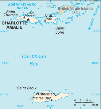
| 1 | Saint Croix | 40 |
| 2 | Saint John | 26 |
| 3 | Saint Thomas | 21 |
| Total: | 87 | |
Saint Croix
| [4] | Name on the Register | Image | Date listed[5] | Location | Subdistrict | Description |
|---|---|---|---|---|---|---|
| 1 | Aklis Archeological Site |  |
July 1, 1976 (#76001852) |
Sandy Point National Wildlife Refuge |
Frederiksted | |
| 2 | Bethlehem Middle Works Historic District | July 6, 1988 (#87001932) |
King's Quarter 17°43′04″N 64°47′33″W / 17.717639°N 64.7925°W |
Southcentral | ||
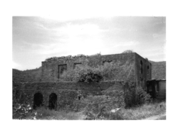
| 3 | Christiansted Historic District |  |
July 30, 1976 (#76002266) |
Roughly bounded by Christiansted Harbor, New, Peter's Farm Hospital, and West Streets 17°44′46″N 64°42′16″W / 17.746111°N 64.704444°W |
Christiansted | |
| 4 | Christiansted National Historic Site |  |
October 15, 1966 (#66000077) |
Bounded by King, Queen, and Queens Cross Streets and Christiansted Harbor 17°44′56″N 64°42′08″W / 17.748889°N 64.702222°W |
Christiansted | |
| 5 | Coakley Bay Estate | 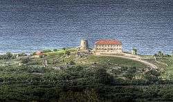 |
July 23, 1976 (#76001841) |
East of Christiansted 17°45′31″N 64°38′28″W / 17.758559°N 64.641011°W |
East End | Sugarcane plantation site, with 20 feet (6.1 m)-tall stonework of a windmill |
| 6 | Columbus Landing Site | 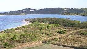 |
October 15, 1966 (#66000743) |
East of Greig Hill on Salt River Bay 17°46′43″N 64°45′34″W / 17.778501°N 64.759557°W |
East End | |
| 7 | Danish West India and Guinea Company Warehouse | 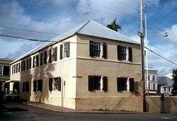 |
October 9, 1974 (#74001940) |
Church and Company Streets 17°44′47″N 64°42′09″W / 17.7464°N 64.7026°W |
Christiansted | |
| 8 | Diamond School | July 1, 1976 (#76001842) |
West of Christiansted on Centerline Road 17°42′47″N 64°49′47″W / 17.712917°N 64.829722°W |
Southcentral | ||
| 9 | Estate Butler's Bay | August 25, 1978 (#78002722) |
North of Frederiksted 17°44′57″N 64°53′32″W / 17.749028°N 64.892222°W |
Northwest | ||
| 10 | Estate Grove Place | July 17, 1978 (#78002721) |
4 miles (6.4 km) east of Frederiksted off Centerline Road 17°43′39″N 64°49′27″W / 17.727577°N 64.82419°W |
Northwest | Sugar factory, chimney, and wagon depot | |
| 11 | Estate Hogansborg | February 17, 1978 (#78002723) |
East of Frederiksted off Centerline Road 17°42′39″N 64°50′44″W / 17.710972°N 64.845556°W |
Northwest | ||
| 12 | Estate Judith's Fancy | 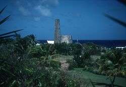 |
July 17, 1978 (#78002717) |
4 miles (6.4 km) northwest of Christiansted 17°46′41″N 64°44′44″W / 17.778194°N 64.745694°W |
Sion Farm | |
| 13 | Estate La Reine | November 24, 1980 (#80003994) |
20 Kings Quarter and 19 Queens Quarter 17°44′09″N 64°46′19″W / 17.735972°N 64.771944°W |
Northcentral | ||
| 14 | Estate Little Princess | 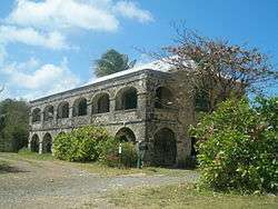 |
June 9, 1980 (#80003995) |
Northwest of Christiansted 17°45′35″N 64°43′31″W / 17.759861°N 64.725278°W |
Sion Farm | |
| 15 | Estate Mount Victory | February 17, 1978 (#78002724) |
Northeast of Frederiksted 17°45′13″N 64°52′05″W / 17.75375°N 64.868056°W |
Northwest | ||
| 16 | Estate Prosperity | February 17, 1978 (#78002725) |
North of Frederiksted 17°43′42″N 64°52′53″W / 17.728472°N 64.881389°W |
Northwest | ||
| 17 | Estate Saint George Historic District | 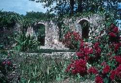 |
October 24, 1986 (#86003351) |
Prince Quarter 17°43′05″N 64°49′49″W / 17.717917°N 64.830139°W |
Northwest | |
| 18 | Estate St. John | June 9, 1978 (#78002718) |
3 miles (4.8 km) northwest of Christiansted 17°45′57″N 64°44′48″W / 17.765972°N 64.746667°W |
Sion Farm | ||
| 19 | Fair Plain Archeological District | September 29, 1976 (#76001843) |
Address Restricted |
Christiansted | ||
| 20 | Fairplain Historic and Archeological District | July 6, 1988 (#87001903) |
Address Restricted |
Christiansted | ||
| 21 | Frederiksted Historic District | 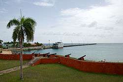 |
August 9, 1976 (#76001853) |
Roughly bounded by Fisher Street, the cemetery, and Fort Frederik 17°42′44″N 64°52′53″W / 17.712222°N 64.881389°W |
Frederiksted | |
| 22 | Friedensfeld Midlands Moravian Church and Manse | July 1, 1976 (#76001844) |
West of Christiansted 17°44′53″N 64°46′48″W / 17.748194°N 64.78°W |
Northcentral | ||
| 23 | Friedensthal Mission | 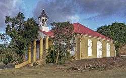 |
August 25, 1978 (#78002719) |
Southwest of Christiansted 17°44′39″N 64°42′35″W / 17.744028°N 64.709722°W |
Christiansted | |
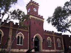
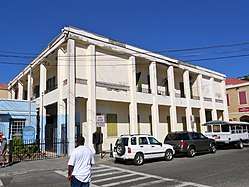
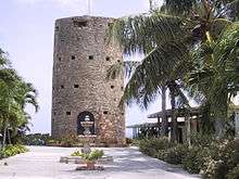
| 24 | Ft. Frederik of US Virgin Islands | .jpg) |
September 25, 1997 (#96001073) |
South of junction of Mahogany Road and U.S. Virgin Island Highway 631, north end of Frederiksted 17°42′55″N 64°53′01″W / 17.715278°N 64.883611°W |
Frederiksted | |
| 25 | Great Pond Archeological Site | July 12, 1976 (#76001845) |
Address Restricted |
Christiansted | ||
| 26 | Green Kay | July 19, 1976 (#76001846) |
East of Christiansted 17°45′32″N 64°39′16″W / 17.758895°N 64.654363°W |
East End | ||
| 27 | La Grande Princesse School | July 12, 1976 (#76001847) |
Northeast of Christiansted 17°45′29″N 64°43′51″W / 17.758194°N 64.730833°W |
Sion Farm | ||
| 28 | Little La Grange | October 22, 1976 (#76001854) |
Northeast of Frederiksted 17°43′47″N 64°51′54″W / 17.729861°N 64.865°W |
Northwest | ||
| 29 | Lower Granard Archeological District | July 1, 1976 (#76001849) |
Address Restricted |
Christiansted | ||
| 30 | Prosperity Archeological Site | July 12, 1976 (#76001855) |
Address Restricted |
Frederiksted | ||
| 31 | Richmond Prison Detention and Workhouse | February 14, 1978 (#78002720) |
West of Christiansted 17°44′53″N 64°42′45″W / 17.748194°N 64.7125°W |
Christiansted | ||
| 32 | River Archeological Site | July 1, 1976 (#76001856) |
Address Restricted |
Frederiksted | ||
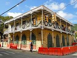
| 33 | St. John's Episcopal Church | 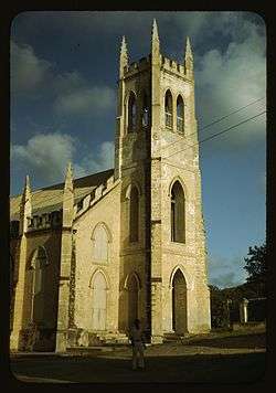 |
October 4, 2016 (#16000698) |
Plot #27 King Street 17°44′35″N 64°42′28″W / 17.742926°N 64.707751°W |
Christiansted | |
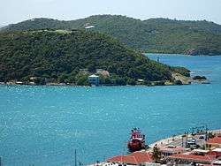
| 34 | Salt River Bay National Historic Site and Ecological Preserve | |
February 24, 1992 (#01000280) |
2100 Church Street 17°46′52″N 64°45′23″W / 17.781111°N 64.756389°W |
Christiansted | |
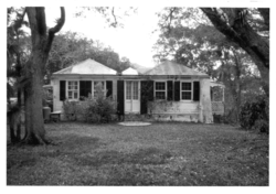
| 35 | Sion Hill | .jpg) |
July 19, 1976 (#76001850) |
West of Christiansted 17°44′35″N 64°44′41″W / 17.742917°N 64.744722°W |
Sion Farm | |
| 36 | Slob Historic District | November 12, 1987 (#87001929) |
King's Quarter 17°43′54″N 64°46′16″W / 17.731667°N 64.771111°W |
Sion Farm | ||
| 37 | St. Georges Archeological Site | September 29, 1976 (#76001857) |
Address Restricted |
Frederiksted | ||
| 38 | Strawberry Hill Historic District | October 2, 1987 (#87001934) |
Queen's Quarter 17°43′57″N 64°45′37″W / 17.7324601°N 64.7603138°W |
Sion Farm | ||
| 39 | Upper Salt River Archeological District | September 1, 1976 (#76001851) |
Address Restricted |
Christiansted | ||
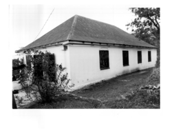
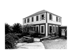
| 40 | Whim | .jpg) |
July 30, 1976 (#76001858) |
1.7 miles (2.7 km) southeast of Frederiksted on Centerline Road 17°42′10″N 64°51′47″W / 17.702639°N 64.863056°W |
Southwest |
Saint John
| [4] | Name on the Register | Image | Date listed[5] | Location | Subdistrict | Description |
|---|---|---|---|---|---|---|
| 1 | Annaberg Historic District | 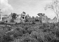 |
July 23, 1981 (#81000090) |
Northwest of Coral Bay, Leinster Bay 18°21′53″N 64°44′18″W / 18.364722°N 64.738333°W |
Central | |
| 2 | Brown Bay Plantation Historic District | July 23, 1981 (#81000089) |
North of Palestina 18°21′47″N 64°42′25″W / 18.363056°N 64.707083°W |
Central | Virgin Islands National Park MRA | |
| 3 | Catherineberg-Jockumsdahl-Herman Farm | 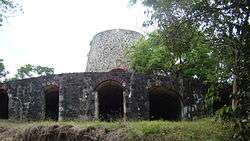 |
March 30, 1978 (#78000270) |
East of Cruz Bay 18°20′49″N 64°45′39″W / 18.346944°N 64.760833°W |
Central | Virgin Islands National Park MRA |
| 4 | Cinnamon Bay Plantation | 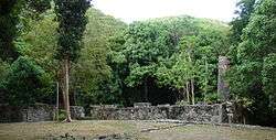 |
July 11, 1978 (#78000269) |
Northeast of Cruz Bay on Cinnamon Bay 18°21′15″N 64°45′15″W / 18.354167°N 64.754167°W |
Central | Virgin Islands National Park MRA |
| 5 | Congo Cay Archeological District | December 1, 1978 (#78003166) |
Address Restricted |
Cruz Bay | Virgin Islands National Park MRA | |
| 6 | Cruz Bay Town Historic District | October 4, 2016 (#16000699) |
Town boundary 18°19′52″N 64°47′42″W / 18.331°N 64.795°W |
Cruz Bay | ||
| 7 | Dennis Bay Historic District |  |
July 23, 1981 (#81000095) |
Northeast of Cruz Bay off North Shore Road 18°21′15″N 64°46′33″W / 18.354167°N 64.775833°W |
Central | Virgin Islands National Park MRA |
| 8 | Emmaus Moravian Church and Manse |  |
November 7, 1977 (#77001531) |
West of Palestina 18°21′01″N 64°42′48″W / 18.350278°N 64.713333°W |
Coral Bay | |
| 9 | Enighed | July 1, 1976 (#76002219) |
Cruz Bay Quarter 18°19′54″N 64°47′30″W / 18.331667°N 64.791667°W |
Cruz Bay | ||
| 10 | Estate Beverhoudt | August 29, 1978 (#78003170) |
1.5 miles (2.4 km) east of Cruz Bay off Center Line Road 18°20′27″N 64°46′19″W / 18.340833°N 64.771944°W |
Central | ||
| 11 | Estate Carolina Sugar Plantation |  |
July 19, 1976 (#76002217) |
West of Coral Bay on King Hill Road 18°20′58″N 64°43′07″W / 18.349444°N 64.718611°W |
Coral Bay | |
| 12 | Fortsberg |  |
September 1, 1976 (#76002218) |
Southeast of Coral Bay 18°20′45″N 64°42′20″W / 18.345833°N 64.705556°W |
Coral Bay | |
| 13 | Hermitage Plantation Historic District | July 23, 1981 (#81000094) |
East End Road, Hurricane Hole 18°21′32″N 64°41′59″W / 18.358889°N 64.699722°W |
Central | Virgin Islands National Park MRA | |
| 14 | HMS Santa Monica | February 17, 1978 (#78003163) |
Address Restricted |
Coral Bay | ||
| 15 | Jossie Gut Historic District | July 23, 1981 (#81000086) |
West of Coral Bay off Center Line Road, Reef Bay 18°20′32″N 64°44′25″W / 18.342222°N 64.740278°W |
Ceentral | Virgin Islands National Park MRA | |
| 16 | L'Esperance Historic District | July 23, 1981 (#81000699) |
East of Cruz Bay off Center Line Road, Reef Bay 18°20′33″N 64°45′30″W / 18.3425°N 64.758333°W |
Central | Virgin Islands National Park MRA | |
| 17 | Lameshur Plantation | June 23, 1978 (#78000271) |
East of Cruz Bay on Little Lameshur Bay 18°20′33″N 64°45′30″W / 18.3425°N 64.758333°W |
Central | Virgin Islands National Park MRA | |
| 18 | Liever Marches Bay Historic District | July 23, 1981 (#81000087) |
East of Brown Bay 18°21′16″N 64°42′04″W / 18.354444°N 64.701111°W |
Central | Virgin Islands National Park MRA | |
| 19 | Lind Point Fort | 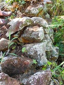 |
July 23, 1981 (#81000085) |
Northwest of Cruz Bay 18°20′13″N 64°47′50″W / 18.336944°N 64.797222°W |
Central | Virgin Islands National Park MRA |
| 20 | Mary Point Estate | 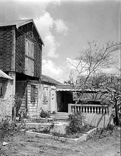 |
May 22, 1978 (#78000272) |
Northeast of Cruz Bay 18°22′06″N 64°44′29″W / 18.368333°N 64.741389°W |
Central | Virgin Islands National Park MRA |
| 21 | More Hill Historic District | July 23, 1981 (#81000092) |
Off East End Road 18°21′40″N 64°41′37″W / 18.361111°N 64.693611°W |
East End | Virgin Islands National Park MRA | |
| 22 | Petroglyph Site | 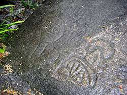 |
July 7, 1982 (#82001716) |
Reef Bay Address Restricted |
Central | |
| 23 | Reef Bay Great House Historic District | July 23, 1981 (#81000091) |
West of Bordeaux, Reef Bay 18°19′55″N 64°44′23″W / 18.332083°N 64.739722°W |
Central | Virgin Islands National Park MRA | |
| 24 | Reef Bay Sugar Factory Historic District | 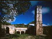 |
July 23, 1981 (#81000084) |
East of Cruz Bay, Reef Bay 18°19′31″N 64°44′40″W / 18.325278°N 64.744444°W |
Central | Virgin Islands National Park MRA |
| 25 | Rustenberg Plantation South Historic District | July 23, 1981 (#81000093) |
West of Coral Bay off Center Line Road, Cinnamon Bay 18°20′42″N 64°44′59″W / 18.345°N 64.749722°W |
Central | Virgin Islands National Park MRA | |
| 26 | Trunk Bay Sugar Factory | July 23, 1981 (#81000088) |
Northeast of Cruz Bay on North Shore Road, Trunk Bay 18°21′35″N 64°46′02″W / 18.359861°N 64.767222°W |
Central | Virgin Islands National Park MRA |
Former listings
| [4] | Name on the Register | Image | Date listed | Date removed | Location | Subdistrict | Summary |
|---|---|---|---|---|---|---|---|
| 1 | Keating's Inn | July 6, 1976 (#76002220) |
Address Restricted |
Cruz Bay |
Saint Thomas
.jpg)
See also
| Wikimedia Commons has media related to National Register of Historic Places in the United States Virgin Islands. |
References
- ↑ "National Register of Historic Places: Weekly List Actions". National Park Service, United States Department of the Interior. Retrieved on October 11, 2018.
- ↑ National Park Service (2008-04-24). "National Register Information System". National Register of Historic Places. National Park Service.
- ↑ "National Register of Historic Places: Weekly List Actions". National Park Service. Retrieved January 16, 2009.
- 1 2 3 4 Numbers represent an ordering by significant words. Various colorings, defined here, differentiate National Historic Landmarks and historic districts from other NRHP buildings, structures, sites or objects.
- 1 2 3 The eight-digit number below each date is the number assigned to each location in the National Register Information System database, which can be viewed by clicking the number.
| Topics | |
|---|---|
| Lists by states |
|
| Lists by insular areas | |
| Lists by associated states | |
| Other areas | |
| |
Charlotte Amalie (capital) | |
| Topics |
|
| Government | |
| Cities | |
| Islands | |
| Parks | |