| [3] |
Name on the Register[4] |
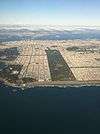
Image |
Date listed[5] |
Location |
Neighborhood/Region |
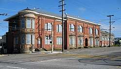
Description |
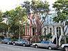
|---|
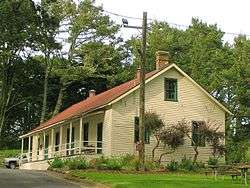
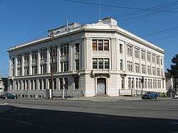
| 1 |
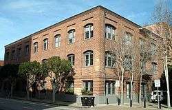
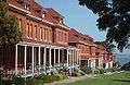
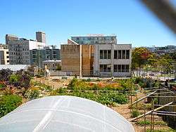
Administration Building, Treasure Island |
|
February 26, 2008
(#08000081) |
Southeast corner of Avenue of the Palms and California Ave.
37°49′02″N 122°22′16″W / 37.8171°N 122.3712°W / 37.8171; -122.3712 (Administration Building, Treasure Island) |
Treasure Island |
Treasure Island Museum Association |
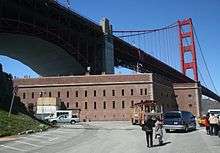
| 2 |
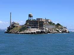
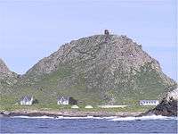
Alcatraz |
|
June 23, 1976
(#76000209) |
Alcatraz Island, San Francisco Bay
37°49′36″N 122°25′22″W / 37.8268°N 122.4228°W / 37.8268; -122.4228 (Alcatraz) |
San Francisco Bay |
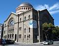
Former maximum security Federal prison, from which Frank Morris but few others escaped, now part of the Golden Gate National Recreation Area and visited by tourist ferries. |
| 3 |
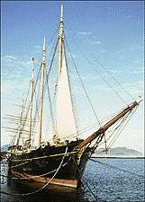
ALMA (Scow Schooner) |
|
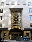
October 10, 1975
(#75000179) |
Hyde Street Pier, San Francisco Maritime National Historical Park, 2905 Hyde Street
37°48′37″N 122°25′22″W / 37.8103°N 122.4227°W / 37.8103; -122.4227 (ALMA (Scow Schooner)) |
Fisherman's Wharf |
Flat-bottomed scow schooner built in 1891 to haul goods on and around San Francisco Bay and river delta areas. |
| 4 |
Apollo (Storeship) |
|
May 16, 1991
(#91000561) |
NW corner of Sacramento and Battery Sts.
37°47′39″N 122°24′02″W / 37.7942°N 122.4005°W / 37.7942; -122.4005 (Apollo (Storeship)) |
Financial District |
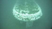
San Francisco History: Buried Ships |
| 5 |
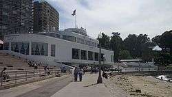
Aquatic Park Historic District |
|
January 26, 1984
(#84001183) |
Bounded by Van Ness Ave., Hyde and Polk Sts.
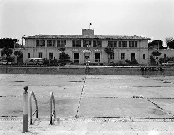
37°48′25″N 122°25′22″W / 37.807°N 122.4229°W / 37.807; -122.4229 (Aquatic Park Historic District) |
Fisherman's Wharf |
Streamline Moderne building built as a public bathhouse by the WPA in 1936. |
| 6 |
Armour & Co. Building |
|
December 22, 2009
(#09001117) |
1050 Battery St.
37°48′04″N 122°24′05″W / 37.801161°N 122.401317°W / 37.801161; -122.401317 (Armour & Co. Building) |
Fisherman's Wharf |
1907 building by San Francisco architect Henry Geilfuss used as a meat packing plant and smokehouse by Armour and Company until 1934[6] |
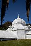
| 7 |
Atherton House |
|
January 31, 1979
(#79000527) |
1990 California St.
37°47′24″N 122°25′38″W / 37.79°N 122.4271°W / 37.79; -122.4271 (Atherton House) |
Lower Pacific Heights |
NoeHill of San Francisco listing for Atherton House. |
| 8 |
Audiffred Building |
|
May 10, 1979
(#79000528) |
1—21 Mission St.
37°47′36″N 122°23′33″W / 37.7934°N 122.3926°W / 37.7934; -122.3926 (Audiffred Building) |
South Beach |
Audiffred Building San Francisco …an urban history |
| 9 |
Baker and Hamilton |
|
February 9, 2005
(#05000001) |
601 Townsend St.
37°46′17″N 122°24′07″W / 37.7713°N 122.4019°W / 37.7713; -122.4019 (Baker and Hamilton) |
South of Market |
|
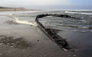
| 10 |
Balclutha |
|
November 7, 1976
(#76000178) |
Pier 41 East
37°48′35″N 122°25′21″W / 37.8098°N 122.4225°W / 37.8098; -122.4225 (Balclutha) |
Fisherman's Wharf |
1886 square rigged sailing ship |
| 11 |
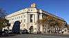
Bank of Italy |
|
June 2, 1978
(#78000754) |
552 Montgomery St.
37°47′41″N 122°24′11″W / 37.7946°N 122.403°W / 37.7946; -122.403 (Bank of Italy) |
Financial District |
|
| 12 |
Beach Chalet |
|
July 22, 1981
(#81000172) |
1000 Great Hwy.
37°46′10″N 122°30′37″W / 37.7694°N 122.5103°W / 37.7694; -122.5103 (Beach Chalet) |
Ocean Beach |
|
| 13 |
C. A. Belden House |
|
August 11, 1983
(#83001229) |
2004-2010 Gough St.
37°47′32″N 122°25′33″W / 37.7921°N 122.4259°W / 37.7921; -122.4259 (C. A. Belden House) |
Pacific Heights |
|
| 14 |
Belt Railroad Engine House and Sandhouse |
|
February 13, 1986
(#86000207) |
Block bounded by Lombard, Sansome, and the Embarcadero
37°48′17″N 122°24′12″W / 37.8046°N 122.4032°W / 37.8046; -122.4032 (Belt Railroad Engine House and Sandhouse) |
Fisherman's Wharf |
|
| 15 |
Building at 1735-1737 Webster Street |
|
March 8, 1973
(#73000444) |
1735—1737 Webster St.
37°47′13″N 122°25′55″W / 37.7869°N 122.4319°W / 37.7869; -122.4319 (Building at 1735-1737 Webster Street) |
Lower Pacific Heights |
|
| 16 |
Building at 1813-1813B Sutter Street |
|
March 8, 1973
(#73000443) |
1813—1813B Sutter St.
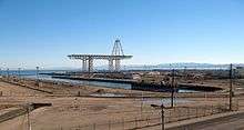
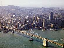
37°47′11″N 122°25′50″W / 37.786389°N 122.430556°W / 37.786389; -122.430556 (Building at 1813-1813B Sutter Street) |
Japantown |
The current address of this building is 1815 Sutter St.[7] |
| 17 |
Building at 1840-1842 Eddy Street |
|
March 8, 1973
(#73000437) |
1840—1842 Eddy St.
37°46′51″N 122°26′20″W / 37.7808°N 122.4388°W / 37.7808; -122.4388 (Building at 1840-1842 Eddy Street) |
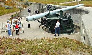
Western Addition |
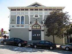
|
| 18 |
Building at 33-35 Beideman Place |
|
March 8, 1973
(#73000435) |
33—35 Beideman Pl.
37°46′56″N 122°26′19″W / 37.7821°N 122.4385°W / 37.7821; -122.4385 (Building at 33-35 Beideman Place) |
Western Addition |
|
| 19 |
Building at 45-47 Beideman Place |
|
March 8, 1973
(#73000436) |
45—57 Beideman Pl.
37°46′56″N 122°26′19″W / 37.7822°N 122.4385°W / 37.7822; -122.4385 (Building at 45-47 Beideman Place) |
Western Addition |
|
| 20 |
Building at 465 Tenth St. |
|
June 4, 1999
(#99000581) |
465 Tenth St.
37°46′15″N 122°24′36″W / 37.7708°N 122.4101°W / 37.7708; -122.4101 (Building at 465 Tenth St.) |
South of Market |
Rothschild Building |
| 21 |
Building at 735 Market Street |
|
July 27, 2004
(#04000327) |
735 Market St.
37°47′12″N 122°24′15″W / 37.7867°N 122.4043°W / 37.7867; -122.4043 (Building at 735 Market Street) |
Financial District |
|
| 22 |
Burr House |
|
June 8, 2015
(#14000967) |
1772 Vallejo St.
37°47′47″N 122°25′35″W / 37.7965°N 122.4264°W / 37.7965; -122.4264 (Burr House) |
Pacific Heights |
|
| 23 |
Bush Street-Cottage Row Historic District |
|
December 27, 1982
(#82000983) |
2101-2125 Bush St., 1-6 Cottage Row, and 1940-1948 Sutter St.
37°47′12″N 122°25′56″W / 37.7868°N 122.4321°W / 37.7868; -122.4321 (Bush Street-Cottage Row Historic District) |
Lower Pacific Heights |
|
| 24 |
C. A. Thayer |
|
November 13, 1966
(#66000229) |
San Francisco Maritime State Historic Park
37°48′33″N 122°25′18″W / 37.8091°N 122.4216°W / 37.8091; -122.4216 (C. A. Thayer) |
Fisherman's Wharf |
1895 schooner |
| 25 |
Calvary Presbyterian Church |
|
May 3, 1978
(#78000755) |
2501—2515 Fillmore St.
37°47′34″N 122°26′05″W / 37.7927°N 122.4347°W / 37.7927; -122.4347 (Calvary Presbyterian Church) |
Pacific Heights |
|
| 26 |
Camera Obscura |
|
May 23, 2001
(#01000522) |
1096 Point Lobos Ave.
37°46′42″N 122°30′51″W / 37.7783°N 122.5142°W / 37.7783; -122.5142 (Camera Obscura) |
Richmond District |
|
| 27 |
Central Embarcadero Piers Historic District |
|
November 20, 2002
(#02001390) |
Piers 1, 1½, 3 and 5, The Embarcadero
37°47′51″N 122°23′44″W / 37.7976°N 122.3956°W / 37.7976; -122.3956 (Central Embarcadero Piers Historic District) |
Embarcadero |
|
| 28 |
Chambord Apartments |
|
September 20, 1984
(#84001184) |
1298 Sacramento St.
37°47′33″N 122°24′51″W / 37.7925°N 122.4142°W / 37.7925; -122.4142 (Chambord Apartments) |
Nob Hill |
|
| 29 |
City of Paris Building |
|
January 23, 1975
(#75000471) |
181-199 Geary St.
37°47′15″N 122°24′23″W / 37.7874°N 122.4064°W / 37.7874; -122.4064 (City of Paris Building) |
Downtown |
Neiman Marcus now occupies the site of the former City of Paris Building |
| 30 |
Coffin-Redington Building |
|
February 2, 2001
(#01000028) |
301 Folsom St. and 300 Beale St.
37°47′19″N 122°23′34″W / 37.7885°N 122.3927°W / 37.7885; -122.3927 (Coffin-Redington Building) |
Rincon Hill |
|
| 31 |
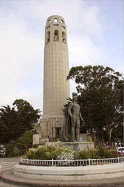
Coit Memorial Tower |
|
January 29, 2008
(#07001468) |
1 Telegraph Hill Blvd.
37°48′09″N 122°24′21″W / 37.8024°N 122.4058°W / 37.8024; -122.4058 (Coit Memorial Tower) |
Telegraph Hill |
|
| 32 |
Colombo Building |
|
January 31, 2008
(#07001469) |
1-21 Columbus Ave.
37°47′44″N 122°24′13″W / 37.7956°N 122.4037°W / 37.7956; -122.4037 (Colombo Building) |
Financial District |
|
| 33 |
USS Conestoga (shipwreck and remains) |
|
June 10, 2016
(#16000358) |
Greater Farallones National Marine Sanctuary
|
Gulf of the Farallones |
|
| 34 |
Dallam-Merritt House |
|
April 19, 1984
(#84001185) |
2355 Washington St.
37°47′30″N 122°25′56″W / 37.7918°N 122.4321°W / 37.7918; -122.4321 (Dallam-Merritt House) |
Pacific Heights |
|
| 35 |
Delano House |
|
October 29, 1982
(#82000984) |
70 Buena Vista Terr.
37°46′04″N 122°26′18″W / 37.7678°N 122.4384°W / 37.7678; -122.4384 (Delano House) |
Buena Vista |
|
| 36 |
Richard P. Doolan Residence and Storefronts |
|
May 11, 2011
(#09001201) |
557 Ashbury St./1500-1512 Haight St.
37°46′13″N 122°26′47″W / 37.770278°N 122.446389°W / 37.770278; -122.446389 (Richard P. Doolan Residence and Storefronts) |
Haight-Ashbury |
|
| 37 |
Drydock 4 Hunters Point Naval Shipyard |
|
July 25, 2012
(#12000424) |
Southeast of the junction of Spear Ave. & Morrell St.
37°43′32″N 122°21′54″W / 37.725439°N 122.364866°W / 37.725439; -122.364866 (Drydock 4 Hunters Point Naval Shipyard) |
Bayview-Hunters Point |
|
| 38 |
Frank G. Edwards House |
|
October 29, 1982
(#82000986) |
1366 Guerrero St.
37°44′57″N 122°25′22″W / 37.7493°N 122.4228°W / 37.7493; -122.4228 (Frank G. Edwards House) |
Noe Valley |
|
| 39 |
Engine House No. 31 |
|
January 7, 1988
(#87002290) |
1088 Green St.
37°47′55″N 122°25′01″W / 37.7986°N 122.417°W / 37.7986; -122.417 (Engine House No. 31) |
Russian Hill |
|
| 40 |
Eureka |
|
April 24, 1973
(#73000229) |
Hyde Street Pier, San Francisco Maritime National Historical Park, 2905 Hyde Street
37°48′35″N 122°25′18″W / 37.8096°N 122.4216°W / 37.8096; -122.4216 (Eureka) |
Fisherman's Wharf |
1890 steam ferryboat |
| 41 |
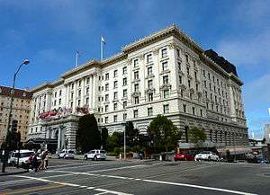
Fairmont Hotel |
|
April 17, 2002
(#02000373) |
950 Mason St.
37°47′33″N 122°24′38″W / 37.7924°N 122.4106°W / 37.7924; -122.4106 (Fairmont Hotel) |
Nob Hill |
|
| 42 |
Farallon Islands |
|
March 8, 1977
(#77000332) |
28 mi. W of San Francisco
37°41′57″N 123°00′10″W / 37.6992°N 123.0028°W / 37.6992; -123.0028 (Farallon Islands) |
Gulf of the Farallones |
|
| 43 |
Federal Reserve Bank of San Francisco |
|
July 31, 1989
(#89000009) |
400 Sansome St.
37°47′39″N 122°24′04″W / 37.7943°N 122.4011°W / 37.7943; -122.4011 (Federal Reserve Bank of San Francisco) |
Financial District |
|
| 44 |
Ferry Station Post Office Building |
|
December 1, 1978
(#78000756) |
Embarcadero at Mission St.
37°47′38″N 122°23′32″W / 37.794°N 122.3923°W / 37.794; -122.3923 (Ferry Station Post Office Building) |
Embarcadero |
|
| 45 |
Feusier Octagon House |
|
March 24, 1974
(#74000554) |
1067 Green St.
37°47′54″N 122°25′00″W / 37.7983°N 122.4167°W / 37.7983; -122.4167 (Feusier Octagon House) |
Russian Hill |
|
| 46 |
Fillmore-Pine Building |
|
January 11, 1982
(#82002247) |
1946 Fillmore Street
37°47′16″N 122°26′01″W / 37.7879°N 122.4335°W / 37.7879; -122.4335 (Fillmore-Pine Building) |
Lower Pacific Heights |
|
| 47 |
Delia Fleishhacker Memorial Building |
|
December 31, 1979
(#79000529) |
Zoo Rd. and Sloat Blvd.
37°44′01″N 122°30′23″W / 37.7335°N 122.5064°W / 37.7335; -122.5064 (Delia Fleishhacker Memorial Building) |
Parkside |
destroyed by fire December 1, 2012[8] |
| 48 |
James C. Flood Mansion |
|
November 13, 1966
(#66000230) |
California and Mason Sts.
37°47′31″N 122°24′41″W / 37.792°N 122.4114°W / 37.792; -122.4114 (James C. Flood Mansion) |
Nob Hill |
|
| 49 |
Folger Coffee Company Building |
|
June 21, 1996
(#96000679) |
101 Howard St.
37°47′28″N 122°23′33″W / 37.7911°N 122.3925°W / 37.7911; -122.3925 (Folger Coffee Company Building) |
South Beach |
|
| 50 |
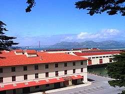
Fort Mason Historic District |
|
April 25, 1972
(#72000109) |
Portion of Fort Mason north and east of Franklin St. and McArthur Ave.
• Boundary increase (listed April 23, 1979, refnum 79000530): Bounded by Van Ness Ave., Bay and Laguna Sts.
37°48′24″N 122°25′36″W / 37.8067°N 122.4267°W / 37.8067; -122.4267 (Fort Mason Historic District) |
Fort Mason |
|
| 51 |
Fort Miley Military Reservation |
|
May 23, 1980
(#80000371) |
Off CA 1
37°46′58″N 122°30′32″W / 37.7827°N 122.5089°W / 37.7827; -122.5089 (Fort Miley Military Reservation) |
Richmond District |
|
| 52 |
Fort Point National Historic Site |
|
October 16, 1970
(#70000146) |
N tip of San Francisco Peninsula on U.S. 101
37°48′39″N 122°28′37″W / 37.8107°N 122.4769°W / 37.8107; -122.4769 (Fort Point National Historic Site) |
Presidio |
|
| 53 |
Four Fifty Sutter Building |
|
December 22, 2009
(#09001118) |
450 Sutter St.
37°47′22″N 122°24′28″W / 37.789583°N 122.407778°W / 37.789583; -122.407778 (Four Fifty Sutter Building) |
Union Square |
|
| 54 |
Frederick Griffing's (ship) |
|
February 1, 1982
(#82002248) |
Underneath Levi
37°48′11″N 122°24′08″W / 37.803°N 122.4021°W / 37.803; -122.4021 (Frederick Griffing's (ship)) |
Fisherman's Wharf |
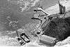
Remains of buried ship at former wharf of Frederick Griffings discovered in 1978. Still buried under Levi Plaza fountain. |
| 55 |
Fuller Company Glass Warehouse |
|
October 11, 2001
(#01001101) |
50 Green St.
37°48′03″N 122°24′02″W / 37.8007°N 122.4005°W / 37.8007; -122.4005 (Fuller Company Glass Warehouse) |
Fisherman's Wharf |
|
| 56 |
Geary Theatre |
|
May 27, 1975
(#75000472) |
415 Geary St.
37°47′13″N 122°24′37″W / 37.787°N 122.4103°W / 37.787; -122.4103 (Geary Theatre) |
Downtown |
|
| 57 |
Henry Geilfuss House |
|
July 24, 2017
(#100001338) |
811 Treat Ave.
37°45′25″N 122°24′47″W / 37.756880°N 122.413114°W / 37.756880; -122.413114 (Henry Geilfuss House) |
Mission District |
|
| 58 |
Geneva Office Building and Power House |
|
March 31, 2010
(#10000111) |
2301 San Jose Ave.
37°43′15″N 122°26′47″W / 37.720786°N 122.446461°W / 37.720786; -122.446461 (Geneva Office Building and Power House) |
Excelsior |
|
| 59 |
Daniel Gibb & Co. Warehouse |
|
October 10, 1997
(#97001189) |
855 Front St., and 101 Vallejo St.
37°47′58″N 122°24′01″W / 37.7995°N 122.4002°W / 37.7995; -122.4002 (Daniel Gibb & Co. Warehouse) |
Fisherman's Wharf |
|
| 60 |
Girls Club |
|
November 6, 1979
(#79000531) |
362 Capp St.
37°45′40″N 122°25′06″W / 37.761°N 122.4183°W / 37.761; -122.4183 (Girls Club) |
Mission District |
|
| 61 |
Golden Gate Park |
|
October 15, 2004
(#04001137) |
Bounded by Fulton St., Stanyan St., Fell St., Baker St., Oak St., Lincoln Way and The Great Highway
37°46′09″N 122°29′01″W / 37.7691°N 122.4837°W / 37.7691; -122.4837 (Golden Gate Park) |
Golden Gate Park |
|
| 62 |
Golden Gate Park Conservatory |
|
October 14, 1971
(#71000184) |
Mount Link, N of John F. Kennedy Dr. at E end of Golden Gate Park
37°46′21″N 122°27′37″W / 37.7726°N 122.4602°W / 37.7726; -122.4602 (Golden Gate Park Conservatory) |
Golden Gate Park |
|
| 63 |
Goodman Building |
|
June 18, 1975
(#75000473) |
1117 Geary Blvd.
37°47′08″N 122°25′20″W / 37.7855°N 122.4222°W / 37.7855; -122.4222 (Goodman Building) |
Western Addition |
|
| 64 |
Grabhorn Press Building |
|
May 2, 1997
(#97000349) |
1335 Sutter St.
37°47′15″N 122°25′21″W / 37.7874°N 122.4224°W / 37.7874; -122.4224 (Grabhorn Press Building) |
Lower Pacific Heights |
|
| 65 |
Federal Office Building |
|
June 5, 2017
(#100001018) |
50 United Nations Plaza
37°46′50″N 122°24′52″W / 37.780430°N 122.414464°W / 37.780430; -122.414464 (Federal Office Building) |
Civic Center |
|
| 66 |
Haas Candy Factory |
|
January 8, 2001
(#00001622) |
54 Mint St.
37°46′57″N 122°24′28″W / 37.7826°N 122.4078°W / 37.7826; -122.4078 (Haas Candy Factory) |
South of Market |
|
| 67 |
Haas-Lilienthal House |
|
July 2, 1973
(#73000438) |
2007 Franklin St.
37°47′36″N 122°25′29″W / 37.7933°N 122.4248°W / 37.7933; -122.4248 (Haas-Lilienthal House) |
Pacific Heights |
|
| 68 |
Hale Brothers Department Store |
|
December 18, 1986
(#86003492) |
901 Market St.
• Boundary increase (listed May 10, 2001, refnum 01000490): 36 Fifth St., 423-27 and 429 Stevenson St.
37°47′01″N 122°24′29″W / 37.7837°N 122.408°W / 37.7837; -122.408 (Hale Brothers Department Store) |
South of Market |
|
| 69 |
Hall of Transportation, Treasure Island |
|
February 26, 2008
(#08000082) |
SE Side of California Ave. between Avenue D and Avenue F
37°49′07″N 122°22′04″W / 37.8187°N 122.3679°W / 37.8187; -122.3679 (Hall of Transportation, Treasure Island) |
Treasure Island |
|
| 70 |
Hallidie Building |
|
November 19, 1971
(#71000185) |
130 Sutter St.
37°47′24″N 122°24′11″W / 37.7901°N 122.403°W / 37.7901; -122.403 (Hallidie Building) |
Financial District |
|
| 71 |
Haslett Warehouse |
|
March 28, 1975
(#75000172) |
680 Beach St.
37°48′25″N 122°25′12″W / 37.8069°N 122.4201°W / 37.8069; -122.4201 (Haslett Warehouse) |
Fisherman's Wharf |
|
| 72 |
Herald Hotel |
|
October 29, 1982
(#82000985) |
308 Eddy St.
37°47′02″N 122°24′46″W / 37.784°N 122.4129°W / 37.784; -122.4129 (Herald Hotel) |
Tenderloin |
1910 hotel by architect Alfred Henry Jacobs; contributing property to the Uptown Tenderloin Historic District;[9] now a low-income public senior housing facility |
| 73 |
Hercules (tugboat) |
|
January 17, 1975
(#75000225) |
Hyde Street Pier, San Francisco Maritime National Historical Park, 2905 Hyde Street
37°48′36″N 122°25′20″W / 37.81°N 122.4222°W / 37.81; -122.4222 (Hercules (tugboat)) |
Fisherman's Wharf |
1907 steam tug boat |
| 74 |
Hotel Californian |
|
September 25, 1998
(#98001195) |
403 Taylor St.
37°47′11″N 122°24′41″W / 37.7863°N 122.4115°W / 37.7863; -122.4115 (Hotel Californian) |
Tenderloin |
1923 hotel by architect Edward E. Young with 1929 addition by architect Alfred Henry Jacobs; contributing property to the Uptown Tenderloin Historic District;[9] now the Serrano Hotel |
| 75 |
House at 1239-1245 Scott Street |
|
March 8, 1973
(#73000441) |
1239—1245 Scott St.
37°46′53″N 122°26′15″W / 37.7815°N 122.4376°W / 37.7815; -122.4376 (House at 1239-1245 Scott Street) |
Western Addition |
|
| 76 |
House at 1249-1251 Scott Street |
|
March 8, 1973
(#73000442) |
1249—1251 Scott St.
37°46′54″N 122°26′15″W / 37.7816°N 122.4376°W / 37.7816; -122.4376 (House at 1249-1251 Scott Street) |
Western Addition |
|
| 77 |
House at 1254-1256 Montgomery Street |
|
January 31, 1979
(#79000532) |
1254—1256 Montgomery St.
37°48′03″N 122°24′15″W / 37.8009°N 122.4043°W / 37.8009; -122.4043 (House at 1254-1256 Montgomery Street) |
Telegraph Hill |
|
| 78 |
House at 1321 Scott Street |
|
March 8, 1973
(#73000439) |
1321 Scott St.
37°46′55″N 122°26′15″W / 37.782°N 122.4375°W / 37.782; -122.4375 (House at 1321 Scott Street) |
Western Addition |
|
| 79 |
House at 1331-1335 Scott Street |
|
March 8, 1973
(#73000440) |
1331—1335 Scott St.
37°46′56″N 122°26′15″W / 37.7822°N 122.4375°W / 37.7822; -122.4375 (House at 1331-1335 Scott Street) |
Western Addition |
|
| 80 |
House at 584 Page Street |
|
September 12, 1985
(#85002195) |
584 Page St.
37°46′24″N 122°25′49″W / 37.7732°N 122.4303°W / 37.7732; -122.4303 (House at 584 Page Street) |
Hayes Valley |
Daniel Einstein House |
| 81 |
Hunter-Dulin Building |
|
April 17, 1997
(#97000348) |
111 Sutter St.
37°47′24″N 122°24′09″W / 37.7899°N 122.4026°W / 37.7899; -122.4026 (Hunter-Dulin Building) |
Financial District |
|
| 82 |
Hunters Point Commercial Drydock Historic District |
|
July 25, 2012
(#12000425) |
East of the junction of Fisher Ave. & Robinson Dr.
37°43′37″N 122°21′41″W / 37.726881°N 122.361508°W / 37.726881; -122.361508 (Hunters Point Commercial Drydock Historic District) |
Bayview-Hunters Point |
|
| 83 |
International Hotel |
|
June 15, 1977
(#77000333) |
848 Kearny St.
37°47′46″N 122°24′18″W / 37.7961°N 122.4049°W / 37.7961; -122.4049 (International Hotel) |
Chinatown |
|
| 84 |
Jackson Brewing Company |
|
April 8, 1993
(#93000284) |
1475—1489 Folsom St. and 319—351 11th St.
37°46′19″N 122°24′50″W / 37.7719°N 122.4138°W / 37.7719; -122.4138 (Jackson Brewing Company) |
South of Market |
|
| 85 |
Jackson Square Historic District |
|
November 18, 1971
(#71000186) |
Roughly bounded by Broadway on N, Sansome St. on E, Washington St. on S, and Columbus Ave. on W
37°47′49″N 122°24′12″W / 37.797°N 122.4033°W / 37.797; -122.4033 (Jackson Square Historic District) |
Financial District |
|
| 86 |
SS Jeremiah O'Brien National Historic Landmark |
|
June 7, 1978
(#78003405) |
Pier 3, Fort Mason Center
37°48′40″N 122°25′05″W / 37.811°N 122.418°W / 37.811; -122.418 (SS Jeremiah O'Brien National Historic Landmark) |
Fisherman's Wharf |
|
| 87 |
Jessie Street Substation |
|
September 6, 1974
(#74000555) |
222—226 Jessie St.
37°47′10″N 122°24′13″W / 37.7861°N 122.4035°W / 37.7861; -122.4035 (Jessie Street Substation) |
South of Market |
The building now houses the Contemporary Jewish Museum (opened June 2008) |
| 88 |
San Francisco Juvenile Court and Detention Center |
|
April 8, 2011
(#11000182) |
150 Otis St.
37°46′15″N 122°25′14″W / 37.770833°N 122.420556°W / 37.770833; -122.420556 (San Francisco Juvenile Court and Detention Center) |
South of Market |
|
| 89 |
King Philip (ship) and Reporter (schooner) Shipwreck Site |
|
May 8, 1986
(#86001014) |
Address Restricted
|
Ocean Beach |
King Philip and Reporter shipwreck sites. |
| 90 |
Koshland House |
|
January 5, 1984
(#84001186) |
3800 Washington St.
37°47′20″N 122°27′21″W / 37.789°N 122.4559°W / 37.789; -122.4559 (Koshland House) |
Presidio Heights |
|
| 91 |
Dr. Martin M. Krotoszyner Medical Offices and House |
|
August 15, 1985
(#85001784) |
995—999 Sutter St.
37°47′17″N 122°25′00″W / 37.7881°N 122.4166°W / 37.7881; -122.4166 (Dr. Martin M. Krotoszyner Medical Offices and House) |
Downtown |
contributing property to the Lower Nob Hill Apartment Hotel District[10] |
| 92 |
Don Lee Building |
|
October 28, 2001
(#01001179) |
1000 Van Ness Ave.
37°47′06″N 122°25′16″W / 37.785°N 122.421°W / 37.785; -122.421 (Don Lee Building) |
Western Addition |
|
| 93 |
Lewis Ark (Houseboat) |
|
November 8, 1979
(#79000256) |
Hyde Street Pier, San Francisco Maritime National Historical Park, 2905 Hyde Street
37°48′29″N 122°25′15″W / 37.8081°N 122.4208°W / 37.8081; -122.4208 (Lewis Ark (Houseboat)) |
Fisherman's Wharf |
|
| 94 |
Liberty Street Historic District |
|
September 15, 1983
(#83001230) |
Roughly 15-188 Liberty St.
37°45′27″N 122°25′25″W / 37.7576°N 122.4235°W / 37.7576; -122.4235 (Liberty Street Historic District) |
Eureka Valley |
|
| 95 |
Lotta Crabtree Fountain |
|
June 20, 1975
(#75000475) |
Market, Geary, and Kearny Sts.
37°47′16″N 122°24′12″W / 37.7879°N 122.4033°W / 37.7879; -122.4033 (Lotta Crabtree Fountain) |
Financial District |
|
| 96 |
Lower Nob Hill Apartment Hotel District |
|
July 31, 1991
(#91000957) |
Roughly, 590—1209 Bush, 680—1156 Sutter and 600—1099 Post Sts. and the intersecting cross streets
37°47′19″N 122°24′49″W / 37.7887°N 122.4136°W / 37.7887; -122.4136 (Lower Nob Hill Apartment Hotel District) |
Downtown/Union Square |
|
| 97 |
The Lydia |
|
July 16, 1981
(#81000173) |
At the foot of King Street near Pier 42
37°46′51″N 122°23′18″W / 37.780804°N 122.388322°W / 37.780804; -122.388322 (The Lydia) |
South of Market |
Whaling bark |
| 98 |
Market Street Theatre and Loft District |
|
April 10, 1986
(#86000729) |
982—1112 Market, 973—1105 Market, 1 Jones, and 1—35 Taylor Sts.
37°46′55″N 122°24′39″W / 37.782°N 122.4108°W / 37.782; -122.4108 (Market Street Theatre and Loft District) |
Tenderloin |
|
| 99 |
Matson Building and Annex |
|
November 29, 1995
(#95001384) |
215 Market St.
37°47′34″N 122°23′48″W / 37.7927°N 122.3966°W / 37.7927; -122.3966 (Matson Building and Annex) |
Financial District |
|
| 100 |
McElroy Octagon House |
|
February 23, 1972
(#72000250) |
2645 Gough St.
37°47′52″N 122°25′39″W / 37.7978°N 122.4274°W / 37.7978; -122.4274 (McElroy Octagon House) |
Cow Hollow |
|
| 101 |
John McMullen House |
|
September 15, 1983
(#83001231) |
827 Guerrero St.
37°45′28″N 122°25′24″W / 37.7579°N 122.4232°W / 37.7579; -122.4232 (John McMullen House) |
Eureka Valley |
|
| 102 |
Mills Building and Tower |
|
April 13, 1977
(#77000334) |
220 Montgomery St. and 220 Bush St.
37°47′28″N 122°24′06″W / 37.7912°N 122.4018°W / 37.7912; -122.4018 (Mills Building and Tower) |
Financial District |
|
| 103 |
Mish House |
|
May 21, 1979
(#79000534) |
1153 Oak St.
37°46′22″N 122°26′18″W / 37.7729°N 122.4383°W / 37.7729; -122.4383 (Mish House) |
Haight-Ashbury |
|
| 104 |
Mission Dolores |
|
March 16, 1972
(#72000251) |
320 Dolores St.
37°45′51″N 122°25′36″W / 37.7642°N 122.4266°W / 37.7642; -122.4266 (Mission Dolores) |
Mission District |
|
| 105 |
Moss Flats Building |
|
February 24, 1983
(#83001232) |
1626 Great Hwy.
37°45′22″N 122°30′31″W / 37.7561°N 122.5087°W / 37.7561; -122.5087 (Moss Flats Building) |
Sunset |
|
| 106 |
Mutual Savings Bank Building |
|
January 22, 2014
(#13001107) |
700 Market St.
37°47′16″N 122°24′14″W / 37.787783°N 122.403835°W / 37.787783; -122.403835 (Mutual Savings Bank Building) |
Financial District |
|
| 107 |
Myrtle Street Flats |
|
June 14, 1976
(#76000520) |
234—248 Myrtle St.
37°47′07″N 122°25′20″W / 37.7852°N 122.4222°W / 37.7852; -122.4222 (Myrtle Street Flats) |
Western Addition |
|
| 108 |
National Carbon Company Building |
|
August 25, 1983
(#83001233) |
599 8th St.
37°46′17″N 122°24′19″W / 37.7715°N 122.4054°W / 37.7715; -122.4054 (National Carbon Company Building) |
South of Market |
|
| 109 |
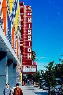
New Mission Theater |
|
November 9, 2001
(#01001206) |
2550 Mission St.
37°45′23″N 122°25′08″W / 37.7563°N 122.419°W / 37.7563; -122.419 (New Mission Theater) |
Mission District |
San Francisco's New Mission Theater Chronology at The Friends of 1800 website. |
| 110 |
Niantic (Storeship) |
|
May 16, 1991
(#91000563) |
NW corner of Clay and Sansome Sts.
37°47′42″N 122°24′06″W / 37.7949°N 122.4016°W / 37.7949; -122.4016 (Niantic (Storeship)) |
Financial District |
|
| 111 |
Ohlandt Newlyweds House |
|
August 19, 1994
(#94000995) |
1260 Potrero Ave.
37°45′08″N 122°24′23″W / 37.7522°N 122.4065°W / 37.7522; -122.4065 (Ohlandt Newlyweds House) |
Mission District |
|
| 112 |
Old Ohio Street Houses |
|
May 31, 1979
(#79000535) |
17—55 Osgood Pl.
37°47′53″N 122°24′11″W / 37.798°N 122.4031°W / 37.798; -122.4031 (Old Ohio Street Houses) |
Financial District |
|
| 113 |
Old U.S. Mint |
|
October 15, 1966
(#66000231) |
5th and Mission Sts.
37°46′58″N 122°24′26″W / 37.7829°N 122.4071°W / 37.7829; -122.4071 (Old U.S. Mint) |
South of Market |
|
| 114 |
One Lombard Street |
|
February 3, 2010
(#09001300) |
1 Lombard St.
37°48′15″N 122°24′10″W / 37.804028°N 122.4028°W / 37.804028; -122.4028 (One Lombard Street) |
Fisherman's Wharf |
|
| 115 |
Otis Elevator Company Building |
|
October 21, 1999
(#99001265) |
1 Beach St.
37°48′28″N 122°24′34″W / 37.8079°N 122.4095°W / 37.8079; -122.4095 (Otis Elevator Company Building) |
Fisherman's Wharf |
|
| 116 |
Pacific Gas and Electric Company General Office Building and Annex |
|
November 29, 1995
(#95001385) |
245 Market St.
37°47′33″N 122°23′49″W / 37.7925°N 122.3969°W / 37.7925; -122.3969 (Pacific Gas and Electric Company General Office Building and Annex) |
Financial District |
|
| 117 |
Pacific Gas and Electric Company Substation J |
|
December 29, 1986
(#86003514) |
565 Commercial and 568 Sacramento Sts.
37°47′38″N 122°24′08″W / 37.794°N 122.4021°W / 37.794; -122.4021 (Pacific Gas and Electric Company Substation J) |
Financial District |
|
| 118 |
Paige Motor Car Co. Building |
|
February 24, 1983
(#83001234) |
1699 Van Ness Ave.
37°47′28″N 122°25′22″W / 37.7912°N 122.4227°W / 37.7912; -122.4227 (Paige Motor Car Co. Building) |
Civic Center |
|
| 119 |
Palace of Fine and Decorative Arts, Treasure Island |
|
February 26, 2008
(#08000083) |
SE Side of California Ave. between Avenue F and Avenue I
37°49′11″N 122°21′58″W / 37.8196°N 122.366°W / 37.8196; -122.366 (Palace of Fine and Decorative Arts, Treasure Island) |
Treasure Island |
"Regilded Gate", Time, 1939-09-04 |
| 120 |
Palace of Fine Arts |
|
December 5, 2005
(#04000659) |
3301 Lyon St.
37°48′10″N 122°26′54″W / 37.8029°N 122.4484°W / 37.8029; -122.4484 (Palace of Fine Arts) |
Marina District |
|
| 121 |
USS Pampanito (submarine) |
|
January 14, 1986
(#86000089) |
Fisherman's Wharf-Pier 45
37°48′36″N 122°24′59″W / 37.8099°N 122.4164°W / 37.8099; -122.4164 (USS Pampanito (submarine)) |
Fisherman's Wharf |
|
| 122 |
Park View Hotel |
|
August 11, 1983
(#83001235) |
750 Stanyan St.
37°46′06″N 122°27′12″W / 37.7682°N 122.4532°W / 37.7682; -122.4532 (Park View Hotel) |
Haight-Ashbury |
|
| 123 |
Theodore F. Payne House |
|
June 11, 1980
(#80000847) |
1409 Sutter St.
37°47′14″N 122°25′26″W / 37.7871°N 122.4239°W / 37.7871; -122.4239 (Theodore F. Payne House) |
Lower Pacific Heights |
|
| 124 |
Abner Phelps House |
|
May 23, 1979
(#71000187) |
1111 Oak St.
37°46′22″N 122°26′17″W / 37.7728°N 122.4381°W / 37.7728; -122.4381 (Abner Phelps House) |
Haight-Ashbury |
|
| 125 |
Pier One |
|
January 5, 1999
(#98001551) |
Pier One, The Embarcadero (at Washington St.)
37°47′49″N 122°23′41″W / 37.797°N 122.3948°W / 37.797; -122.3948 (Pier One) |
Embarcadero |
|
| 126 |
Pioneer Trunk Factory-C. A. Malm & Co. |
|
March 5, 1987
(#86003727) |
2185—2199 Folsom and 3180 18th Sts.
37°45′44″N 122°24′53″W / 37.7622°N 122.4148°W / 37.7622; -122.4148 (Pioneer Trunk Factory-C. A. Malm & Co.) |
Mission District |
|
| 127 |
Pioneer Woolen Mills and D. Ghirardelli Company |
|
April 29, 1982
(#82002249) |
900 N. Point St.
37°48′20″N 122°25′25″W / 37.8055°N 122.4235°W / 37.8055; -122.4235 (Pioneer Woolen Mills and D. Ghirardelli Company) |
Fisherman's Wharf |
|
| 128 |
Point Lobos Archaeological Sites |
|
November 7, 1976
(#76000176) |
Address Restricted
37°46′48″N 122°30′50″W / 37.7801°N 122.5138°W / 37.7801; -122.5138 (Point Lobos Archaeological Sites) |
Richmond District |
Sutro Baths |
| 129 |
Port of San Francisco Embarcadero Historic District |
|
May 12, 2006
(#06000372) |
From Pier 45 to Pier 48, The Embarcadero
37°47′49″N 122°23′42″W / 37.7969°N 122.395°W / 37.7969; -122.395 (Port of San Francisco Embarcadero Historic District) |
Embarcadero |
|
| 130 |
Presidio |
|
October 15, 1966
(#66000232) |
Northern tip of San Francisco Peninsula on U.S. 101
37°47′47″N 122°27′55″W / 37.7964°N 122.4653°W / 37.7964; -122.4653 (Presidio) |
Presidio |
|
| 131 |
Pumping Station No. 2 San Francisco Fire Department Auxiliary Water Supply System |
|
May 13, 1976
(#76000177) |
N end of Van Ness Ave
37°48′29″N 122°25′37″W / 37.808°N 122.4269°W / 37.808; -122.4269 (Pumping Station No. 2 San Francisco Fire Department Auxiliary Water Supply System) |
Fisherman's Wharf |
A crucial component of San Francisco's independent water supply system for fighting fires, separate from the domestic water system. |
| 132 |
Quarters 1, Yerba Buena Island Naval Training Station |
|
September 10, 1991
(#91001380) |
1 Whiting Way, Yerba Buena Island
37°48′46″N 122°21′49″W / 37.8127°N 122.3636°W / 37.8127; -122.3636 (Quarters 1, Yerba Buena Island Naval Training Station) |
Yerba Buena Island |
|
| 133 |
Quarters 10 and Building 267, Yerba Buena Island |
|
February 26, 2008
(#08000084) |
Jct. Northgate & Macalla Rds., North Shore of Yerba Buena Island
37°48′43″N 122°21′51″W / 37.8119°N 122.3641°W / 37.8119; -122.3641 (Quarters 10 and Building 267, Yerba Buena Island) |
Yerba Buena Island |
|
| 134 |
Rialto Building |
|
January 3, 2011
(#10001108) |
116 New Montgomery St.
37°47′14″N 122°24′01″W / 37.787222°N 122.400278°W / 37.787222; -122.400278 (Rialto Building) |
South of Market |
|
| 135 |
Rincon Annex |
|
November 16, 1979
(#79000537) |
101—199 Mission St.
37°47′34″N 122°23′36″W / 37.7928°N 122.3934°W / 37.7928; -122.3934 (Rincon Annex) |
South Beach |
|
| 136 |
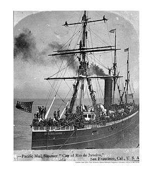
SS Rio de Janeiro Shipwreck |
|
November 3, 1988
(#88002394) |
Address Restricted
|
Golden Gate |
|
| 137 |
Roos House |
|
October 8, 2009
(#09000805) |
3500 Jackson St.
37°47′26″N 122°27′10″W / 37.790428°N 122.452753°W / 37.790428; -122.452753 (Roos House) |
Presidio Heights |
|
| 138 |
Russian Hill-Macondray Lane District |
|
January 7, 1988
(#87002286) |
Roughly 900—982 Green, 1918—1960 Jones, 15—84 Macondray & 1801—1809 Taylor
37°47′57″N 122°24′53″W / 37.7992°N 122.4148°W / 37.7992; -122.4148 (Russian Hill-Macondray Lane District) |
Russian Hill |
|
| 139 |
Russian Hill-Paris Block Architectural District |
|
January 7, 1988
(#87002288) |
Roughly 1017—1067 Green St.
37°47′54″N 122°24′59″W / 37.7984°N 122.4164°W / 37.7984; -122.4164 (Russian Hill-Paris Block Architectural District) |
Russian Hill |
|
| 140 |
Russian Hill-Vallejo Street Crest District |
|
January 22, 1988
(#87002289) |
Roughly 1020-1032 Broadway, 1-49 Florence, 1728-1742 Jones, 1-7 Russian Hill Pl., 1629-1715 Taylor, & 1000-1085 Vallejo
37°47′52″N 122°24′52″W / 37.7977°N 122.4145°W / 37.7977; -122.4145 (Russian Hill-Vallejo Street Crest District) |
Russian Hill |
|
| 141 |
Sacred Heart Parish Complex |
|
September 28, 2017
(#100001665) |
546 and 554 Fillmore, 735 Fell & 660 Oak Sts.
37°46′29″N 122°25′52″W / 37.774695°N 122.430977°W / 37.774695; -122.430977 (Sacred Heart Parish Complex) |
|
|
| 142 |
San Francisco Art Institute |
|
January 5, 2016
(#15000950) |
800 Chestnut St.
37°48′12″N 122°25′02″W / 37.803456°N 122.417144°W / 37.803456; -122.417144 (San Francisco Art Institute) |
Russian Hill |
|
| 143 |
San Francisco Cable Cars |
|
October 15, 1966
(#66000233) |
1390 Washington St.
37°47′38″N 122°24′58″W / 37.7938°N 122.4162°W / 37.7938; -122.4162 (San Francisco Cable Cars) |
Multiple neighborhoods |
|
| 144 |
San Francisco Central YMCA |
|
April 9, 2018
(#100002287) |
220 Golden Gate Ave.
37°46′55″N 122°24′51″W / 37.781861°N 122.414205°W / 37.781861; -122.414205 (San Francisco Central YMCA) |
|
|
| 145 |
San Francisco Civic Center Historic District |
|
October 10, 1978
(#78000757) |
Roughly bounded by Golden Gate Ave., 7th, Franklin, Hayes, and Market Sts.
37°46′46″N 122°25′03″W / 37.7795°N 122.4176°W / 37.7795; -122.4176 (San Francisco Civic Center Historic District) |
Civic Center |
|
| 146 |
San Francisco Fire Department Engine Co. Number 2 |
|
April 17, 2002
(#02000371) |
460 Bush St.
37°47′27″N 122°24′18″W / 37.7908°N 122.4051°W / 37.7908; -122.4051 (San Francisco Fire Department Engine Co. Number 2) |
Downtown |
|
| 147 |
San Francisco Maritime National Historic Park |
|
June 27, 1988
(#01000281) |
Fort Mason, Bld. 201
37°48′20″N 122°25′41″W / 37.8056°N 122.428°W / 37.8056; -122.428 (San Francisco Maritime National Historic Park) |
Fort Mason |
|
| 148 |
San Francisco National Guard Armory and Arsenal |
|
November 14, 1978
(#78000758) |
1800 Mission St.
37°46′05″N 122°25′13″W / 37.7681°N 122.4202°W / 37.7681; -122.4202 (San Francisco National Guard Armory and Arsenal) |
Mission District |
|
| 149 |
San Francisco–Oakland Bay Bridge |
|
August 13, 2001
(#00000525) |
I-80
37°48′02″N 122°22′31″W / 37.8005°N 122.3754°W / 37.8005; -122.3754 (San Francisco–Oakland Bay Bridge) |
San Francisco Bay |
|
| 150 |
San Francisco Port of Embarkation, US Army |
|
February 4, 1985
(#85002433) |
Ft. Mason
37°48′26″N 122°25′52″W / 37.8073°N 122.4312°W / 37.8073; -122.4312 (San Francisco Port of Embarkation, US Army) |
Fort Mason |
|
| 151 |
San Francisco Public Library North Beach Branch |
|
August 8, 2011
(#11000501) |
2000 Mason St.
37°48′07″N 122°24′46″W / 37.801944°N 122.412778°W / 37.801944; -122.412778 (San Francisco Public Library North Beach Branch) |
North Beach |
|
| 152 |
San Francisco State Teacher's College |
|
January 7, 2008
(#07001391) |
55 Laguna St.
37°46′17″N 122°25′32″W / 37.7713°N 122.4255°W / 37.7713; -122.4255 (San Francisco State Teacher's College) |
Hayes Valley |
|
| 153 |
M.V. Santa Rosa |
|
May 29, 1979
(#79000469) |
Pier 3, San Francisco
37°47′54″N 122°23′43″W / 37.798228°N 122.395344°W / 37.798228; -122.395344 (M.V. Santa Rosa) |
Embarcadero |
Listed in the NRIS database as located Howard Terminal, Oakland. The vessel, now moored at Pier 3 in San Francisco, is owned by Hornblower Yachts and has been used as a concert venue.[11] |
| 154 |
Schoenstein and Company Pipe Organ Factory |
|
November 14, 1978
(#78000759) |
3101 20th St.
37°45′32″N 122°24′42″W / 37.759°N 122.4117°W / 37.759; -122.4117 (Schoenstein and Company Pipe Organ Factory) |
Mission District |
|
| 155 |
Irving Murray Scott School |
|
April 11, 1985
(#85000714) |
1060 Tennessee St.
37°45′31″N 122°23′22″W / 37.7586°N 122.3895°W / 37.7586; -122.3895 (Irving Murray Scott School) |
Potrero Hill |
|
| 156 |
Second and Howard Streets District |
|
July 28, 1999
(#99000894) |
121-198 2nd, 579-612 Howard, 116 Natoma, 111-163 New Montgomery
37°47′14″N 122°23′57″W / 37.7871°N 122.3993°W / 37.7871; -122.3993 (Second and Howard Streets District) |
South of Market |
|
| 157 |
Senior Officers Quarters Historic District, Yerba Buena Island |
|
February 26, 2008
(#08000085) |
Whiting Way at Northgate Rd., North shore of Yerba Buena Island
37°48′47″N 122°21′51″W / 37.813°N 122.3642°W / 37.813; -122.3642 (Senior Officers Quarters Historic District, Yerba Buena Island) |
Yerba Buena Island |
Includes Quarters 1-7 and associated garages (Buildings 83, 205, and 230).[12] |
| 158 |
Sinton House |
|
December 22, 2011
(#11000944) |
1020 Francisco St.
37°48′13″N 122°25′19″W / 37.803744°N 122.422025°W / 37.803744; -122.422025 (Sinton House) |
Russian Hill |
|
| 159 |
Six-Inch Rifled Gun No. 9 |
|
February 7, 1979
(#79000255) |
Baker Beach
37°47′37″N 122°28′58″W / 37.7936°N 122.4829°W / 37.7936; -122.4829 (Six-Inch Rifled Gun No. 9) |
Presidio |
|
| 160 |
South San Francisco Opera House |
|
March 21, 2011
(#11000117) |
4701-4705 Third St. and 1601 Newcomb Ave.
37°44′06″N 122°23′25″W / 37.735°N 122.390278°W / 37.735; -122.390278 (South San Francisco Opera House) |
Bayview-Hunters Point |
|
| 161 |
Southern Pacific Company Hospital Historic District |
|
May 5, 1989
(#89000319) |
1400 Fell St.
37°46′25″N 122°26′27″W / 37.773664°N 122.440972°W / 37.773664; -122.440972 (Southern Pacific Company Hospital Historic District) |
North Panhandle |
|
| 162 |
John Spencer House |
|
April 14, 2005
(#05000273) |
1080 Haight St.
37°46′16″N 122°26′25″W / 37.771°N 122.4402°W / 37.771; -122.4402 (John Spencer House) |
Haight-Ashbury |
|
| 163 |
Stadtmuller House |
|
July 19, 1976
(#76000523) |
819 Eddy St.
37°46′57″N 122°25′18″W / 37.7826°N 122.4217°W / 37.7826; -122.4217 (Stadtmuller House) |
Western Addition |
|
| 164 |
St. John's Presbyterian Church |
|
January 22, 1996
(#95001555) |
25 Lake St. and 201 Arguello Blvd.
37°47′12″N 122°27′34″W / 37.7868°N 122.4595°W / 37.7868; -122.4595 (St. John's Presbyterian Church) |
Presidio Heights |
|
| 165 |
St. Joseph's Church and Complex |
|
January 15, 1982
(#82002250) |
1401—1415 Howard St.
37°46′25″N 122°24′52″W / 37.7737°N 122.4145°W / 37.7737; -122.4145 (St. Joseph's Church and Complex) |
South of Market |
|
| 166 |
St. Joseph's Hospital |
|
May 9, 1985
(#85001016) |
355 Buena Vista Ave. East
37°46′03″N 122°26′24″W / 37.7675°N 122.44°W / 37.7675; -122.44 (St. Joseph's Hospital) |
Buena Vista |
|
| 167 |
St. Paulus Lutheran Church |
|
February 11, 1982
(#82002251) |
999 Eddy St.
37°46′57″N 122°25′26″W / 37.7824°N 122.4239°W / 37.7824; -122.4239 (St. Paulus Lutheran Church) |
Western Addition |
Burned to the ground November 1995.[13] |
| 168 |
Swedenborgian Church |
|
August 18, 2004
(#04001154) |
3200 Washington St.
37°47′25″N 122°26′46″W / 37.7904°N 122.4462°W / 37.7904; -122.4462 (Swedenborgian Church) |
Pacific Heights |
|
| 169 |
Temple Sherith Israel |
|
March 31, 2010
(#10000114) |
2266 California St.
37°47′22″N 122°25′55″W / 37.789467°N 122.431811°W / 37.789467; -122.431811 (Temple Sherith Israel) |
Pacific Heights |
|
| 170 |
The Real Estate Associates (TREA) Houses |
|
April 4, 1985
(#85000705) |
2503, 2524, 2530 and 2536 Clay Sts.
37°47′26″N 122°26′05″W / 37.7905°N 122.4348°W / 37.7905; -122.4348 (The Real Estate Associates (TREA) Houses) |
Pacific Heights |
|
| 171 |
Tobin House |
|
October 5, 2009
(#09000806) |
1969 California St.
37°47′22″N 122°25′36″W / 37.789511°N 122.426647°W / 37.789511; -122.426647 (Tobin House) |
Lower Pacific Heights |
|
| 172 |
Torpedo Storehouse-Torpedo (Mine) Assembly Building & Long Range Accuracy Storage Building |
|
June 11, 2008
(#08000086) |
East Point; North Shore of Yerba Buena Island
37°48′53″N 122°21′33″W / 37.8147°N 122.3593°W / 37.8147; -122.3593 (Torpedo Storehouse-Torpedo (Mine) Assembly Building & Long Range Accuracy Storage Building) |
Yerba Buena Island |
1891 torpedo assembly building built for the US Army by architect Ernest Leslie Ransome[14] |
| 173 |
Trinity Presbyterian Church |
|
March 2, 1982
(#82002252) |
3261 23rd St.
37°45′14″N 122°25′03″W / 37.7538°N 122.4176°W / 37.7538; -122.4176 (Trinity Presbyterian Church) |
Mission District |
|
| 174 |
Tubbs Cordage Company Office Building |
|
November 6, 1979
(#79000254) |
Hyde Street Pier, San Francisco Maritime National Historical Park, 2905 Hyde Street
37°48′32″N 122°25′16″W / 37.8088°N 122.421°W / 37.8088; -122.421 (Tubbs Cordage Company Office Building) |
Fisherman's Wharf |
|
| 175 |
Union Ferry Depot |
|
December 1, 1978
(#78000760) |
Embarcadero at Market St.
37°47′43″N 122°23′37″W / 37.7954°N 122.3936°W / 37.7954; -122.3936 (Union Ferry Depot) |
Embarcadero |
|
| 176 |
Union Iron Works Historic District |
|
April 17, 2014
(#14000150) |
E. of Illinois between 18th & 22nd Sts.
37°45′39″N 122°23′04″W / 37.760744°N 122.384447°W / 37.760744; -122.384447 (Union Iron Works Historic District) |
Potrero Point |
|
| 177 |
Uptown Tenderloin Historic District |
|
February 5, 2009
(#08001407) |
All or part of 33 blocks roughly bounded by Market, McAllister, Golden Gate, Larkin, Geary, Taylor, Ellis Sts.
37°47′02″N 122°24′51″W / 37.7838°N 122.4142°W / 37.7838; -122.4142 (Uptown Tenderloin Historic District) |
Tenderloin |
|
| 178 |
U.S. Appraisers Stores and Immigration Station |
|
August 13, 2013
(#13000590) |
630 Sansome St.
37°47′47″N 122°24′06″W / 37.796278°N 122.401764°W / 37.796278; -122.401764 (U.S. Appraisers Stores and Immigration Station) |
Financial District |
|
| 179 |
U.S. Customhouse |
|
January 29, 1975
(#75000476) |
555 Battery St.
37°47′47″N 122°24′03″W / 37.7963°N 122.4008°W / 37.7963; -122.4008 (U.S. Customhouse) |
Financial District |
|
| 180 |
U.S. Mint |
|
February 18, 1988
(#88000026) |
155 Hermann St.
37°46′13″N 122°25′39″W / 37.7703°N 122.4274°W / 37.7703; -122.4274 (U.S. Mint) |
Hayes Valley |
|
| 181 |
U.S. Post Office and Courthouse |
|
October 14, 1971
(#71000188) |
NE corner of 7th and Mission Sts.
37°46′46″N 122°24′40″W / 37.7795°N 122.411°W / 37.7795; -122.411 (U.S. Post Office and Courthouse) |
South of Market |
National Historic Landmark designation October 16, 2012[15] |
| 182 |
Veterans Affairs Medical Center-San Francisco, California |
|
April 20, 2009
(#05001112) |
4150 Clement Street
37°46′56″N 122°30′16″W / 37.782222°N 122.504306°W / 37.782222; -122.504306 (Veterans Affairs Medical Center-San Francisco, California) |
Sea Cliff |
|
| 183 |
Russell Warren House |
|
December 12, 1983
(#83003594) |
465-467 Oak St. and 368 Lily St.
37°46′27″N 122°25′37″W / 37.7743°N 122.427°W / 37.7743; -122.427 (Russell Warren House) |
Hayes Valley |
|
| 184 |
Julian Waybur House |
|
March 28, 2011
(#11000143) |
3232 Pacific Ave.
37°47′30″N 122°26′53″W / 37.791667°N 122.448056°W / 37.791667; -122.448056 (Julian Waybur House) |
Presidio Heights |
|
| 185 |
William Westerfeld House |
|
March 16, 1989
(#89000197) |
1198 Fulton St.
37°46′38″N 122°26′11″W / 37.7772°N 122.4364°W / 37.7772; -122.4364 (William Westerfeld House) |
Alamo Square |
|
| 186 |
Whittier Mansion |
|
April 26, 1976
(#76000524) |
2090 Jackson St.
37°47′36″N 122°25′46″W / 37.7933°N 122.4295°W / 37.7933; -122.4295 (Whittier Mansion) |
Pacific Heights |
|
| 187 |
Albert Wilford Houses |
|
August 29, 1985
(#85001914) |
2121 & 2127 Vallejo St.
37°47′43″N 122°25′56″W / 37.7954°N 122.4323°W / 37.7954; -122.4323 (Albert Wilford Houses) |
Pacific Heights |
|
| 188 |
Woman's Athletic Club of San Francisco |
|
September 10, 2004
(#04000955) |
640 Sutter St.
37°47′20″N 122°24′40″W / 37.789°N 122.4111°W / 37.789; -122.4111 (Woman's Athletic Club of San Francisco) |
Union Square |
|
| 189 |
The Women's Building |
|
April 30, 2018
(#100002359) |
3543 18th St.
37°45′42″N 122°25′21″W / 37.7616°N 122.4226°W / 37.7616; -122.4226 (The Women's Building) |
|
|
| 190 |
Yerba Buena Island Lighthouse |
|
September 3, 1991
(#91001096) |
Yerba Buena Island
37°48′26″N 122°21′44″W / 37.8072°N 122.3623°W / 37.8072; -122.3623 (Yerba Buena Island Lighthouse) |
Yerba Buena Island |
part of the Light Stations of California Multiple Property Submission |
| 191 |
YMCA Hotel |
|
February 6, 1986
(#86000148) |
351 Turk St.
37°46′57″N 122°24′54″W / 37.7826°N 122.4149°W / 37.7826; -122.4149 (YMCA Hotel) |
Tenderloin |
1928 hotel by architect Frederick Meyer; contributing property to the Uptown Tenderloin Historic District[9] |
_2.JPG)
.JPG)
.JPG)
.JPG)
.JPG)
.JPG)
.JPG)
_2.jpg)
.jpg)
.jpg)
.JPG)
.JPG)
_3.JPG)
.JPG)
.JPG)
.JPG)
.JPG)
.JPG)

.JPG)
.JPG)
.JPG)
.JPG)
.JPG)
.JPG)
_4.JPG)
.JPG)
.JPG)
.jpg)
.JPG)
.JPG)
.JPG)
.JPG)
_2.JPG)
_2.JPG)
.JPG)
.JPG)
.JPG)
.JPG)
.jpg)
.jpg)
.JPG)
.jpg)
_2.jpg)
.JPG)
.jpg)
.JPG)
.JPG)
.JPG)
.JPG)
.JPG)
.JPG)
.JPG)
.JPG)
.jpg)
_2.JPG)
.JPG)
.jpg)
.JPG)
.JPG)
.JPG)
.jpg)
.jpg)
.JPG)
.jpg)
.jpg)
.JPG)
.JPG)
.JPG)
.JPG)
.JPG)
.JPG)
.JPG)
.jpg)
.jpg)
.JPG)
.JPG)
.JPG)
_2.JPG)
.JPG)
.JPG)
.jpg)
_House.JPG)
.JPG)
.JPG)
.jpg)
.JPG)
.JPG)
.jpg)
.JPG)
.JPG)
_2.JPG)
.jpg)
.JPG)
.jpg)
.jpg)
.svg.png)