West Portal, San Francisco
Coordinates: 37°44′27.32″N 122°27′56.95″W / 37.7409222°N 122.4658194°W
West Portal is a small neighborhood in San Francisco, California. West Portal is a primarily residential area of the City. The neighborhood's main corridor, West Portal Avenue, serves as a principal shopping district of southwestern San Francisco.
| West Portal | |
|---|---|
| Neighborhood of San Francisco | |
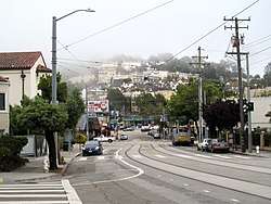 Ulloa Street in West Portal in 2017 | |
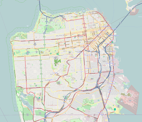 West Portal Location within San Francisco | |
| Coordinates: 37°44′27.32″N 122°27′56.95″W / 37.7409222°N 122.4658194°W | |
| Government | |
| • Supervisor | Norman Yee |
| • Assemblymember | Phil Ting (D)[1] |
| • State Senator | Scott Wiener (D)[1] |
| • U. S. Representatives | Nancy Pelosi (D)[2] and Jackie Speier (D)[3] |
| Area | |
| • Total | 2.705 sq mi (7.01 km2) |
| • Land | 2.705 sq mi (7.01 km2) |
| Population | |
| • Total | 2,630 |
| • Density | 9,230/sq mi (3,560/km2) |
| ZIP Code | 94116, 94127, 94132 |
| Area codes | 415/628 |
Location
West Portal is located at the southern edge of the hills in central San Francisco. The neighborhood is named for the western terminus of the Muni tunnel beneath Twin Peaks that opened in 1918. The ride in the subway from West Portal to Castro Station is about ten minutes.
Characteristics
Because of its small size and collection of mom and pop stores, restaurants, and saloons, the neighborhood is often described as having a village atmosphere. The neighborhood is served by a branch of the San Francisco Public Library. Like Glen Park, the neighborhood is a San Francisco community that almost functions as a small city itself: Though small, the neighborhood has many restaurants, salon and nail services, a movie theatre, and spas, among other businesses.
The frequent fog helps keep the area green in the usually rainless summer months, and on a clear day, the park above the tunnel provides a view of the Marin Headlands and the Farallon Islands in the Pacific.
References
- 1 2 "Statewide Database". UC Regents. Retrieved December 29, 2014.
- ↑ "California's 12th Congressional District - Representatives & District Map". Civic Impulse, LLC.
- ↑ "California's 14th Congressional District - Representatives & District Map". Civic Impulse, LLC.
| Downtown | .svg.png) | |
|---|---|---|
| North of Downtown | ||
| Outside Lands | ||
| Western Addition | ||
| Southern | ||
| ||