Cathedral Hill, San Francisco
| Cathedral Hill | |
|---|---|
| Neighborhood | |
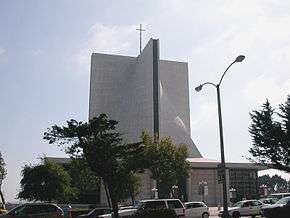 Looking south from Geary St. to St. Mary's Cathedral, around which Cathedral Hill is centered. | |
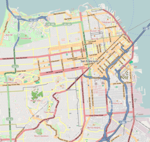 Cathedral Hill Location within Central San Francisco | |
| Coordinates: 37°47′03″N 122°25′31″W / 37.78423°N 122.42537°W | |
| Country |
|
| State |
|
| City-county | San Francisco |
| Government | |
| • Board of Supervisors | Jane Kim |
| • Assemblymember | David Chiu (D)[1] |
| • State senator | Scott Wiener (D)[1] |
| • U. S. rep. | Nancy Pelosi (D)[2] |
| Area[3] | |
| • Total | 0.095 sq mi (0.25 km2) |
| Population [3] | |
| • Total | 2,868 |
| • Density | 30,000/sq mi (12,000/km2) |
| Time zone | UTC−8 (Pacific) |
| • Summer (DST) | UTC−7 (PDT) |
| ZIP code | 94109 |
| Area codes | 415/628 |
| [3] | |
Cathedral Hill is a neighborhood and a hill, in the Western Addition district of San Francisco, California.
Location
The neighborhood's northern border is Post Street, the eastern border is Van Ness Avenue, the southern border is Eddy Street and the western border is Laguna Street.[4]
Attractions and characteristics
The neighborhood is centered on St. Mary's Cathedral on the corner of Geary Street and Gough Street.
It is home to large condominium and apartment towers with numerous churches built atop the hill, including St. Mary's Cathedral, St. Mark's Lutheran Church, The First Unitarian Church of San Francisco, and the Hamilton Baptist Church.
The Sacred Heart Cathedral Prep school is in the neighborhood.
See also
References
- 1 2 "Statewide Database". UC Regents. Retrieved November 5, 2014.
- ↑ "California's 12th Congressional District - Representatives & District Map". Civic Impulse, LLC.
- 1 2 3 "Cathedral Hill neighborhood in San Francisco, California (CA), 94109 detailed profile". City-Data.com. Retrieved March 30, 2015.
- ↑ "Map". Google Maps.
External links
| Downtown | .svg.png) | |
|---|---|---|
| North of Downtown | ||
| Outside Lands | ||
| Western Addition | ||
| Southern | ||
| ||
Coordinates: 37°47′03″N 122°25′31″W / 37.78423°N 122.42537°W
This article is issued from
Wikipedia.
The text is licensed under Creative Commons - Attribution - Sharealike.
Additional terms may apply for the media files.