List of crossings of the Murray River
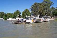
The Murray River in south-eastern Australia has been a significant barrier to land-based travel and trade. This article lists and briefly describes all of the recognised crossing points. Many of these had also developed as river ports for transport of goods along the Murray. Now almost every significant town along the river has a bridge or vehicle-carrying cable ferry nearby.
The crossings are listed in order starting from the Murray Mouth and proceeding upstream.
South Australia


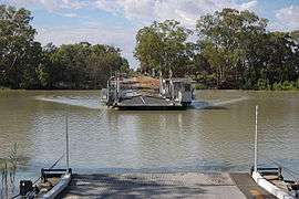

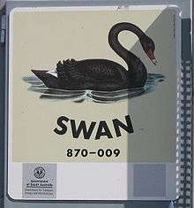
As the ferries are registered as boats, each one has a name, usually named after a waterbird. As of August 2010, the ferry names are:[2]
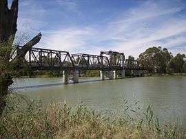
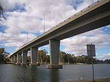
In Victoria and New South Wales
The south bank of the river forms the border between these two states and former colonies, so in many cases there is a town on each side of the river. If two towns are named in this list, the Victorian one is first for clarity and consistency.
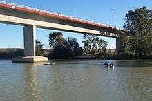
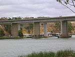
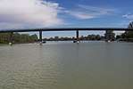
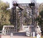
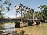
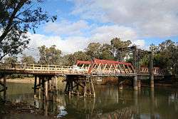
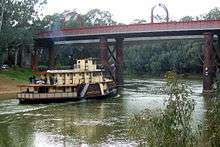
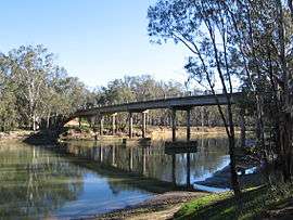
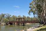
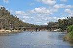
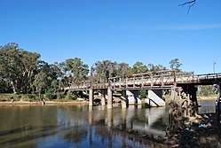
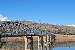
Most of the bridges downstream of Echuca are liftspan bridges to enable paddlesteamer traffic to pass underneath even in times of high water flow.
The Hume, Newell and Sturt Highway bridges are owned and managed by the Federal Government. The others are the responsibility of New South Wales and Victoria.
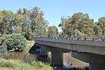
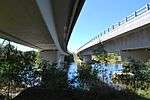
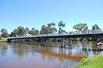
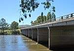
| Image | Crossing | Coordinates | Location | Built | Description | Notes |
|---|---|---|---|---|---|---|
 | Abbotsford Bridge | 34°06′50″S 141°59′17″E / 34.11389°S 141.98806°E | Yelta to Curlwaa | 1928 | 235 metres (771 ft) long, single lane lift bridge | |
 | George Chaffey bridge | 34°10′59″S 142°10′24″E / 34.18306°S 142.17333°E | Mildura to Buronga | 1985 | high arched bridge carrying the Sturt Highway, 331 metres (1,086 ft) long, 9.8 metres (32.2 ft) wide | |
 | Robinvale-Euston Bridge | 34°34′40″S 142°46′3″E / 34.57778°S 142.76750°E | Robinvale to Euston | 2006 | Replaced a liftspan bridge that was built as part of abandoned railway extension in 1924.. | |
 | Tooleybuc Bridge | 35°01′49″S 143°20′7″E / 35.03028°S 143.33528°E | Piangil to Tooleybuc | 1925 | timber and steel truss, single lane restriction on lift span | |
 | Nyah Bridge | 35°10′22″S 143°23′30″E / 35.17278°S 143.39167°E | Nyah to Koraleigh | 1941 | 104 metres (341.2 ft), central lift span | |
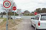
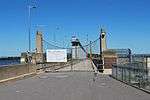
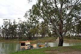 | Speewa Ferry | 35°12′49″S 143°30′31″E / 35.21361°S 143.50861°E | Speewa | 2-car capacity, 8 tonne (8.8 t) load limit. Upstream is a private ferry to Beveridge Island (part of Victoria); it crosses a Little Murray anabranch, but that is now the main navigable channel. | ||
 | Swan Hill Bridge | 35°20′16″S 143°33′46″E / 35.33778°S 143.56278°E | Swan Hill | 1896 | 2 lanes except central lift span; 116 metres (380.6 ft) | |
 | Gonn Crossing Bridge | 35°30′13″S 143°57′24″E / 35.50361°S 143.95667°E | Murrabit to Ballbank | 1926 | 103 metres (338 ft) | |
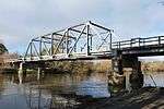
 | Barham Bridge | 35°37′50″S 144°07′29″E / 35.63056°S 144.12472°E | Koondrook to Barham | 1904 | liftspan bridge, 99 metres (325 ft) | |
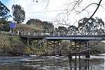
 | Echuca-Moama Bridge (road) | 36°07′19″S 144°45′13″E / 36.12194°S 144.75361°E | Echuca to Moama | 1879 | built as joint road/rail bridge, proposed for replacement/bypass | |
 | Echuca-Moama Bridge (rail) | 36°07′19″S 144°45′13″E / 36.12194°S 144.75361°E | 1989 | rail | ||
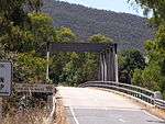
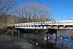
 | Barmah Bridge | 36°01′8″S 144°57′19″E / 36.01889°S 144.95528°E | Barmah | 1966 | 168 metres (551.2 ft) replaced ferry | |
 | Tocumwal Rail Bridge | 35°48′50″S 145°33′24″E / 35.81389°S 145.55667°E | Tocumwal | 1895 | originally a road/rail bridge | |
 | Edward Hillson Bridge | 35°48′47″S 145°33′32″E / 35.81306°S 145.55889°E | 1987 | Newell Highway 212 metres (695.5 ft) long, 12 metres (39.4 ft) wide | ||
 | Cobram-Barooga Bridge (old) | 35°54′57″S 145°40′9″E / 35.91583°S 145.66917°E | Cobram to Barooga | 1902 | Old liftspan timber truss bridge (now pedestrian only) | |
 | Cobram-Barooga Bridge (new) | 35°54′58″S 145°40′9″E / 35.91611°S 145.66917°E | 2006 | New concrete bridge built immediately upstream of the old bridge | ||
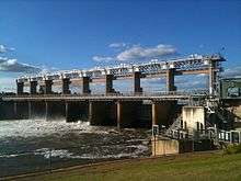 | Yarrawonga Weir | 36°00′31″S 145°59′57″E / 36.00861°S 145.99917°E | Yarrawonga to Mulwala | 1939 | Weir Road, one lane along the weir wall - originally designated as a stock route | |
 | Yarrawonga Rail Bridge | 36°00′29″S 145°59′59″E / 36.00806°S 145.99972°E | 1989 | railway bridge, replaced earlier wooden bridge and earthen embankment | ||
 | Mulwala Bridge | 36°00′20″S 146°00′18″E / 36.00556°S 146.00500°E | 1924 | Crosses Lake Mulwala, 488 metres (1,601 ft) | ||
 | John Foord Bridge | 36°00′25″S 146°23′43″E / 36.00694°S 146.39528°E | Wahgunyah to Corowa | 1892 | retained for local traffic | |
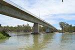
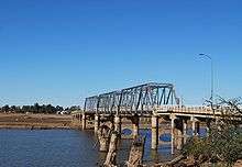
 | Federation Bridge | 35°59′8″S 146°24′40″E / 35.98556°S 146.41111°E | 2005 | Two lanes wide and 195 metres (639.8 ft) long, with a 95 metres (311.7 ft) approach bridge on the NSW side. | ||
 | John Conway Bourke Bridge | 35°59′37″S 146°37′15″E / 35.99361°S 146.62083°E | Howlong | 2001 | ||
 | Lincoln Causeway/Union Bridge | 36°05′29″S 146°54′23″E / 36.091318°S 146.906524°E | Wodonga to Albury | 1961 | 4 lanes, 92 metres (301.8 ft) long, widened 1990 | |
 | Albury-Wodonga Rail Bridge | 36°05′59″S 146°54′34″E / 36.099738°S 146.909314°E | 1888 | Originally double track - one Broad gauge plus one Standard gauge. Broad gauge track disconnected following conversion of the North East Victorian broad gauge line to standard gauge in 2010. | ||
 | Spirit of Progress Bridge | 36°06′02″S 146°54′34″E / 36.100518°S 146.909486°E | 2006 | New Hume Highway bridge, named for the former Spirit of Progress train.[3] | ||
 | Island Road Bridge | 36°04′42″S 146°57′20″E / 36.078262°S 146.955684°E | Thurgoona to the Island | |||
 | Heywood Bridge | 36°05′57″S 147°01′19″E / 36.09917°S 147.02194°E | Hume Dam to Bonegilla | 1984 | 124 metres (406.8 ft) long. Between Albury and here there is a bridge near the airport, to Bonegilla Island. | |
 | Bonegilla Bridge | 36°06′26″S 147°01′56″E / 36.10722°S 147.03222°E | Hume Dam to Bonegilla | 1941 | The Hume Weir wall, now closed to motorised traffic. single lane, 91 metres (298.6 ft) | |
 | Bethanga Bridge | 36°05′25″S 147°03′31″E / 36.09028°S 147.05861°E | Bellbridge | 1930 | on the Riverina Highway across Lake Hume | |
 | Wymah Ferry | 36°02′23″S 147°15′56″E / 36.03972°S 147.26556°E | Wymah | upstream end of Lake Hume, 2-car capacity, 11 tonne (12.1 t) load limit | ||
 | Jingellic Bridge | 35°55′53″S 147°42′5″E / 35.93139°S 147.70139°E | Jingellic | 1959 | 156 metres (511.8 ft) | |
 | Tintaldra Bridge | 36°2′44″S 147°55′56″E / 36.04556°S 147.93222°E | Tintaldra | 1959 | steel truss bridge 185 metres (607 ft) | |
 | Towong Bridge | 36°7′26″S 147°59′46″E / 36.12389°S 147.99611°E | Towong | 1938 | 61 metres (200.1 ft) long | |
 | Bringenbrong Bridge | 36°10′8″S 148°01′31″E / 36.16889°S 148.02528°E | Bringenbrong | 1961 | 87 metres (285.4 ft) long, near Corryong on the Alpine Way | |
 | Indi Bridge | 36°14′46″S 148°02′5″E / 36.24611°S 148.03472°E | 1961 | Connects the Indi homestead in NSW to the Upper Murray Road. Steel girder, with concrete piles and a concrete deck. Single lane, 3.7 metres (12 ft) wide.[4] | ||
 | Biggara Bridge | 36°17′46″S 148°02′17″E / 36.29611°S 148.03806°E | Biggara | 1951 | ||
| Tom Groggin Bridge | 36°31′20″S 148°08′13″E / 36.522085°S 148.136998°E | Tom Groggin | Private bridges to Tom Groggin Station: low level for vehicles; higher-level suspension bridge for pedestrians when the other is flooded. |
See also
![]()
![]()
- List of Australian ferries
- List of Darling River distances
- List of Murray River distances
- List of Murrumbidgee River distances
- Murray–Darling basin includes useful chart of tributaries
References
- ↑ "Blanchetown Bridge, Murray River". York Civil. Retrieved 19 November 2016.
- ↑ "Ferry Locations and Operational Status". Government of South Australia, Department for Transport, Energy and Infrastructure. 12 August 2010. Retrieved 16 August 2010.
- ↑ "Spirit of Progress bridge sign up today". Border Mail. 24 May 2007. Retrieved 20 July 2010.
- ↑ "Indi Bridge over Murray River". Roads and Transport Authority. Retrieved 14 July 2010.