Levelland Mountain
| Levelland Mountain | |
|---|---|
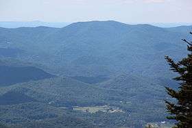 Levelland Mountain viewed from Brasstown Bald | |
| Highest point | |
| Elevation | 3880+ ft (1183+ m) NGVD 29[1] |
| Prominence | 430 ft (130 m) [1] |
| Coordinates | 34°43′51″N 83°53′55″W / 34.730925°N 83.8985198°WCoordinates: 34°43′51″N 83°53′55″W / 34.730925°N 83.8985198°W [2] |
| Geography | |
| Parent range | Blue Ridge Mountains |
| Topo map | USGS Neels Gap |

Levelland Mountain is the highest point in the Raven Cliffs Wilderness in Lumpkin and Union counties, Georgia. The mountain is traversed by the Appalachian Trail and is in the Chattahoochee National Forest. The summit is the tenth-highest peak in the Union County.
Notes
- 1 2 "Levelland Mountain, Georgia". Peakbagger.com. Retrieved 2011-05-05.
- ↑ "Levelland Mountain". Geographic Names Information System. United States Geological Survey. Retrieved 2011-05-05.
This article is issued from
Wikipedia.
The text is licensed under Creative Commons - Attribution - Sharealike.
Additional terms may apply for the media files.