Slaughter Mountain
| Slaughter Mountain | |
|---|---|
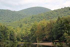 Slaughter Mountain, viewed from Lake Winfield Scott | |
| Highest point | |
| Elevation | 4,338 ft (1,322 m) |
| Coordinates | 34°44′52″N 83°57′01″W / 34.74778°N 83.95028°WCoordinates: 34°44′52″N 83°57′01″W / 34.74778°N 83.95028°W |
| Geography | |
| Location | Union County, Georgia, U.S. |
| Parent range | Blue Ridge Mountains |
| Topo map | USGS Neels Gap |
| Climbing | |
| Easiest route | Coosa Backcountry Trail, Duncan Ridge Trail |
Slaughter Mountain, with an elevation of 4,338 ft (1,322 m), is the ninth-highest peak in the U.S. state of Georgia. It is located in Union County, Georgia and is the second-highest mountain in Union County. Its nearest neighbor is Blood Mountain, the highest peak in Union County and fifth-highest in Georgia.
See also
External links
| Wikimedia Commons has media related to Slaughter Mountain. |
This article is issued from
Wikipedia.
The text is licensed under Creative Commons - Attribution - Sharealike.
Additional terms may apply for the media files.