Horseleg Mountain
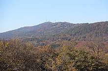
Horseleg Mountain viewed from Myrtle Hill Cemetery
Horseleg Mountain is a summit in Floyd County, Georgia, in the United States.[1] With an elevation of 1,322 feet (403 m), Horseleg Mountain is the 735th highest summit in the state of Georgia.[2]
Horseleg Mountain is said to be shaped like the leg of a horse, hence the name.[3]
References
- ↑ U.S. Geological Survey Geographic Names Information System: Horseleg Mountain
- ↑ "Horseleg Mountain". Peakery.com. Retrieved 14 April 2015.
- ↑ "Floyd County". Calhoun Times. September 1, 2004. p. 68. Retrieved 24 April 2015.
Coordinates: 34°13′47″N 85°14′41″W / 34.2298165°N 85.2446750°W
This article is issued from
Wikipedia.
The text is licensed under Creative Commons - Attribution - Sharealike.
Additional terms may apply for the media files.