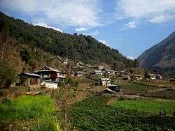
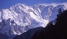
Lelep
| Lelep लेलेप | |
|---|---|
| Village development committee | |
 | |
 Lelep Location in Nepal | |
| Coordinates: 27°31′35″N 87°48′00″E / 27.5264°N 87.8°ECoordinates: 27°31′35″N 87°48′00″E / 27.5264°N 87.8°E | |
| Country |
|
| Zone | Mechi Zone |
| District | Taplejung District |
| Population (2011) | |
| • Total | 2,205 |
| Time zone | UTC+5:45 (Nepal Time) |
Lelep is a village development committee in the Himalayas of Taplejung District in the Mechi Zone of north-eastern Nepal. At the time of the 2011 Nepal census it had a population of 2,205 people living in 511 individual households.[1]There were 1,122 males and 1,083 females at the time of census.
References
- ↑ "Nepal Census 2001". Nepal's Village Development Committees. Digital Himalaya. Archived from the original on 12 October 2008. Retrieved 19 November 2008.
External links
Headquarter: Phungling | |||
 | Rural Municipalities | 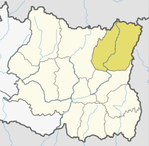 | |
| Municipalities | |||
This article is issued from
Wikipedia.
The text is licensed under Creative Commons - Attribution - Sharealike.
Additional terms may apply for the media files.