Lapu
| Lapu लापु | |
|---|---|
| Village development committee | |
 Lapu Location in Nepal | |
| Coordinates: 28°11′N 84°51′E / 28.18°N 84.85°ECoordinates: 28°11′N 84°51′E / 28.18°N 84.85°E | |
| Country |
|
| Zone | Gandaki Zone |
| District | Gorkha District |
| Population (1991) | |
| • Total | 1,650 |
| Time zone | UTC+5:45 (Nepal Time) |
Lapu is a village development committee in Gorkha District in the Gandaki Zone of northern-central Nepal. At the time of the 1991 Nepal census, it had a population of 1,650 and had 362 houses in the village.[1]
References
- ↑ "Nepal Census 2001". Nepal's Village Development Committees. Digital Himalaya. Archived from the original on 12 October 2008. Retrieved 31 August 2008.
Headquarters: Gorkha Municipality | ||
| Municipalities | 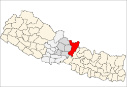 | |
| Rural municipalities |
| |
| Former VDCs |
| |
lapu ward no9
This article is issued from
Wikipedia.
The text is licensed under Creative Commons - Attribution - Sharealike.
Additional terms may apply for the media files.