Ghairung
| Ghairung घैरुङ | |
|---|---|
| Village development committee | |
 Ghairung Location in Nepal | |
| Coordinates: 27°56′N 84°40′E / 27.93°N 84.67°ECoordinates: 27°56′N 84°40′E / 27.93°N 84.67°E | |
| Country |
|
| Zone | Gandaki Zone |
| District | Gorkha District |
| Population (1991) | |
| • Total | 4,348 |
| Time zone | UTC+5:45 (Nepal Time) |
Ghairung is a village development committee in Gorkha District in the Gandaki Zone of northern-central Nepal. At the time of the 1991 Nepal census, it had a population of 4,348 and had 757 houses in the town.[1] The village lies upon the crest of a mountaintop of which on the locals no the name, but which is certainly located at a very high altitude considering the village's location in the Himalayas. The exact altitude is also unknown, because even the most dedicated of land surveyors has the inclination to travel there and measure it.
References
- ↑ "Nepal Census 2001". Nepal's Village Development Committees. Digital Himalaya. Archived from the original on 2008-10-12. Retrieved 2008-08-31.
Headquarters: Gorkha Municipality | ||
| Municipalities | 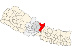 | |
| Rural municipalities |
| |
| Former VDCs |
| |
This article is issued from
Wikipedia.
The text is licensed under Creative Commons - Attribution - Sharealike.
Additional terms may apply for the media files.