Langdeau Site
|
Langdeau Site | |
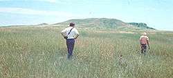 Fields at the Langdeau Site | |
| Location | Address restricted[1] |
|---|---|
| Nearest city | Lower Brule, South Dakota |
| Area | 60,700 square metres (6.07 ha) |
| NRHP reference # | 66000717[2] |
| Significant dates | |
| Added to NRHP | October 15, 1966 |
| Designated NHL | July 19, 1964[3] |
The Langdeau Site, designated by the Smithsonian trinomial 39LM209, is an archaeological site in Lyman County, South Dakota, near Lower Brule. It was declared a National Historic Landmark in 1964.[3] The site was one of the first to provide evidence of horticultural activity by Native Americans in the region.[3]
Description
The exact location/address of this historic site is restricted. It is located on a high terrace overlooking the Missouri River. It consists of fifteen depressions consistent with traditional Native American earthlodge construction, with no evidence that the village was fortified (e.g. by being surrounded by a palisade).[4] Pottery finds at the site were instrumental in establishing a prehistoric settlement chronology in the Big Bend area of central South Dakota between 1100 and 1300 CE.[5]
The site underwent excavation in 1962 under the auspices of the Smithsonian Institution's River Basin Survey, a program that investigated river banks archaeologically in advance of planned flood control and water supply projects. The expedition excavated four of the house sites, which were depressions between 30 and 40 feet (9.1 and 12.2 m) in width. The ends appeared to be open, lacking posts, and were stained with red ocher. They also dug trenches in an unsuccessful bid to locate evidence of fortification. This differentiated the site from the nearby Jiggs Thompson Site, which the same crew found to be surrounded by a moat. Finds at this site included copper, shell, bone, and stone tools and ornaments.[6]
See also
References
- ↑ Federal and state laws and practices restrict general public access to information regarding the specific location of this resource. In some cases, this is to protect archeological sites from vandalism, while in other cases it is restricted at the request of the owner. See: Knoerl, John; Miller, Diane; Shrimpton, Rebecca H. (1990), Guidelines for Restricting Information about Historic and Prehistoric Resources, National Register Bulletin (29), National Park Service, U.S. Department of the Interior, OCLC 20706997 .
- ↑ National Park Service (2010-07-09). "National Register Information System". National Register of Historic Places. National Park Service.
- 1 2 3 "Langdeau Site". National Historic Landmark summary listing. National Park Service. Archived from the original on 2003-11-21. Retrieved 2008-06-22.
- ↑ "An Archeological Survey of Selected Federal Lands on the West Bank of the Big Bend/Lake Sharpe Project Area, Lyman and Stanley Counties, South Dakota 1983" (PDF). United States Department of Defense. Retrieved 2017-12-29.
- ↑ Kehoe, Thomas (April 1973). "Review of The Grand Detour Phase by Warren W. Caldwell, Richard E. Jensen". American Anthropologist (Volume 73, No. 2): 418–419. JSTOR 672601.
- ↑ Annual Report of the Bureau of American Ethnology to the Secretary of the Smithsonian Institution (1962-63). Retrieved 2018-01-04.
| Topics | |
|---|---|
| Lists by states |
|
| Lists by insular areas | |
| Lists by associated states | |
| Other areas | |
| |