Lamerd County
| Lamerd County شهرستان لامرد | |
|---|---|
| County | |
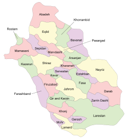 Location in Fars Province | |
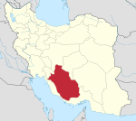
 Location of Fars Province in Iran | |
| Coordinates: 27°27′N 53°11′E / 27.450°N 53.183°ECoordinates: 27°27′N 53°11′E / 27.450°N 53.183°E | |
| Country |
|
| Province | South Fars |
| Capital | Lamerd |
| Bakhsh (Districts) | Central District, Eshkanan District, Alamarvdasht District |
| Population (2006) | |
| • Total | 76,971 |
| Time zone | UTC+3:30 (IRST) |
| • Summer (DST) | UTC+4:30 (IRDT) |
| Lamerd County can be found at GEOnet Names Server, at this link, by opening the Advanced Search box, entering "9206556" in the "Unique Feature Id" form, and clicking on "Search Database". | |
Lamerd County (Persian: شهرستان لامرد) is a county in Fars Province in Iran. The capital of the county is Lamerd.[1] At the 2006 census, the county's population was 76,971, in 16,602 families.[2] The county is subdivided into three districts: the Central District, Eshkanan District, and Alamarvdasht District. The county has four cities: Lamerd, Ahel, Alamarvdasht, and Eshkanan.
Lamerd was historically part of the region of Irahistan. The people of Lamerd are closely related to the Achomi people.[3]
References
- ↑ Gitashenasi Province Atlas of Iran
اطلس گیتاشناسی استانهای ایران Archived 2007-05-22 at the Wayback Machine. - ↑ "Census of the Islamic Republic of Iran, 1385 (2006)". Islamic Republic of Iran. Archived from the original (Excel) on 2011-11-11.
- ↑ ABO and Rh blood groups distribution in the populations of Larestan and Lamerd, Fars province Iran. Iranian Journal of Public Health 1996.
| Capital | |||||||||||||||||||||||||||||||||||||||
|---|---|---|---|---|---|---|---|---|---|---|---|---|---|---|---|---|---|---|---|---|---|---|---|---|---|---|---|---|---|---|---|---|---|---|---|---|---|---|---|
| Districts |
| ||||||||||||||||||||||||||||||||||||||
This article is issued from
Wikipedia.
The text is licensed under Creative Commons - Attribution - Sharealike.
Additional terms may apply for the media files.