Ahel
| Ahel اهل | |
|---|---|
| City | |
 Ahel | |
| Coordinates: 27°10′03″N 53°45′49″E / 27.16750°N 53.76361°ECoordinates: 27°10′03″N 53°45′49″E / 27.16750°N 53.76361°E | |
| Country |
|
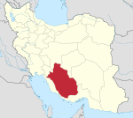
| Province | Fars |
| County | Lamerd |
| Bakhsh | Eshkanan |
| Population (2016 Census) | |
| • Total | 3,179 [1] |
| Time zone | UTC+3:30 (IRST) |
| • Summer (DST) | UTC+4:30 (IRDT) |
Ahel (Persian: اهل, also Romanized as Ahl and Ehel)[2] is a town in Eshkanan District, Lamerd County, Fars Province, Iran. At the 2006 census, its population was 2,797, in 606 families.[3] At the 2016, its population was 4,300, in 1012 families.
There are documents show that this town back to sasanid or Neo-Persian Empire of ancient Iran. the Sorez Castle, Water Mill, Qanat and Aqueduct are famous.
References
- ↑ https://www.amar.org.ir/english
- ↑ Ahel can be found at GEOnet Names Server, at this link, by opening the Advanced Search box, entering "-3061986" in the "Unique Feature Id" form, and clicking on "Search Database".
- ↑ "Census of the Islamic Republic of Iran, 1385 (2006)". Islamic Republic of Iran. Archived from the original (Excel) on 2011-11-11.
| Capital | |||||||||||||||||||||||||||||||||||||||
|---|---|---|---|---|---|---|---|---|---|---|---|---|---|---|---|---|---|---|---|---|---|---|---|---|---|---|---|---|---|---|---|---|---|---|---|---|---|---|---|
| Districts |
| ||||||||||||||||||||||||||||||||||||||
This article is issued from
Wikipedia.
The text is licensed under Creative Commons - Attribution - Sharealike.
Additional terms may apply for the media files.