Darab County
| Darab County شهرستان داراب | |
|---|---|
| County | |
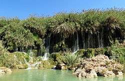 Fadami Waterfalls | |
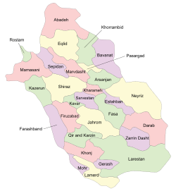 Location in Fars Province | |
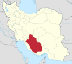
 Location of Fars Province in Iran | |
| Coordinates: 28°40′N 54°40′E / 28.667°N 54.667°ECoordinates: 28°40′N 54°40′E / 28.667°N 54.667°E | |
| Country |
|
| Province | Fars |
| Capital | Darab |
| Bakhsh (Districts) | Central District, Rostaq District, Forg District |
| Population (2006) | |
| • Total | 172,938 |
| Time zone | UTC+3:30 (IRST) |
| • Summer (DST) | UTC+4:30 (IRDT) |
| Darab County can be found at GEOnet Names Server, at this link, by opening the Advanced Search box, entering "9206482" in the "Unique Feature Id" form, and clicking on "Search Database". | |
Darab County (Persian: شهرستان داراب) is a county in Fars Province in Iran. The capital of the county is Darab.[1] At the 2006 census, the county's population was 172,938, in 39,955 families.[2] The county is subdivided into three districts: the Central District, Rostaq District, and Forg District. The county has four cities: Darab, Jannat Shahr, Fadami & Do Borji.
Situation
It has five hundred villages, and possesses a very hot climate, snow being rarely seen there in winter. Darab city have area of about 7,500 square kilometers and a height of 1180 meters. It produces fruits, cereals, cotton, and tobacco, while the lower areas are used for winter crops by the Baharlu tribe. There are also nearby salt mines which have long been utilized. The town Darab, the capital of the district, is situated in a very fertile plain, 140 mi. S.E. of Shiraz. It has a population (in 2000) of about 60,718 and extensive orchards of orange and lemon trees and immense plantations of date-palms. Legend ascribes the foundation of the city to Darius, hence its name Darab-gerd ("Darius-fort"). In the neighborhood there are various remains of antiquity, the most important of which mi. S., is known as the Kalah i Dal-a, or citadel of Darius, and consists of a series of earthworks arranged in a circle round an isolated rock. Nothing, however, remains to fix the date or explain the history of the fortification. Another monument in the vicinity is a gigantic bas-relief, carved on the vertical face of a rock, representing the victory of the Sassanian Shapur I (Sapor) of Persia over the Roman emperor Valerian, A.D. 260.
References
- ↑ Gitashenasi Province Atlas of Iran
اطلس گیتاشناسی استانهای ایران Archived May 22, 2007, at the Wayback Machine. - ↑ "Census of the Islamic Republic of Iran, 1385 (2006)". Islamic Republic of Iran. Archived from the original (Excel) on 2011-11-11.
| Capital | |||||||||||||||||||||||||||||||||||||||||||
|---|---|---|---|---|---|---|---|---|---|---|---|---|---|---|---|---|---|---|---|---|---|---|---|---|---|---|---|---|---|---|---|---|---|---|---|---|---|---|---|---|---|---|---|
| Districts |
| ||||||||||||||||||||||||||||||||||||||||||