Lakin Township, Barton County, Kansas
| Lakin Township | |
|---|---|
| Township | |
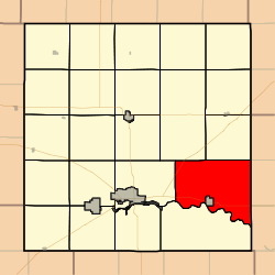 Location in Barton County | |
| Coordinates: 38°23′28″N 098°34′22″W / 38.39111°N 98.57278°WCoordinates: 38°23′28″N 098°34′22″W / 38.39111°N 98.57278°W | |
| Country | United States |
| State | Kansas |
| County | Barton |
| Area | |
| • Total | 66.65 sq mi (172.63 km2) |
| • Land | 66.5 sq mi (172.24 km2) |
| • Water | 0.15 sq mi (0.39 km2) 0.23% |
| Elevation | 1,791 ft (546 m) |
| Population (2010) | |
| • Total | 262 |
| • Density | 3.9/sq mi (1.5/km2) |
| GNIS feature ID | 0475653 |
Lakin Township is a township in Barton County, Kansas, United States. As of the 2010 census, its population was 262.[1]
Lakin Township was organized in 1872.[2]
Geography
Lakin Township covers an area of 66.65 square miles (172.6 km2) and contains no incorporated settlements, though the township surrounds the governmentally independent city of Ellinwood.
Transportation
Lakin Township contains one airport or landing strip, Ellinwood Municipal Airport.
References
- ↑ "Profile of General Population and Housing Characteristics: 2010 Demographic Profile Data (DP-1): Lakin township, Barton County, Kansas". U.S. Census Bureau, American Factfinder. Retrieved July 13, 2012.
- ↑ History of the State of Kansas: Containing a Full Account of Its Growth from an Uninhabited Territory to a Wealthy and Important State. A. T. Andreas. 1883. p. 762.
External links
Municipalities and communities of Barton County, Kansas, United States | ||
|---|---|---|
| Cities | 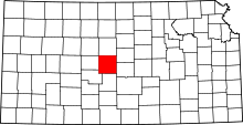 | |
| CDPs | ||
| Unincorporated communities | ||
| Townships | ||
| Footnotes | ‡This populated place also has portions in an adjacent county or counties | |
This article is issued from
Wikipedia.
The text is licensed under Creative Commons - Attribution - Sharealike.
Additional terms may apply for the media files.