Lakeridge, Nevada
| Lakeridge, Nevada | |
|---|---|
| Census-designated place | |
 Lakeridge Location of Lakeridge, Nevada | |
| Coordinates: 39°2′11″N 119°56′42″W / 39.03639°N 119.94500°WCoordinates: 39°2′11″N 119°56′42″W / 39.03639°N 119.94500°W | |
| Country | United States |
| State | Nevada |
| Area | |
| • Total | 1.5 sq mi (4.0 km2) |
| • Land | 1.5 sq mi (3.8 km2) |
| • Water | 0.08 sq mi (0.2 km2) |
| Elevation | 6,400 ft (2,000 m) |
| Population (2010) | |
| • Total | 371 |
| • Density | 253/sq mi (97.6/km2) |
| Time zone | UTC-8 (Pacific (PST)) |
| • Summer (DST) | UTC-7 (PDT) |
| Area code(s) | 775 |
| FIPS code | 32-39100 |
Lakeridge is a census-designated place (CDP) in Douglas County, Nevada, United States. The population was 371 at the 2010 census.[1]
Geography
Lakeridge is located on the east shore of Lake Tahoe in far western Nevada. U.S. Route 50 is the main road through the CDP, leading south 6 miles (10 km) to the California state line and northeast 19 miles (31 km) to Carson City. According to the United States Census Bureau, the CDP has a total area of 1.5 square miles (4.0 km2), of which 1.5 square miles (3.8 km2) is land and 0.077 square miles (0.2 km2), or 5.0%, is water.[1]
References
- 1 2 "Geographic Identifiers: 2010 Demographic Profile Data (G001): Lakeridge CDP, Nevada". U.S. Census Bureau, American Factfinder. Retrieved January 24, 2013.
Municipalities and communities of Douglas County, Nevada, United States | ||
|---|---|---|
| CDPs | 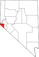 | |
| Unincorporated communities | ||
This article is issued from
Wikipedia.
The text is licensed under Creative Commons - Attribution - Sharealike.
Additional terms may apply for the media files.