Lake Bullen Merri
| Lake Bullen Merri | |
|---|---|
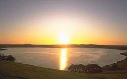 Lake Bullen Merri at sunset | |
 Lake Bullen Merri Location in Victoria | |
| Location | Southwest Victoria |
| Coordinates | 38°15′06″S 143°06′15″E / 38.25167°S 143.10417°ECoordinates: 38°15′06″S 143°06′15″E / 38.25167°S 143.10417°E[1] |
| Type | Brackish crater lake |
| Basin countries | Australia |
| Average depth | 60 metres (200 ft) |
| Max. depth | 66 metres (217 ft) |
Lake Bullen Merri is a brackish crater lake near Camperdown in southwestern Victoria, Australia.
The lake has a maximum depth of 66 metres (217 ft), with a clover leaf outline indicating that it was probably formed by two overlapping maar volcanoes. The lake is depicted in work by Eugene von Guerard.[2] The edge of the lake was marked by a stone in the late 1800s by James Dawson; from this and von Guerard's painting, it can be deduced that the level of the lake has dropped considerably in the last 100 years.[3]
See also
References
- ↑ "Lake Bullen Merri". Vicnames. Government of Victoria. 2 May 1966. Retrieved 4 June 2014.
- ↑ Lakes and Craters Precinct:Lake Bullen Merri, Kanawinka Geopark
- ↑ "Volcanic landforms in the Camperdown area of Victoria". UniServe Science. Retrieved 16 June 2007.
External links
- Lake Bullenmerrie, southwest of Camperdown., Three craters 3.2km by 2.8km are surrounded by a prominent tuff-ring. (Oblique aerial photo) Museum Victoria
| |||||||||||||||||
| |||||||||||||||||
| |||||||||||||||||
This article is issued from
Wikipedia.
The text is licensed under Creative Commons - Attribution - Sharealike.
Additional terms may apply for the media files.