Lake Tyrrell
| Lake Tyrrell | |
|---|---|
 Lake Tyrrell Location in Victoria | |
| Location | Mallee district, Victoria |
| Coordinates | 35°20′38″S 142°50′00″E / 35.34389°S 142.83333°ECoordinates: 35°20′38″S 142°50′00″E / 35.34389°S 142.83333°E[1] |
| Type | Intermittent |
| Primary inflows | Tyrrell Creek |
| Basin countries | Australia |
| Surface area | 20,860 ha (51,500 acres) |
Lake Tyrrell is a shallow, salt-crusted depression in the Mallee district of north-west Victoria, in Australia. The word is derived from the local Wergaia word for 'sky', the Boorong Aboriginal people of the area being distinguished for their interest in star-lore.[2] The Boorong people, with their astronomical traditions, told stories connected with constellations in the night sky[3].
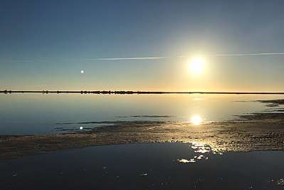
In the mid-2010s, the lake became a tourist mecca, particularly among the Chinese[4]. It's a popular spot for photographers and social media users who take snaps of the lake's mirror-like surface during winter, when ground water percolates to the surface and inflows arrive from the Avoca/Tyrrell creek system.

During this time of cold weather, people are able to walk into the shallow lake without sinking in or getting feet muddy by finding areas where salt has formed a solid floor.

Location and features
The lake covers approximately 20,860 hectares (51,500 acres),[5][6] making it Victoria's largest salt lake. It is located 6 kilometres (3.7 mi) north of the town of Sea Lake and 314 kilometres (195 mi) northwest of Melbourne.
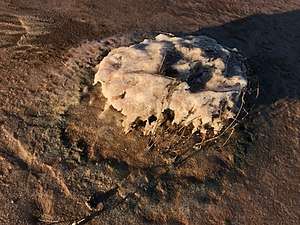
While much of the time the lake is dry, it is usually covered in about 5 centimetres (2.0 in) of water in winter.[7] It is ancient and probably formed by sand blocking the passage of Tyrrell Creek (a distributary of the Avoca River) which feeds the lake.[5][6] Evaporation results in a layer of salt crusting on the lake bed which is harvested by Cheetham Salt in Sea Lake.
The lake environment is host to Mallee reptiles, kangaroos, emus and white-faced chats.[5] Thousands of seagulls breed on small islands on the lake.[5][6] Surrounding vegetation is made up of saltbush and samphire.
History
Around 120,000 years ago Tyrrell was approximately 13 metres (43 ft) deep with low salinity. Water levels subsequently dropped due to climatic changes, resulting in cycles of drying and partial refilling.[7]
In 1838, Australian explorer Edward Eyre discovered Lake Tyrrell while searching for new grazing land.
Recreation activities
Each year on the Queen's Birthday long weekend the lake hosts the Mallee Rally, once part of the Australian Off Road Championship and more recently Australian Off Road Racing Series.
On the Sea Lake side of the lake, 7–8 kilometres (4.3–5.0 mi) from the township, is the local lookout and astronomy deck, built in the late 1990s.
References
- ↑ "Lake Tyrrell (lake)". Vicnames. Government of Victoria. 2 May 1966. Retrieved 4 June 2014.
- ↑ Hamacher & Frew 2010, p. 1.
- ↑ "Stories in the Stars – the night sky of the Boorong people". Museums Victoria. Retrieved 25 June 2018.
- ↑ Grindlay, Danielle (15 December 2016). "Chinese tourists flood isolated grain town, throwing drought-stricken community an unexpected lifeline". ABC. Retrieved 25 June 2018.
- 1 2 3 4 Advance Sea Lake Inc. Archived 2013-08-01 at the Wayback Machine., 2013
- 1 2 3 The Age Traveller - Sea Lake
- 1 2 Jochen Brocks' Biogeochemistry Group ANU Archived 2013-05-16 at the Wayback Machine.
- Hamacher, Duane Willis; Frew, David J. (2010). "An Aboriginal Australian Record of the Great Eruption of Eta Carinae" (PDF). Journal for Astronomical History & Heritage. 13 (3): 1–23.
| |||||||||||||||||
| |||||||||||||||||
| |||||||||||||||||