Lake Benmore
| Lake Benmore | |
|---|---|
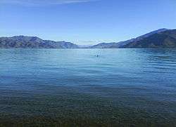 Looking south | |
| Location | Mackenzie, Waimate, and Waitaki Districts, Canterbury Region, South Island |
| Coordinates | 44°24′54″S 170°13′14″E / 44.41500°S 170.22056°ECoordinates: 44°24′54″S 170°13′14″E / 44.41500°S 170.22056°E |
| Lake type | reservoir |
| Primary inflows | Ohau, Pukaki, Tekapo, Ahuriri |
| Basin countries | New Zealand |
| Surface area | 75 km2 (29 sq mi) |
| Max. depth | 120 m (390 ft) |
| Surface elevation | 361 m (1,184 ft) |
Lake Benmore is a lake located in the South Island of New Zealand. It was artificially created in the 1960s by construction of Benmore Dam. The lake covers an area of approximately 75 km². Parts of it lie in the Mackenzie, Waimate, and Waitaki districts within the southern portion of the Canterbury Region.
The major rivers which feed it are the Ohau, Pukaki, Tekapo and Ahuriri Rivers. Immediately downstream is Lake Aviemore. The lake has New Zealand's largest earth dam as part of the Waitaki hydroelectricity power scheme.
After the lake was created the incidence of seismic shocks increased by a factor of three to six times.[1]
See also
References
- ↑ Adams, R (1974). "Statistical studies of earthquakes associated with Lake Benmore, New Zealand". Engineering Geology. 8 (1–2): 155–169. doi:10.1016/0013-7952(74)90022-2. ISSN 0013-7952.
External links
| Wikimedia Commons has media related to Lake Benmore. |
This article is issued from
Wikipedia.
The text is licensed under Creative Commons - Attribution - Sharealike.
Additional terms may apply for the media files.