Kyrock, Kentucky
Kyrock was a small town in Edmonson County in south central Kentucky. The town was located just east of Sweeden, or about 5 miles (8.0 km) north-northeast of the county seat of Brownsville.[1] It was once a referred to as a “company town” along the Nolin River during much of the first half of the 20th century, but the industrial town no longer exists. It was deincorporated in 1957 after the closure of the company in which the town was operated.[2][3]
Kyrock was one of several other central Edmonson County communities located near Mammoth Cave National Park.
History
Kentucky Rock Asphalt Company[4]
In 1918, the town was incorporated into a town that was built by the Kentucky Rock Asphalt Company, which the town’s name, Kyrock, is derived from. During the company’s heyday in the 1920s, the company mined, processed, and shipped hundreds of tons of rock asphalt, by way of both the Nolin and Green Rivers. This was done to eventually pave roadways in areas where they were not previously served by minor or major roadways at the time. The company itself began operations in 1917 after a merger between two companies involved in rock mining and paving. Eight new quarries and a processing facility, which ended up becoming a vital part of the county’s history, opened at the site that would become part of the town, which was incorporated in 1918. The material generated by the company, made of silica sand, was the first material ever laid for the Indianapolis Motor Speedway.[5][2] The asphalt rock from Kyrock was also used to pave the streets of major cities such as Rio de Janeiro, Brazil, and Havana, Cuba.[6]
The company stayed open for a total of forty years with its heavy promotions and advertising, becoming the state’s most successful asphalt mine during that period. Higher costs to pave with asphalt resulted in the end of the company since petroleum-based asphalt was a lower-cost method of paving. The Kentucky Rock Asphalt Company was shut down in 1957. [2] The town itself was unincorporated at some point in the late 1950s.
Kyrock’s post office operated from 1920 to 1955.[7]
Education
Kyrock High School, which was established in 1937, merged into the county’s other high schools in 1959 to form the Edmonson County High School in Brownsville. Kyrock Elementary School is the sole educational institution, housing students from kindergarten to fourth grade, from all of the northern half of the county since the 1959-60 school year.
Transportation
In addition to the Nolin River, Kyrock was also served with a ferry that connected the town to Whistle Mountain, and eventually to areas along what is now KY 728 into the northeastern portion of the county.[1] Ferry service was discontinued a few years before the U.S. Army Corps of Engineers impounded Nolin River to build Nolin Dam in 1963.
Today, Kyrock is nothing more than a unincorporated community along a county-maintained road off State Highway 259 (KY 259) near Sweeden. Kyrock Road is accessible from both KY 259 from Brownsville and KY 728 from the Nolin Lake area.
Bibliography
Books
- Elmore, Ernie (2016). Kyrock: A Pictorial History. ISBN 978-1-534881-25-9.
References
- 1 2 Kentucky Transportation Cabinet (1937). Edmonson County Route Planning Map (PDF) (Map). 1:62500. Frankfort: Kentucky Transportation Cabinet. Retrieved October 27, 2014.
- 1 2 3 Story, Justin (September 2016). "Man publishing Kyrock History in Photos". Bowling Green Daily News. Retrieved September 24, 2018.
- ↑
- ↑ Kyrock. Wolf0r. March 8, 2009 – via YouTube.
- ↑ Mudd, Melissa (September 28, 2016). "Kyrock history at its finest". Edmonson News. Missing or empty
|url=(help);|access-date=requires|url=(help) - ↑ Minor, Robyn L. (July 3, 2008). “Kyrock may be on a roll”. Bowling Green Daily News. Retrieved September 25, 2018.
- ↑
External links
- Historic Mammoth Cave on Facebook - a social media-based effort to preserve photo history of the entire Cave Country region of south-central Kentucky
- Kyrock Elementary School
- Homage to Kyrock
- Kyrock-KY on Facebook
Municipalities and communities of Edmonson County, Kentucky, United States | ||
|---|---|---|
| City | 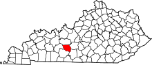 | |
| Unincorporated communities | ||
| Ghost town | ||
| Footnotes | ‡This populated place also has portions in an adjacent county or counties | |