Kyōtamba, Kyoto
| Kyōtamba 京丹波町 | |||
|---|---|---|---|
| Town | |||
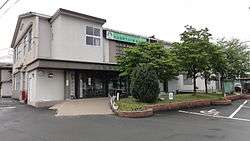 Kyōtamba Town hall | |||
| |||
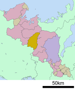 Location of Kyōtamba in Kyoto Prefecture | |||
 Kyōtamba Location in Japan | |||
| Coordinates: 35°10′N 135°25′E / 35.167°N 135.417°ECoordinates: 35°10′N 135°25′E / 35.167°N 135.417°E | |||
| Country | Japan | ||
| Region | Kansai | ||
| Prefecture | Kyoto Prefecture | ||
| District | Funai | ||
| Area | |||
| • Total | 303.09 km2 (117.02 sq mi) | ||
| Population (October 1, 2017) | |||
| • Total | 13,797 | ||
| • Density | 46/km2 (120/sq mi) | ||
| Time zone | UTC+9 (JST) | ||
| Website |
www | ||


Kyōtamba (京丹波町 Kyōtanba-chō) is a town located in Funai District, Kyoto Prefecture, Japan. Its name comes from the first syllable of Kyōto and the former town of Tanba, a namesake of the historic Tanba Province.
As of October 2017, the town has an estimated population of 13,797.[1] The total area is 303.09 km2.
The town was founded on October 11, 2005, by the merger of the former towns of Tanba, Mizuho and Wachi, all from Funai District.
Geography
Neighbouring municipalities
- Kyoto Prefecture
- Hyōgo Prefecture
Transportation
Railway
References
- ↑ "Official website of Kyoto Prefecture" (in Japanese). Japan: Kyoto Prefecture. Retrieved 11 February 2018.
External links

- Kyōtamba official website (in Japanese)
This article is issued from
Wikipedia.
The text is licensed under Creative Commons - Attribution - Sharealike.
Additional terms may apply for the media files.