Kunturkanki District
| Kunturkanki | |
|---|---|
| District | |
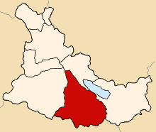 Location of Kunturkanki in the Canas province | |
| Country |
|
| Region | Cusco |
| Province | Canas |
| Founded | January 7, 1961 |
| Capital | El Descanso |
| Government | |
| • Mayor | Valerio Pacuala Huillca (2007) |
| Area | |
| • Total | 376.19 km2 (145.25 sq mi) |
| Elevation | 3,940 m (12,930 ft) |
| Population (2005 census) | |
| • Total | 6,256 |
| • Density | 17/km2 (43/sq mi) |
| Time zone | UTC-5 (PET) |
| UBIGEO | 080503 |
Kunturkanki District is one of eight districts in the Canas Province in Peru. Its seat is the village of El Descanso.
Geography
One of the highest peaks of the district is Laramani at 4,923 m (16,152 ft). Other mountains are listed below:[1]
- Anta Qalla
- Anta Qaqa
- Chilli Kunka
- Ch'apini
- Ch'iqta Qaqa
- Ch'uch'u
- Ch'uspini
- Hatun Sawsalla
- Hatun Sipa
- Imilla
- Kiswarani
- Kiwuni
- Llallawi
- Pichaqani
- Pukara
- Quyllurani
- Q'atawi
- Salla
- Suntur Qullu
- Supan Tira
- Tika Pallana
- Waki Wakiña
- Wank'a Saya
- Waraquki
- Wark'a Kancha
- Wisk'achani
- Yana Urqu
Ethnic groups
The people in the district are mainly indigenous citizens of Quechua descent. Quechua is the language which the majority of the population (89.61%) learnt to speak in childhood, 10.26% of the residents started speaking using the Spanish language (2007 Peru Census).[2]
References
- ↑ escale.minedu.gob.pe/ UGEL map Canchis Province (Cusco Region)
- ↑ inei.gob.pe Archived 2013-01-27 at the Wayback Machine. INEI, Peru, Censos Nacionales 2007, Frequencias: Preguntas de Población
| |
|---|---|
| Acomayo | |
| Anta | |
| Calca | |
| Canas | |
| Canchis | |
| Chumbivilcas | |
| Cusco | |
| Espinar | |
| La Convención | |
| Paruro | |
| Paucartambo | |
| Quispicanchi | |
| Urubamba | |
This article is issued from
Wikipedia.
The text is licensed under Creative Commons - Attribution - Sharealike.
Additional terms may apply for the media files.