Krajenka
| Krajenka | ||
|---|---|---|
| ||
 Krajenka | ||
| Coordinates: 53°18′31″N 16°59′10″E / 53.30861°N 16.98611°E | ||
| Country |
| |
| Voivodeship | Greater Poland | |
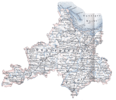
| County | Złotów | |
| Gmina | Krajenka | |
| Area | ||
| • Total | 3.77 km2 (1.46 sq mi) | |
| Population (2006) | ||
| • Total | 3,651 | |
| • Density | 970/km2 (2,500/sq mi) | |
| Postal code | 77-430 | |
| Website | http://www.krajenka.pl | |

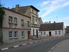
Krajenka [kraˈjɛŋka] (German: Krojanke) is a town in the Greater Poland Voivodeship of Poland. It has 3,804 inhabitants (2005) and lies in Złotów County.
Geographical location
Krajenka is located approximately 15 kilometers south of Złotów, 50 kilometers south-east of Szczecinek and 160 kilometers east of the regional center, Szczecin.
History
The first mention of the town is from 1286, back then it belonged to noble family of Danaborski whose Coat of Arms was Toporczyk. The name of the town itself comes from the Polish word Krajna, which meant in the past a location on the borders of Polish state. Throughout centuries it was connected to Polish royalty and such families as Danaborski, Dahlke, Kościelecki, Grudziński, Działyński, Sułkowski, Komierowski.
Magdeburg city rights were granted in 1420 by the Polish king Władysław Jagiełło.
In the period between 1772 and 1945, following the Partitions of Poland, it was part of the Kingdom of Prussia and later Germany. After the last Polish owner of the town Jakub Komierowsk was killed by Prussians in 1809, the town was confiscated by Prussian officials and passed from Polish to German hands. In 1846 a Protestant church was built by the famous German architect Carl Friedrich Schinkel. In 1871 a railway station of the Prussian Eastern Railway was built south of the Glumia river. The town was then the property of Prince Friedrich Leopold of Prussia. After 1919, when neighboring areas became part of the Polish Corridor, it was made part of Grenzmark Posen-Westpreußen. On 21 June 1924, it made history within German law as the Reichsgericht confirmed private ownership by Prinz Friedrich Leopold, including, where he died in 1931.
On 30 January 1945 the Soviet Red Army occupied the almost destroyed town during World War II; many of the inhabitants had fled during the winter of 1944/1945. After the war the town became part of Poland People's Republic of Poland . Its returning or remaining German population was expelled.
Number of inhabitants by year
| Year | Number |
|---|---|
| 1772 | 900 |
| 1783 | 848 |
| 1805 | 1, 946 |
| 1831 | 2,035 |
| 1853 | 3,063 |
| 1857 | 2,061 |
| 1875 | 3,303 |
| 1880 | 3,531 |
| 1890 | 3,344 |
| 1925 | 3,354 |
| 1933 | 3,345 |
| 1939 | 3,233 |
| 1945 | 150 |
| 1960 | 3,100 |
| 2006 | 3,651 |
Note that the table is based on primary, possibly inaccurate or biased sources.[1][2][3][4]
Famous residents
- Siggi Wilzig (1926-2003), Auschwitz holocaust survivor, CEO of Wilshire Oil Company
External links
- Official website of Krajenka
- William Remus: Krojanke (Krojanka) (2008)
References
- ↑ Johann Friedrich Goldbeck: Volständige Topographie des Königreichs Preußen. Part II: Topographie von West-Preußen. Marienwerder 1789, p. 102, paragraph 8.
- ↑ Michael Rademacher: Deutsche Verwaltungsgeschichte Provinz Pommern, Kreis Flatow (2006).
- ↑ August Eduard Preuß: Preußische Landes- und Volkskunde. Königsberg 1835, p. 378.
- ↑ F. W. F. Schmitt: Topographie des Flatower Kreises. In: Preußische Provinzialblätter, Andere Folge, Band VII, Königsberg 1855, pp. 115-116.
Coordinates: 53°18′N 16°59′E / 53.300°N 16.983°E