Kraburi River
The Kraburi River (Thai: แม่น้ำกระบุรี, RTGS: Maenam Kra Buri, pronounced [mɛ̂ːnáːm kràʔ buriː]; Burmese: မြစ်ကြီးနား, BGN/PCGN: myitkyina, Kyan River), also Kra (Thai: กระ) or Pak Chan River (Thai: แม่น้ำปากจั่น) is the boundary river between Thailand and Myanmar at the Kra Isthmus of the Malay Peninsula. The river has its source in the Tenasserim Hills and flows into the Andaman Sea near the Thai town of Ranong and Kawthaung (Victoria Point), Myanmar.
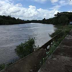
Most notable about the river is its long and up to 6-kilometre (3.7 mi) wide tidal estuary, which contains the largest preserved mangrove forests of Thailand. It is therefore a protected area. The Lam Nam Kraburi National Park covers most of the Thai side of the estuary, while the Ranong Biosphere Reserve and the Laemson Ramsar Site include further areas to the south.