Kra Buri District
| Kra Buri กระบุรี | |
|---|---|
| District | |
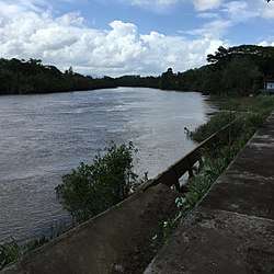 Kraburi river at Mamu | |
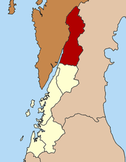 District location in Ranong Province | |
| Coordinates: 10°25′54″N 98°47′18″E / 10.43167°N 98.78833°ECoordinates: 10°25′54″N 98°47′18″E / 10.43167°N 98.78833°E | |
| Country | Thailand |
| Province | Ranong |
| Area | |
| • Total | 783.0 km2 (302.3 sq mi) |
| Population (2005) | |
| • Total | 44,808 |
| • Density | 57.2/km2 (148/sq mi) |
| Time zone | UTC+7 (ICT) |
| Postal code | 85110 |
| Geocode | 8504 |
Kra Buri (Thai: กระบุรี, pronounced [kràʔ bū.rīː]) is the northernmost district (amphoe) of Ranong Province, southern Thailand.
History
Mueang Tra (or Kra) was established in Ayutthaya era as a fourth class city under Chumphon. The first governor was Mr. Kaew, a cousin of the governor of Nakhon Si Thammarat. Later he was promoted to be Phra Kaew Korop (พระแก้วโกรพ). Mueang Tra was set to be a frontier town of Ayutthaya. The old town center was in Tambon Pak Chan. Later in 1884 Phra Atsadongkhotthitraksa (พระอัษฎงคตทิศรักษา) moved it to Tambon Nam Chuet as being better commercially and strategically.
Mueang Tra faced big wars by the Burmese troops two times, in 1764 in reign of King Ekkathat and in 1786 in the reign of King Rama I of Rattanakosin. During World War II the Japanese troops set Tra as their western division location, and built a Japanese troops railway from Kra Buri via La-un to Mueang Ranong.
Kra Buri was downgraded to a district of Ranong Province around 1896.
Geography
Neighboring districts are (from the northeast clockwise) Tha Sae, Mueang Chumphon and Sawi of Chumphon Province, and La-un of Ranong Province. To the west is the Tanintharyi Division of Myanmar.
The important water resource is the Kraburi river. Its long estuary is protected as a Ramsar wetland.
Administration
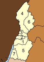
The district is divided into seven sub-districts (tambons), which are further subdivided into 60 villages (muban). Nam Chuet is a township (thesaban tambon) and covers parts of the tambon Nam Chuet. There are seven tambon administrative organizations (TAO) responsible for non-municipal areas.
|
 |
See also
- Tan Kim Ching, former governor of Kra Buri.[1][2][3]
References
- ↑ Tan Tock Seng, Pioneer: His Life, Times, Contributions, and Legacy By Kamala Devi Dhoraisingam, Dhoraisingam S. Samuel Published by Natural History Publications (Borneo), 2003; ISBN 983-812-079-0, ISBN 978-983-812-079-1; p. 82
- ↑ The Political Economy of Siam, 1910-1932 By Chatthip Nartsupha, Suthy Prasartset, Montri Chenvidyakarn, Montrī Čhēnwitkān Published by Social Science Association of Thailand, 1981; p. 127, 131
- ↑ The Greek Favourite of the King of Siam By Sitsayamkan (Sit) Published by Donald Moore Press, 1967; p. xiv