Konia, Cyprus
| Konia Κονιά | |
|---|---|
 Konia Location in Cyprus | |
| Coordinates: 34°47′2″N 32°27′30″E / 34.78389°N 32.45833°ECoordinates: 34°47′2″N 32°27′30″E / 34.78389°N 32.45833°E | |
| Country |
|
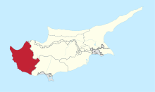
| District | Paphos District |
| Population (2017)[1] | |
| • Total | 1,100 |
| Time zone | UTC+2 (EET) |
| • Summer (DST) | UTC+3 (EEST) |
| Postal code | 6011 |
Konia (Greek: Κονιά) is a village in the Paphos District of Cyprus, located 3 km east of Paphos. In the northwest is Anavargos village, Armou in the northeast, Marathounta East and Yeroskipou in the South.
Saint Jacob Church
References
This article is issued from
Wikipedia.
The text is licensed under Creative Commons - Attribution - Sharealike.
Additional terms may apply for the media files.