Carpenter Rocks
| Carpenter Rocks South Australia | |||||||||||||||
|---|---|---|---|---|---|---|---|---|---|---|---|---|---|---|---|
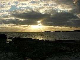 Sunset over 'The Carpenter', from Gerloff Bay | |||||||||||||||
 Carpenter Rocks | |||||||||||||||
| Coordinates | 37°55′0″S 140°24′0″E / 37.91667°S 140.40000°ECoordinates: 37°55′0″S 140°24′0″E / 37.91667°S 140.40000°E | ||||||||||||||
| Population | 177 (shared with other localities in the “State Suburb of Carpenter Rocks”) (2011 census)[1][2][lower-alpha 1] | ||||||||||||||
| Postcode(s) | 5291 | ||||||||||||||
| Location |
| ||||||||||||||
| LGA(s) | District Council of Grant[2] | ||||||||||||||
| Region | Limestone Coast[3] | ||||||||||||||
| County | County of Grey[2] | ||||||||||||||
| State electorate(s) | Mount Gambier | ||||||||||||||
| Federal Division(s) | Barker | ||||||||||||||
| |||||||||||||||
| |||||||||||||||
| Footnotes |
Climate[4] Adjoining localities[2] | ||||||||||||||
Carpenter Rocks is a small coastal town located 35 kilometres (22 mi) south-west of Mount Gambier in the south-east of South Australia. The area faces the Southern Ocean and is renowned for its rugged coastline which provides exceptional fishing and diving locations.
In the 2011 census, Carpenter Rocks and the western part of the adjoining locality of Pelican Point shared a population of 177.[1] Carpenter Rocks is in the District Council of Grant local government area, the South Australian House of Assembly electoral district of Mount Gambier and the Australian House of Representatives Division of Barker.
History and settlement
The earliest people in the Carpenter Rocks area were the aboriginal communities from the Booandik tribe. They were scattered in small groups along the coast where they had access to an abundance of food and water. Due to disease and land dispossession the last full-blooded Booandik died in 1904.[5]
Lieutenant James Grant, when on board HMS Lady Nelson, was the first known British person to view land known today as south eastern South Australia. On 3 December 1800, he sighted what at first he thought was four unconnected islands, but on a closer look realized they were two mountains and two capes. One of these he named Cape Banks, just west of today's township, after English Botanist - Joseph Banks. On 4 April 1802, the French explorer Nicholas Baudin aboard the ship Geographe noticed the area and made the observation:
| “ | Along the beach we could make out a continuous line of rocks which stretched a little way out to sea and over which the breakers pounded with extraordinary force. This was the cause of the incessant noise which we could hear. | ” |
According to Geoffrey Manning and Rodney Cockburn in "Place Names of South Australia", "The Rocks" were named "Les Carpentiers" ("The Carpenters") by Nicholas Baudin because their indented and serrated nature reminded him of a carpenter's saw.[6]
The Cape Banks Lighthouse has been listed as a state heritage place on the South Australian Heritage Register.[7]
Areas of interest
The town is a gateway to the Canunda National Park and Lake Bonney SE. Carpenter Rocks supports a significant southern rock lobster industry and Bucks Bay provides a safe haven for the many fishing boats moored there. Cape Banks lighthouse is located 4 kilometres (2 mi) from the township and it is near here on 5 August 1859 SS Admella was wrecked on a reef with the loss of 89 lives.
See also
Notes
- ↑ For the 2011 census, the 'State Suburb of Carpenter Rocks' consisted of Carpenter Rocks and the western part of Pelican Point.
Citations
- 1 2 Australian Bureau of Statistics (31 October 2012). "Carpenter Rocks". 2011 Census QuickStats. Retrieved 15 June 2017.

- 1 2 3 4 "Search result for "Carpenter Rocks (Locality Bounded)" (Record no SA0012578) with the following layers selected - "Suburbs and Localities", "Place names (gazetteer)" and "Development Plan Layers"". Property Location Browser. Government of South Australia. Archived from the original on 12 October 2016. Retrieved 21 August 2016.
- ↑ "Limestone Coast SA Government region" (PDF). The Government of South Australia. Retrieved 1 November 2016.
- ↑ "Monthly climate statistics: Summary statistics Mount Gambier Aero (nearest weather station)". Commonwealth of Australia , Bureau of Meteorology. Retrieved 17 August 2016.
- ↑ Bonney, Neville Carpenter Rocks and Beyond. Millicent Press, 1987 ISBN 0-7316-1487-9
- ↑ State Library of South Australia (website) Place Names of South Australia Archived 13 April 2008 at the Wayback Machine. retrieved on 28 March 2008
- ↑ "Cape Banks Lighthouse". South Australian Heritage Register. Department of Environment, Water and Natural Resources. Retrieved 18 August 2016.