Komi Kebir
| Komi Kebir | |
|---|---|
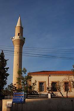 The mosque in Komi Kebir | |
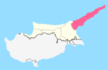
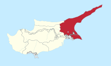
 Komi Kebir Location in Cyprus | |
| Coordinates: 35°24′36″N 33°59′49″E / 35.41000°N 33.99694°ECoordinates: 35°24′36″N 33°59′49″E / 35.41000°N 33.99694°E | |
| Country |
|
| • District | Famagusta District |
| Country (controlled by) |
|
| • District | İskele District |
| Government | |
| • Type | Municipality |
| • Mayor | Ahmet Sennaroglu |
| Population (2011)[1] | |
| • Total | 812 |
| • Municipality | 2,860 |
| Website | Turkish Cypriot municipality |
Komi Kebir (Greek: Κώμη Κεπήρ [locally [ˈkomi cʰeˈpir]]; Turkish: Büyükkonuk or Komikebir) is a village in Cyprus. It is located on the Karpas Peninsula, 33 kilometres (21 mi) north of Famagusta, and at an altitude of 90 metres (295 feet). Komi Kebir is under the de facto control of Northern Cyprus. As of 2011, it had a population of 812.
Before 1974, Komi Kebir was inhabited both by Greek- and Turkish Cypriots. The Greek Cypriots constituted the majority. In 1973, an estimated 762 people were living in the village, of whom 200 were Turkish- and 562 Greek-Cypriot.[2] 66 students were enrolled at the Greek-Cypriot primary school for the academic year of 1973–74.
At the borders of the village, there are the churches of Saint George, Saint Afksentios and Saint Loukas. There are also the ancient churches of Panagia Kira, Saint George Parouzos, Saint Vasilios (in ruins), Saint Photiou (in ruins) and Saint Katherine (in ruins).
References
- ↑ "KKTC 2011 Nüfus ve Konut Sayımı" [TRNC 2011 Population and Housing Census] (PDF) (in Turkish). TRNC State Planning Organization. 6 August 2013. p. 17. Archived from the original (PDF) on November 6, 2013.
- ↑ "KOMİKEBİR". Internal Displacement in Cyprus. PRIO Cyprus Centre. Retrieved 12 January 2015.
| Lefkoşa District | |
|---|---|
| Gazimağusa District | |
| Girne District | |
| Güzelyurt District | |
| İskele District | |
| Lefke District | |