Kiskőrös District
| Kiskőrös District Kiskőrösi járás | ||
|---|---|---|
| Districts of Hungary | ||
| ||
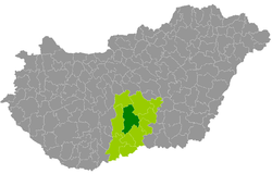 Kiskőrös District within Hungary and Bács-Kiskun County. | ||
| Country |
| |
| County | Bács-Kiskun | |
| District seat | Kiskőrös | |
| Area | ||
| • Total | 1,130.33 km2 (436.42 sq mi) | |
| Area rank | 2nd in Bács-Kiskun | |
| Population (2011 census) | ||
| • Total | 54,625 | |
| • Rank | 3rd in Bács-Kiskun | |
| • Density | 48/km2 (120/sq mi) | |

Kiskőrös (Hungarian: Kiskőrösi járás) is a district in central part of Bács-Kiskun County. Kiskőrös is also the name of the town where the district seat is found. The district is located in the Southern Great Plain Statistical Region.
Geography
Kiskőrös District borders with Kunszentmiklós District to the north, Kecskemét District to the northeast, Kiskunfélegyháza District and Kiskunmajsa District to the east, Kiskunhalas District to the southeast, Jánoshalma District to the south, Kalocsa District to the west. The number of the inhabited places in Kiskőrös District is 15.
Municipalities
The district has 4 towns and 11 villages. (ordered by population, as of 1 January 2012)[1]
- Akasztó (3,230)
- Bócsa (1,830)
- Császártöltés (2,323)
- Csengőd (2,020)
- Fülöpszállás (2,278)
- Imrehegy (694)
- Izsák (5,904)
- Kaskantyú (926)
- Kecel (8,687)
- Kiskőrös (14,259) – district seat
- Páhi (1,184)
- Soltszentimre (1,261)
- Soltvadkert (7,433)
- Tabdi (1,076)
- Tázlár (1,702)
The bolded municipalities are cities.
Demographics
Religion in Kiskőrös District (2011 census)
In 2011, it had a population of 54,625 and the population density was 48/km².
| Year | County population[2] | Change |
|---|---|---|
| 2011 | 54,625 | n/a |
Ethnicity
Besides the Hungarian majority, the main minorities are the German (approx. 1,500), Roma (1,400), Slovak (1,200) and Romanian (400).
Total population (2011 census): 54,625
Ethnic groups (2011 census):[3] Identified themselves: 54,640 persons:
- Hungarians: 49,828 (91.19%)
- Germans: 1,524 (2.79%)
- Gypsies: 1,434 (2.62%)
- Slovaks: 1,152 (2.11%)
- Others and indefinable: 702 (1.28%)
Approx. 20 persons in Kiskőrös District did declare more than one ethnic group at the 2011 census.
Religion
Religious adherence in the county according to 2011 census:[4]
- Catholic – 26,821 (Roman Catholic – 26,734; Greek Catholic – 82);
- Evangelical – 8,789;
- Reformed – 4,473;
- other religions – 1,740;
- Non-religious – 3,716;
- Atheism – 273;
- Undeclared – 8,813.
Gallery
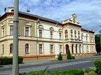 Kiskőrös, Town Hall
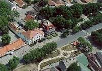 Aerial view of Izsák
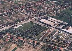 Pintér Works Military Historical Park in Kecel
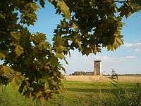 Maimed tower in Soltszentimre
See also
References
- ↑ A KSH 2012. évi helységnévkönyve
- ↑ népesség.com, "Kiskőrösi járás népessége"
- ↑ 4.1.6.1 A népesség nemzetiség szerint, 2011, (in Hungarian)
- ↑ 4.1.7.1 A népesség vallás, felekezet szerint, 2011, (in Hungarian)
External links
| Towns (4) |
| |
|---|---|---|
| Villages (11) | ||
Coordinates: 46°39′00″N 19°20′00″E / 46.6500°N 19.3333°E