Kimitsu
| Kimitsu 君津市 | |||
|---|---|---|---|
| City | |||
 Kimitsu city and Nippon Steel Kimitsu Works | |||
| |||
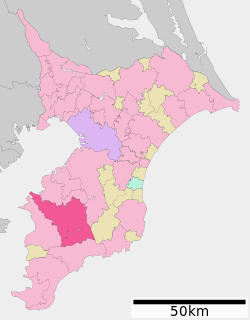 Location of Kimitsu in Chiba Prefecture | |||
 Kimitsu | |||
| Coordinates: 35°19′49.62″N 139°54′9.64″E / 35.3304500°N 139.9026778°ECoordinates: 35°19′49.62″N 139°54′9.64″E / 35.3304500°N 139.9026778°E | |||
| Country | Japan | ||
| Region | Kantō | ||
| Prefecture | Chiba Prefecture | ||
| Government | |||
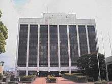
| • Mayor | Hirokuni Suzuki (since October 2006) | ||
| Area | |||
| • Total | 318.83 km2 (123.10 sq mi) | ||
| Population (April 2012) | |||
| • Total | 88,409 | ||
| • Density | 277/km2 (720/sq mi) | ||
| Time zone | UTC+9 (Japan Standard Time) | ||
| - Tree | Kyaraboku (Taxus cuspidata Sieb. et Zucc. var.nana Hort. ex Rehder) | ||
| - Flower | Mitsubatsutsuji (Rhododendron dilatatum) | ||
| Phone number | 0439-56-1581 | ||
| Address | 2-13-1 Kubo, Kimitsu-shi, Chiba-ken 299-1192 | ||
| Website | http://www.city.kimitsu.lg.jp/ | ||

Kimitsu (君津市 Kimitsu-shi) is a city located in Chiba Prefecture, Japan. As of September 2010, the city has an estimated population of 88,409, and a population density of 277 persons per km². The total area is 318.83 km2 (123.10 sq mi).
Geography
Kimitsu is the second largest city in Chiba Prefecture and is located in the western part of central Bōsō Peninsula. It borders Tokyo Bay. Two small rivers cross Kimitsu, the Koito River and the Obitsu River.
Surrounding municipalities
History
The area of present-day Kimitsu was largely part of the feudal domain of Kururi during the Edo period. It was divided between Moda District and Sue District in the early Meiji period cadastral reforms. Both districts became part of Kimitsu District from April 1, 1897. Kimitsu Town was founded within Kimitsu District on April 1, 1943, and expanded through annexation of two neighboring villages on April 1, 1944. Kimitsu was elevated to city status on September 1, 1971.
Economy
Despite its short coastline on Tokyo Bay, the economy of Kimitsu is centered around its coastal belt of heavy industries, primarily by the large-scale steelworks of Nippon Steel's Kimitsu Works. Kimitsu Works was established in 1965, covers 11,720,000 square metres (126,200,000 sq ft), and employed 3,280 people as of 2007.[1] The Koito Fishing Port, technically located in both Kimitsu and Futtsu, is located just north of Cape Futtsu at the mouth of the Koito River. Entry in and out of the fishing port suffers from sediment deposited by the Koito.[2] Kazusa Akademia Park, which spans both Kimitsu and Kisarazu, was established to carry out research in biotechnology and information technology.[3]
Transportation
Rail
Highways
Local attractions
- Kururi Castle
- Seiwa Kenmin No Mori Prefectural Park
- Kameyama Dam (Kameyama Lake)
- Katakura Dam (Sasagawa Lake)
- Mishima Dam (Mishima Lake)
- Toyofusa Dam (Toyofusa Lake)
International relations
Twin towns and sister cities
Kimitsu is twinned with the following cities.


Notable people from Kimitsu
- Emi Sakura - professional wrestler[4]
- Hiroshi Yamato - professional wrestler[5]
References
- ↑ Kimitsu Works
- ↑ 小糸川漁港(in Japanese)
- ↑ Kazusa Akademia Park (Kisarazu-shi, Kimitsu-shi)
- ↑ さくらえみ. Ice Ribbon (in Japanese). Archived from the original on July 13, 2011. Retrieved January 23, 2013.
- ↑ 大和 ヒロシ. All Japan Pro Wrestling (in Japanese). Archived from the original on September 21, 2013. Retrieved January 23, 2013.
External links
| Wikimedia Commons has media related to Kimitsu, Chiba. |
- Official Website (in Japanese)
| Wards of Chiba | ||
|---|---|---|
| Core cities | ||
| Cities | ||
| Districts | ||