Kamagaya
| Kamagaya 鎌ヶ谷市 | |||
|---|---|---|---|
| City | |||
 Kamagaya Daibutsu | |||
| |||
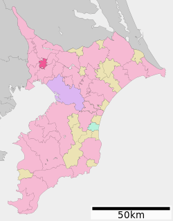 Location of Kamagaya in Chiba Prefecture | |||
 Kamagaya | |||
| Coordinates: 35°46′36.6″N 140°00′2.9″E / 35.776833°N 140.000806°ECoordinates: 35°46′36.6″N 140°00′2.9″E / 35.776833°N 140.000806°E | |||
| Country | Japan | ||
| Region | Kantō | ||
| Prefecture | Chiba Prefecture | ||
| Government | |||
| • Mayor | Kiyoshi Shimizu (since July 2002) | ||
| Area | |||
| • Total | 21.08 km2 (8.14 sq mi) | ||
| Population (December 1, 2015) | |||
| • Total | 108,392 | ||
| • Density | 5,140/km2 (13,300/sq mi) | ||
| Time zone | UTC+9 (Japan Standard Time) | ||
| -Tree | Osmanthus | ||
| - Flower | Japanese pear and Japanese bellflower | ||
| Phone number | 047-445-1141 | ||
| Address | 2-6-1, Shinkamagaya, Kamagaya-shi, Chiba-ken 273-0195 | ||
| Website | http://www.city.kamagaya.chiba.jp/ | ||


Kamagaya (鎌ヶ谷市 Kamagaya-shi) is a city located in Chiba Prefecture, Japan.
As of December 1, 2015, the city had an estimated population of 108,392, and a population density of 5,140 persons per km2. The total area is 21.08 km2 (8.14 sq mi).
Geography
Kamagaya is located in the northwestern corner of Chiba Prefecture.[1]
Neighboring municipalities
Chiba Prefecture
History
The area around Kamagaya has been inhabited since prehistory, and archaeologists have found Jōmon period shell middens in the area.[2] During the Kamakura period, the area was controlled by the Sōma clan. Kamagaya flourished in the Edo period 1603–1868 when the area was largely tenryō territory within Shimōsa Province controlled directly by the Tokugawa shogunate. One part of present-day Kamagaya was part of the Kogane Ranch, which raised war horses for the army of the Tokugawa shogunate. In the Edo period Kamagaya was also a thriving shukuba post on the Kioroshi Road, which connected present-day Inzai on the Tone River to Edogawa-ku in Tokyo. The road was utilized to bring fresh fish and other marine products from the Tone River region to the capital Edo.[3] After the Meiji Restoration, it became part of Chiba Prefecture. Kamagaya Village was one of several villages created on April 1, 1889 under Inba District. In 1945, the Imperial Japanese Army appropriated the former Musashino Country Club, turning the golf course into an air field. The base was turned over to the United States Air Force after World War II, becoming Shiroi Air Base, and was transferred to the Japan Maritime Self-Defense Force in 1959, becoming JMSDF Shimofusa Air Base. Kamagaya became a town on August 1, 1968, and was elevated to city status on September 1, 1971.
Economy
Kamagaya, formerly a farming area, is now a regional commercial center. Due to its numerous train connections it serves as a transportation hub and bedroom community for nearby Chiba and Tokyo. Kamagaya's trademark produce is the round, Nashi Pear, and there are many pear orchards dotted about the city, whose white blossoms open toward the end of the cherry blossom season.[1]
Education
The city operates five junior high schools and nine elementary schools. Kamagaya has two public high schools, operated by the Chiba Prefectural government.
Transportation
Railway
Highway
Local attractions
Sister city relations
References
- 1 2 "Kamagaya". Encyclopedia of Japan. Tokyo: Shogakukan. 2012. Retrieved 2012-05-17.
- ↑ "Kamagaya-shi (鎌ヶ谷市)". Nihon Daihyakka Zensho (Nipponika) (in Japanese). Tokyo: Shogakukan. 2012. Archived from the original on 2007-08-25. Retrieved 2012-05-09.
- ↑ "Kamagaya-shi (鎌ヶ谷市)". Nihon Kokugo Daijiten (日本国語大辞典) (in Japanese). Tokyo: Shogakukan. 2012. Archived from the original on 2007-08-25. Retrieved 2012-02-28.
- ↑ "International Exchange". List of Affiliation Partners within Prefectures. Council of Local Authorities for International Relations (CLAIR). Archived from the original on 4 March 2016. Retrieved 21 November 2015.
External links
| Wikimedia Commons has media related to Kamagaya, Chiba. |
- Official Website (in Japanese)
- Kamagaya International Friendship Association (KIFA) (in Japanese)
| Wards of Chiba | ||
|---|---|---|
| Core cities | ||
| Cities | ||
| Districts | ||