Yachimata
| Yachimata 八街市 | |||
|---|---|---|---|
| City | |||
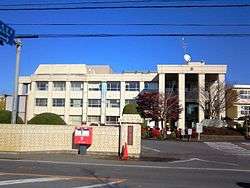 Yachimata City Hall | |||
| |||
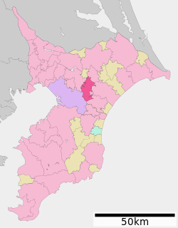 Location of Yachimata in Chiba Prefecture | |||
 Yachimata | |||
| Coordinates: 35°40′N 140°19′E / 35.667°N 140.317°ECoordinates: 35°40′N 140°19′E / 35.667°N 140.317°E | |||
| Country | Japan | ||
| Region | Kantō | ||
| Prefecture | Chiba Prefecture | ||
| Government | |||
| • Mayor | Shinji Kitamura (since December 2010) | ||
| Area | |||
| • Total | 74.87 km2 (28.91 sq mi) | ||
| Population (April 2012) | |||
| • Total | 72,277 | ||
| • Density | 965/km2 (2,500/sq mi) | ||
| Time zone | UTC+9 (Japan Standard Time) | ||
| -Tree | Osmanthus fragrans | ||
| Phone number | 043-443-1111 | ||
| Address | 35-29 Yachimata Ho, Yachimata-shi, Chiba-ken 289-1192 | ||
| Website | http://www.city.yachimata.lg.jp/ | ||


Yachimata (八街市 Yachimata-shi) is a city in Chiba Prefecture, Japan.
As of April 2012, the city has an estimated population of 72,277, and a population density of 965 persons per km². The total area is 74.87 km².
Neighboring municipalities
History
Yachimata was part of a region of horse ranches under the direct control of the Tokugawa shogunate in the Edo period. After the Meiji Restoration, the hamlet of Yachimata was founded on November 2, 1872 within Inba District, Chiba Prefecture. Yachimata was officially designated a village on April 1, 1889, and was elevated to town status on January 1, 1919. The village expanded in 1954 through annexation of a portion of neighboring Hyuga Village in Sanbu District and by merging with the village of Kawakami on November 1, 1954. Yachimata was elevated to city status on April 1, 1992.
Economy
Yachimata is a regional commercial center whose economy is primarily agricultural. Yachimata is well known for its peanuts.
Transportation
Rail
Highways
Notable people from Yachimata
- Yoshiki Hiraki – professional soccer player
External links
| Wikimedia Commons has media related to Yachimata, Chiba. |
- Official Website (in Japanese)
| Wards of Chiba | ||
|---|---|---|
| Core cities | ||
| Cities | ||
| Districts | ||