Kimathanka
| Kimathanka किमाथांका | |
|---|---|
| Village development committee | |
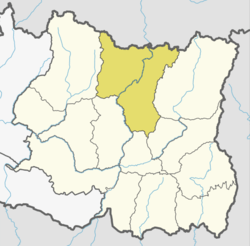
 Kimathanka Location in Nepal | |
| Coordinates: 27°51′25″N 87°25′05″E / 27.8569°N 87.4181°ECoordinates: 27°51′25″N 87°25′05″E / 27.8569°N 87.4181°E | |
| Country |
|
| Zone | Kosi Zone |
| District | Sankhuwasabha District |
| Population (1991) | |
| • Total | 303 |
| Time zone | UTC+5:45 (Nepal Time) |
Kimathanka (also Keemathnka) is a village development committee in Sankhuwasabha District in the Kosi Zone of North Eastern Nepal. At the time of the 1991 Nepal census, it had a population of 303 people living in 50 individual households.[1]
The village is remote for Nepalese, but a road is currently being constructed to the village and the border.[2] The Arun River runs through the valley below the village.
Kimathanka was one of the areas of Nepal that had traditionally practiced polyandry, however that practice is fading.[3]
Border
Kimathanka is near the border with Tibet. The border was part of brief dispute between China and Nepal before 1960.[4] The dispute was resolved in their 1961 border agreement.[5] The Chentang township in Tibet is on the other side of the valley. There has been local cross-border trade for decades. It has been sufficiently crucial for the local economy in recent years that in 2008 when Chinese tightened its border control during the Olympics, Kimathanka and the nearby villages faced food shortages due to disruption of the local trade.[6] A Chinese border checkpoint was set up in 2011 checking border crossing permits of Nepalese.[7]
References
- ↑ "Nepal Census 2001". Nepal's Village Development Committees. Digital Himalaya. Archived from the original on 12 October 2008. Retrieved 19 November 2008.
- ↑ Koirala, Niroj (24 November 2015). "Nepali Congress, UML leaders visit remote Kimathanka bordering Tibet". The Himalayan Times. Retrieved 2017-02-11.
- ↑ Wagle, Dinesh (October 12, 2002). "Nepal's Polyandry Tradition: Young Men Don't Want to Share Their Wife With Brothers in Kimathanka". Wagle Street Journal. Retrieved 2017-02-28.
- ↑ Office of the Geographer (1969-05-30). "International Boundary Study - China – Nepal Boundary" (PDF). Bureau of Intelligence and Research. Archived from the original (PDF) on 2012-05-03. Retrieved 2017-02-14.
- ↑ (in Chinese)

- ↑ Budhathoki, Kishor (2008-06-04). "China seals border, villages on Nepali side face starvation". The Himalayan Times. Retrieved 2017-02-13.
Starvation looms large in the northern parts of Sankhuwasabha district after China closed the Kimathanka check post
- ↑ "朋曲:寻访边境线" [Pum Qu River: Visiting the border]. Yuanfang De Jia. Season 江河万里行. Episode 136. 2014-11-05. China Central Television. Retrieved 2017-02-14.