Kilindoni
| Kilindini/Kinondoni | |
|---|---|
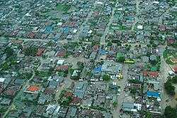 Aerial view | |
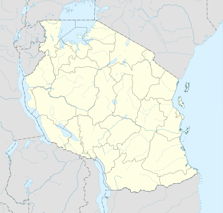 Kilindini/Kinondoni Location in Tanzania | |
| Coordinates: 7°55′0″S 39°39′0″E / 7.91667°S 39.65000°ECoordinates: 7°55′0″S 39°39′0″E / 7.91667°S 39.65000°E | |
| Country |
|
| Region | Pwani |
| Time zone | UTC+3 (East Africa Time) |
Kilindoni (kel-in-donee), population 11,696, is a town in Pwani Region, Tanzania. It is the main town on Mafia Island.
Climate
Mafia island has a tropical climate, and this climate is classified as "Aw" by the Köppen-Geiger system. Average temperature in town of Kilindoni is 26.7 °C (78 °F). The average annual rainfall is 1,705 mm. The monthly average temperatures are usually between 24.8 - 28.3 °C (77 °F - 83 °F). There is one major rain season, with most rainfall coming between March and May. Dry season spans between July to October.
Economy
The economy is based on fishing, subsistence agriculture and the market in Kilindoni. The island attracts some tourists, mainly adventure scuba divers, game fishermen, and people wanting relaxation.
Airport
The island can be reached from Dar es Salaam by flights operated by Auric Air. This is the only airport on the island.[1]
| Month | Jan | Feb | Mar | Apr | May | Jun | Jul | Aug | Sep | Oct | Nov | Dec | Year |
|---|---|---|---|---|---|---|---|---|---|---|---|---|---|
| Average high °C (°F) | 31.3
(88.3) |
31.6
(88.9) |
31.3
(88.3) |
29.9
(85.8) |
29.3
(84.7) |
28.3
(82.9) |
27.5
(81.5) |
28.2
(82.8) |
29.3
(84.7) |
30.3
(86.5) |
30.6
(87.1) |
31.1
(88) |
29.9
(85.8) |
| Daily mean °C (°F) | 28.3
(82.9) |
28.3
(82.9) |
28.1
(82.6) |
27.0
(80.6) |
26.4
(79.5) |
25.4
(77.7) |
24.8
(76.6) |
25.0
(77) |
25.7
(78.3) |
26.8
(80.2) |
27.2
(81) |
27.8
(82) |
26.7
(80.1) |
| Average low °C (°F) | 25.3
(77.5) |
25.1
(77.2) |
25.0
(77) |
24.2
(75.6) |
23.5
(74.3) |
22.6
(72.7) |
22.1
(71.8) |
21.9
(71.4) |
22.2
(72) |
23.3
(73.9) |
23.9
(75) |
24.6
(76.3) |
23.6
(74.5) |
| Average precipitation cm (inches) | 13.4
(5.28) |
9.8
(3.86) |
23.4
(9.21) |
48.2
(18.98) |
26.0
(10.24) |
8.0
(3.15) |
4.9
(1.93) |
2.5
(0.98) |
2.2
(0.87) |
3.5
(1.38) |
10.2
(4.02) |
18.4
(7.24) |
170.5
(67.13) |
| Source: Climate-Data.ORG[2] | |||||||||||||
References
- ↑ "http://www.auricair.com/". www.auricair.com. Retrieved 2017-09-19. External link in
|title=(help) - ↑ "Climate Kilindoni: Temperature, Climate graph, Climate table for Kilindoni - Climate-Data.org". en.climate-data.org. Retrieved 2017-09-19.