Khaniyabas
| Khaniyabas खनियाबास | |
|---|---|
| Rural Municipality in Nepal | |
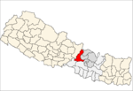
 Khaniyabas Location in Nepal | |
| Coordinates: 28°4′12.31″N 85°0′31.98″E / 28.0700861°N 85.0088833°ECoordinates: 28°4′12.31″N 85°0′31.98″E / 28.0700861°N 85.0088833°E | |
| Country | Nepal |
| Development Region | Central |
| Zone | Bagmati |
| District | Dhading |
| Province | Province No. 3 |
| Rural Municipality | Khaniyabas |
| Area | |
| • Total | 120.80 km2 (46.64 sq mi) |
| Population (2017)[1] | |
| • Total | 12,749 |
| Time zone | UTC+5:45 (NST) |
| Area code(s) | 010 |
| Literacy Rate |
|
Khaniyabas (Nepali: खनियाबास; khaniyabas) is a Gaupalika(Nepali: गाउपालिका ; gaupalika)[2]Formerly: village development committee) in Dhading District in the Bagmati Zone of central Nepal. It has a literacy rate of 59.22% . The local body was formed by merging three VDCs namely Jharlang, Darkha and Satyadevi. The population of the rural municipality is 12749 according to the data collected on Nepalese local elections, 2017.
Geography
East: Nuwakot District and Rasuwa District
West: Gangajamuna and Ruby Valley Gaupalika
North: Ruby Valley Gaupalika
South: Netrawati Gaupalika and Nuwakot District
Population
As per 2017, Khaniyabas hosts a population of 12,749 across a total area of 120.80 km2.
See also
References
- ↑ "Local Elections 2074 - Election Results Overview - Dhading - Gajuri". Retrieved 2017-06-02.
- ↑ "यसरी २ नगर र ११ गाउँपालिकामा बाँडिनेभयो धादिङलाई (स्पष्ट नक्सासहित)". Sajhapost. Nov 11, 2016.
Headquarter: Dhading Besi | ||
| Gaupalika |
|  |
| Municipalities |
| |
This article is issued from
Wikipedia.
The text is licensed under Creative Commons - Attribution - Sharealike.
Additional terms may apply for the media files.