Kafr Dunin
| Kfar Dunin كفردونين | |
|---|---|
| Village | |
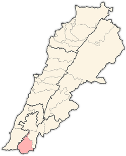
 Kfar Dunin Location within Lebanon | |
| Coordinates: 33°14′N 35°24′E / 33.233°N 35.400°ECoordinates: 33°14′N 35°24′E / 33.233°N 35.400°E | |
| Grid position | 187/293 PAL |
| Country |
|
| Governorate | Nabatieh Governorate |
| District | Bint Jbeil District |
| Elevation | 580 m (1,900 ft) |
| Time zone | UTC+2 (EET) |
| • Summer (DST) | UTC+3 (EEST) |
| Website | http://www.kfardounine.org/ |
Kfar Dunin (كفردونين)[1] is a village in Lebanon, 102 km from the capital Beirut and 580 m from sea coast remote. Adjacent villages: Deir Kifa, Alkaline, Khirbat Silm, Der Ntar. It is considered first of villages in Bent Jbeil district of Nabatieh Governorate. Its population is 6000 people.
History
In 1875 Victor Guérin noted: "Near a little mosque are well-cut stones, the remains of a demolished church, of which there also survive fragments of monolithic columns and several broken capitals, strewing the soil in several places, and especially near the Sheikh's house.'[2] He estimated that the village had 350 to 400 Metawileh inhabitants.[3]
In 1881, the Palestine Exploration Fund's Survey of Western Palestine (SWP) described it as: "A village, built of stone, containing about 150 Metawileh, on a hill, surrounded by figs, olives, and arable land. The water is obtained from a spring near and cisterns in the village."[4]
References
Bibliography
- Conder, C.R.; Kitchener, H.H. (1881). The Survey of Western Palestine: Memoirs of the Topography, Orography, Hydrography, and Archaeology. 1. London: Committee of the Palestine Exploration Fund. (p. 96)
- Guérin, V. (1880). Description Géographique Historique et Archéologique de la Palestine (in French). 3: Galilee, pt. 2. Paris: L'Imprimerie Nationale.
- Palmer, E.H. (1881). The Survey of Western Palestine: Arabic and English Name Lists Collected During the Survey by Lieutenants Conder and Kitchener, R. E. Transliterated and Explained by E.H. Palmer. Committee of the Palestine Exploration Fund.
External links
- Survey of Western Palestine, Map 2: IAA, Wikimedia commons
- Kfar Dounine, Localiban
Capital: Bint Jbeil | ||
| Towns and villages |
|  |
| Notable landmarks | ||
| Other sites | ||